Chair’s monthly report September 2017

Report (on the September business meeting agenda) covering the period 7 August until 10 September 2017.

Highlights

Local Board plan hearing

Consultation on the draft Waitematā Local Board Plan 2017 concluded with a hearing held on 8 August.  15 submitters presented to the board on a range of topics.

At the hearing meeting we also received all the submissions and a high level overview of all the data gathered through the public consultation process.  In total 158 submissions were received on the draft Plan 2017. In addition, 34 people provided feedback at the ‘Have your Say’ engagement events and there were 11 pieces of feedback gathered through Facebook.

80 per cent of respondents either agreed or strongly agreed with this question “are we on the right track with our proposed local board plan?”, while 16 per cent neither agreed or disagreed and 4 per cent either disagreed or strongly disagreed.

We are in the process of revising the draft based on the feedback and will sign off the final plan at the Board’s October business meeting.

Draft Meola Reef Te Tokaroa Development Plan consultation

In August the Board signed off the draft Meola Reef Te Tokaroa Development Plan plan for consultation.    Consultation on the draft is now open until 29 September.  The following introduction to the plan is provided on the Shape Auckland website.

  • The purpose of the development plan is to coordinate development of Meola Reef Reserve Te Tokaroa, in the short, medium and long term (10+ years).
  • Such a long-term plan provides guidance for any changes to the area:
    • maintain and enhance the reserve’s ecological outcomes
    • respond to needs, concerns and desires of Mana Whenua, key stakeholders and the community; and
    • plan for future demand and needs.
  • Meola Reef is a lava reef formation that reaches over two kilometres into the Waitematā harbour.  A landfill was developed on the reef from 1930 to 1976.  After closure of the landfill and capping, the reserve informally developed as a dog walking destination.  The Reserve is now known as one of Auckland’s primary off and on-leash dog parks.
  • Management and mitigation of the closed landfill which underlies the reserve, is outside of the scope of the development plan.  However, any development of the park requires any landfill management works to be completed before park development works.
  • The development plan actions are unfunded at this stage.  The development plan will inform funding decisions.

Link to the draft plan and feedback form here

Pest Management

I worked with board member Rob Thomas to finalise the Board’s feedback on Auckland Regional Pest Management Plan Review (Attached to the agenda).

I attended the launch of Predator Free Grey Lynn at the Grey Lynn Farmers Market with Grey Lynn local, Jesse Mulligan (photo right) with support from Predator Free New Zealand Trust and Kiwibank. We also heard from Kelmarna Gardens for plans for Predator Free Ponsonby.

The importance of pest eradication in the survival of seabirds was highlighted at the excellent Hauraki Gulf Seminar Taking Flight I attended on 6 September at Auckland Museum.

Coxs Bay playground

The opening of the new Coxs Bay playground went ahead on 9 September despite forecast downpours. The playground is based on a theme of natural play and the fact that the area used to be a seasonal iwi harvesting place. New planting and natural play features such as boulders and climbing rocks were included in the design.  A playground celebration will be held on 12 October.

The renewal budget for the project was $370,000.

Western Springs Outer Fields bush tracks

I have been following up on the poor condition of the Western Springs Outer Fields bush tracks. Maintenance of the area had fallen between Regional Facilities Auckland (RFA) and Council’s Community Facilities with no maintenance undertaken for some time.

RFA recently reported securing sufficient budget (quoted by City Parks as $28,752) to undertake the remedial works, as scoped by City Parks.  RFA now needs to complete the requisite procurement process and is seeking to complete the required physical work once we have improved weather conditions so the track will be fully functional for the upcoming summer.

Waima Street Pedestrian bridge

 For some time I have also been following up about the condition of the Waima Street pedestrian bridge that provides a walking and cycling connection between Arch Hill and the NW cycleway. At a meeting with the NZTA’s Director Regional Relationships for the Upper North Island, Pete Clarke we heard that NZTA has now secured a budget to undertake maintenance on the bridge (photo right – Albert Eden Local Board side of the bridge).

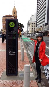
Walking and cycling improvements

In my September Ponsonby News update  I provided an overview of the major package of walking and cycling improvements that are either underway or about to start.  I’ve been attending the regular meetings organised by West Lynn business owners concerned about the loss of parking, location of bus stops and the construction disruption.

 Tamaki Drive cycleway route

In June Auckland Transport consulted on the Tamaki Drive Cycleway proposal from Quay Street to Ngapipi Road.  Auckland Transport’s options for the route where overwhelmingly rejected through the public feedback.  A revised design is now under investigation.   As transport portfolio lead I provided the following initial feedback on behalf of the Board:

The Waitematā Local Board is pleased that Auckland Transport has listened to the feedback received through the public consultation and is investigating a bi-directional cycle route on Tamaki Drive to the Ngapipi intersection. The Board supports this option with general traffic lanes that are as wide as possible to increase the safety of road riders.

 The Board does not support the section between Solent Street and the Strand remaining as a shared path for the following reasons:

  • The investment over the entire route is degraded by maintaining a lower level of service for this section.
  • It is not fit for purpose for the future numbers estimated to use this route once it is fully connected to the network
  • A shared path with high levels of users is not safe especially for people walking, running, skating etc alongside a traffic lane with high vehicles volumes
  • The proposed width of the shared path is not best practice

 The Board seeks a continuous connection from Quay St along Tamaki Drive with a consistent level of service. The Board therefore requests that AT work with NZTA to investigate the continuation of the bi-directional cycle route through the Solent St to the Strand section by re-allocating road space

 The Board also requests that

  • The bi-directional cycle route continues through the Solent Street intersection and that this intersection is re-designed to prioritise the safety of pedestrians and people on bikes
  • A safe, separated connection is provided to the Gladstone Road cycle route through the Strand intersection
  • Auckland Transport investigate opportunities for sustainable urban drainage/water sensitive design and opportunities to plant new street trees along the route

Auckland Transport will undertake further public consultation on the revised design.

 Ponsonby Road pedestrian improvements project

This project has caused a lot of headaches with delays and construction issues. The project is now back on track on due to be completed by mid-November.  The latest update from Auckland Transport (as at 8 September)

  • Both the Anglesea and Brown Street intersection works are progressing as planned. The drainage work on Anglesea Street is now complete and work has begun on the kerb build-outs.
  • The remaining work at Pollen Street intersection is expected to be complete before mid-November 2017.

Meetings and workshops: 7 August until 10 September

  • Weekly Chair’s meeting every Monday morning
  • Meeting with NZTA representatives on 7 August to discuss transport issues in Waitematā
  • Waitematā Local Board workshops on 8, 22, 29 August and 5 September
  • Waitematā Local Board Plan hearing on 8 August
  • Planning Committee waterfront briefing on 9 August
  • Meeting to discuss Auckland Transport’s temporary installations on K’rd for the introduction of double decker buses
  • Meetings with West Lynn business owners on 9, 16 August and 8 September to discuss cycleway construction works planned by Auckland Transport
  • Meeting on 10 August to discuss Ellen Melville Centre opening and planned Community Open Day
  • Meeting with Council planners to discuss the development of a Parnell precinct plan
  • Chair’s draft recommendations run through on 12 August
  • Interview panel member on 12 August for the CEO position at Auckland Transport
  • Monthly Local Board Chairs’ Forum on 15 August
  • Catch up with the Waitematā Youth Collective representatives on 16 August
  • Waitematā Local Board business meeting on 16 August
  • Monthly comms meeting on 16 August
  • Transport portfolio catch up on 17 August
  • Meeting with Council officers and the Principal of Auckland Girls’ Grammar School on 17 August to discuss possible options for developing in partnership the swimming pool and gym at the school
  • Use of social media by Council discussion with comms officers on 17 August
  • Meeting on 18 August with Richmond Rovers Rugby League Club representatives and Auckland Council staff to discuss development of multipurpose facility and new clubrooms in Grey Lynn Park
  • Judging for the NZTA cycle friendly awards on 18 August at the offices of the AA
  • Local Boards sub-regional workshop on 21 August
  • Newmarket level crossing community liaison meeting hosted by Auckland Transport at Jubilee Hall on 21 August
  • Environment portfolio meeting on 24 August
  • Engagement adviser catch up
  • Meeting with representatives from Kelmarna Gardens
  • Site Visit on 24 August to discuss tree planting project on St Marys Road with Chair, SMBA, Auckland Transport and Auckland Council arborist
  • Meeting on 25 August with Auckland Transport representatives and K’rd Business Association GM to discuss poor process and communication regarding the installation of temporary safety treatments on K’rd for the double decker bus project
  • Planning committee joint workshop on 29 August: waterfront and city centre planning
  • Franklin Road community liaison meeting hosted by Auckland Transport on 30 August
  • Domain Committee meeting on 31 August
  • Waitematā Local Board member “Behind the Scenes” tour of Auckland’s War Memorial Museum on 1 September to show the diverse work currently being carried out in order to meet the needs of our growing and diverse city.   The tour included the Pacific Collections Access Project (PCAP) – connecting with communities, Digital lab – collections on line and Basement storage – kaitiaki
  • Meeting on 1 September with the Sustainability squad at Parnell School to discuss their plans for a waste reduction project
  • Met with Sara Stace  a city shaper and architect focused on cycle planning visiting from Australia
  • City Centre and Waterfront Planning Refresh Local Board Input on 5 September
  • Attended the Hauraki Gulf Marine Park Seminar 2017 – Taking Flight at Auckland Museum on 6 September
  • Catch up with General Manager, Newmarket Business Association on 7 September
  • Finance Committee 10 year budget joint workshop with governing body members and local board chairs on 7 September
  • Meeting with Mayor Goff on 8 September to discuss opening of Ellen Melville Centre and Freyberg Place
  • Communication and Engagement Expo on 8 September to find out what department does (covering Public Affairs – media relations, internal, corporate and local communications, Marketing & publicity, Citizen engagements and Insights, Brand & Channel – content, channels, design, Strategic Planning & Performance)

Events and functions:  7 August until 10 September  

  • Auckland Foundation event with guest speaker Julie Nelson of Housing First at Gus Fisher Gallery on 8 August
  • LATE at the Museum on 9 August at the invitation of Auckland Museum
  • Eat Albert Street (link to video of the event) on 10 August (Photo below: Free kai provided by Everybody eats at Griffith Gardens)
  • Vintage Austin Register – Auckland Branch AGM on 13 August
  • Splice cuppa event at Scarecrow Café on 15 August
  • Opening night of Nell Gywnn at Waterfront Theatre on 17 August at the invitation of Auckland Theatre Company
  • Presided at the Citizenship ceremony at Auckland Town Hall on 17 August (photo below with Kaumatua Bob Hawke, Waitemata Local Board member Richard Northey and Chair of Maungakiekie- Tamaki Local Board Josephine Bartley)
  • Margaret Mary’s farewell from TAPAC on 18 August
  • Funeral of Graham (Rocky) McGlynn, RSC President at the Grey Lynn RSC on 19 August
  • Labour’s Election Launch at the Auckland Town Hall on Sunday 20 August
  • PSA’s book launch on 21 August: Progressive Thinking: Ten Perspectives on Housing with panel discussion facilitated by Simon Wilson
  • Opening night of Matilda at the Civic Theatre at the invitation of ATEED on 24 August
  • Modelled on the Project Glow wear runway show on 26 August
  • Launch of Predator Free Grey Lynn at the Grey Lynn Farmers Market on 27 August
  • Lela Jacobs and Jimmy D Fashion Week shows at the invitation of the K’rd Business Association
  • Leaving function for Brett O’Reilly, ATEED CEO at GRID AKL on 31 August (Photo right with Brett)
  • Random Acts of Kindness Day on 1 September organised by Splice ( I dropped by the Splice team below handing out free pots of honey on K’rd)
  • Took part in a tactical urbanism event with Walk Auckland’s Andy Smith to mark the 8th Anniversary of the 40km speed limit on Ponsonby Road (photo right with our “speed gun” hairdryers)
  • Opening of the Corsini Collection at the Auckland Art Gallery on 2 September
  • Attended Merchant Navy Day Auckland Remembrance Service on 3 September at the Maritime Museum  (Photo below with Councillors Daniel Newman and Mike Lee)
  • Meet the candidates meeting for Auckland Central at St Matthews organised by the Auckland City Centre Residents Group on 7 September
  • Parnell Heritage AGM on 7 September
  • Open Day West End Lawn Tennis Club
  • 8th anniversary of the Grey Lynn Farmers Market on 10 September

Gift Declarations

  • Tickets x 2 Nell Gwynn at the invitation of Auckland Theatre Company
  • Tickets x 2 Matilda at the invitation of ATEED
  • Ticket to LATE at the Museum at the invitation of Auckland Museum
  • Lela Jacobs and Jimmy D Fashion Week shows at the invitation of K’rd Business Association

Major package of walking and cycling improvements underway

West Lynn shops Richmond Road planned walking and cycling improvements

Waitematā is set to be the big winner from a significant package of walking and cycling projects that are underway or about to start. Once complete we can look forward to a range benefits flowing to the whole community.  A large part of the focus is on connecting the places people wish to go; shops, schools, places of work and community facilities. Contractors have already started work on a separated cycleway and footpath upgrade that will connect Surrey Crescent to Pt Chevalier via Garnet Road, and to the Grey Lynn Greenway via Richmond Road.

Stage 2 of the Franklin Road upgrade is also underway including new footpaths and cycle lanes on both sides of the road that will connect Ponsonby Road to the planned Midtown cycleway at Victoria Park.   A project on Great North Road between Crummer and Ponsonby Roads, will bring in improvements for pedestrians, those on bikes and bus users.  The Karangahape Road enhancements project includes a separated “Copenagen” cycleway and significant streetscape improvements.

This all means that by 2018 new travel opportunities will have opened up via a connected and safe network.  The “network effect” is already achieving results.  Additional connections in the cycle network have created a 44% increase in people on bikes using the Northwestern Cycleway and a total of 45,600 new cyclists in 2016.  There is growing demand from a majority of Aucklanders to cycle (and walk) if the conditions are right.

The funds for these projects comes from a combination of investment by NZTA, Auckland Transport and the government’s Urban Cycleway Fund and is expected to be about $200m over three years.  It is great value for money for ratepayers who contribute $1 for every $2 from the government. In addition, the City Centre targeted rate is part funding the K’rd project.

However, the changes do bring a period of inconvenience and concerns from businesses and residents along the routes.  In West Lynn I’ve been attending meetings organized by a group of retailers who have come together to work with Auckland Transport to minimize impact from the construction and improve access to parking for the shopping precinct as a whole. I’m on the Community Liaison Group, established by Auckland Transport to continue engaging with key stakeholders through the delivery of the Franklin Road project and to address issues like safety.

There is now compelling data to show that Waitematā will reap big rewards from investment in walking and cycling.  Everyone benefits from slower speeds, safer streets, less pollution, fewer health costs and less congestion, when leaving a car at home becomes more of a viable option for more people.    A recent study from the UK of a quarter of a million people, found that cycling to work is linked to a lower risk of developing cancer by 45% and cardiovascular disease by 46%.  There is also a direct link between safe, active transport and economic prosperity.    Recent research indicates that in Auckland a 1% increase in city centre walkability leads to a $43m increase in localised GDP.   We want to ensure these impressive results also extend to our town centres and local shops.

For more details of the walking and cycling programme, visit Auckland Transport’s website: at.govt.nz/cycling-walking.

Ponsonby News column September 2017

Conference report back: 2 Walk and Cycle conference

 Conference report back:  2 Walk and Cycle conference – moving towards healthy communities, Auckland 6 – 8 July

“Cities have the capability of providing for everybody only when and only because they are created by everybody” Jane Jacobs (quoted by Tyler Golly, conference presenter)

PM John Key and Mayor Len Brown
PM John Key and Mayor Len Brownat the Quay St cycleway opening

I attended the 2 Walk and Cycling Conference 2016, the premier national conference addressing walking and cycling issues held every two years. The conference’s focus was on active, human-powered transport to achieve healthier, smarter and more liveable cities.

A great deal has changed since I attended my first 2 Walk and Cycle Conference in 2008.  The debate has shifted from trying to convince politicians “why” cycling should be funded and on the agenda to “how” to best deliver cycling infrastructure as part of an integrated transport network. The funding situation has improved massively. Eight years ago a very small percentage of Council and Government transport budget was directed to walking and cycling. Previously the conference has been dominated by advocates arguing the case for increased investment and discussing case studies from overseas. 

The new cycleway counter on Quay Street

This year the conference, with significant sponsorship from NZTA, was attended by a range of professionals many of whom are working on projects in NZ boosted by the Urban Cycling Investment fund.

Auckland played host to the conference putting on a number of associated events.  Delegates were treated to a Pecha Kucha special transport edition sponsored by Auckland Transport, Auckland Conversations with the conference keynote speaker Gil Penalosa and were invited to attend the opening of the Quay Street cycleway that includes Auckland’s first visible cycle counter (10,000 trips recorded within the first 19 days!). 

Delegates were also able to experience Auckland’s growing cycling network and the award winning Te ara i whiti/Lightpath.

I participated in the conference as delegate, workshop presenter (Vision Zero workshop detailed in Attachment A), as networking breakfast host (with Margaret Lewis, to discuss the success of K’rd Open Streets event – photo right) and as one of the judges of the Bike to the Future awards announced at the conference dinner (Attachment B).

Conference informal networking breakfast with K'rd's Margaret Lewis
Conference informal networking breakfast with K’rd’s Margaret Lewis

I found the conference hugely encouraging and affirming of how far we have progressed in Auckland with making cycling a viable option for more people to enjoy. There is however still much to do if Auckland is going to unleash the huge benefits that can be realised from prioritising walking and cycling.  My only disappointment about the conference was the lack of diversity that failed to capture the many cycling “tribes” of Auckland.

There were a number of key themes that I took away from the conference

Healthy communities designed for everyone

 There is overwhelming evidence that policies encouraging walking and cycling provide major health benefits.  The Minister of Health should be the biggest champion of active transport when considering ways to combat soaring obesity related illnesses such as diabetes.

Karen Witten in her presentation Healthy places and spaces bringing a children’s voice to city planning noted that children involved in active transport have higher rates of physical activity. “Cities that work for children work for everyone”

The keynote speaker Gil Penalosa talked about all ages, all abilities networks that encourage activity that helps everyone (see more from Gil’s presentation below).  Another keynote speaker Ben Rossiter from Victoria Walks said that “walking is fundamental to healthy communities.”

 Shared paths

 Dr Ben Rossiter from Walk Victoria gave a hard hitting, evidence based assessment on the need to design for walkability.

His presentation, Walking promotion and advocacy: An Australian story explained very convincingly why safer road design is needed for older pedestrians and why shared paths are not best practice. 

  • 25- 40% of those who suffer from a hip injury die within one year
  • If want to deal with health and obesity walking is critical
  • Constraints to older people walking – dogs off leash, bike riders on shared paths
  • If you need sign to slow down the street is designed wrong!

 His view is that shared paths should only be supported where designed for low speed, recreational environments where it is clear that cyclists must give way.

This is a particular issue in Australia and New Zealand where shared paths are often preferred to avoid difficult decisions about re-allocating road space for separate cycle lanes.  This presentation is relevant to a number of designs that are currently being considered for Auckland’s cycleway network eg Ian McKinnion Drive that has recently gone out for consultation and Nelson Street phase 2 that included a section of shared path opposed by the Waitematā Local Board.

 Pop- ups and temporary trials

 I have heard many experts recommend trials and pop ups as a low cost, quick way to demonstrate the benefits of new street design and build community support. Tyler Golly in his presentation Communities Designing Communities, shared ideas from Canada such as bike corrals, painted kerb extensions and parklets.

The Waitematā Local Board has been a supporter of trials particularly for cycling infrastructure but it has proved very difficult to progress.  Part of the problem has been the lack of a nimble, empowered AT team who are able to focus on trials.

Lorne Street parkletHowever we hopefully might start seeing “parklets” in the city.  An Auckland Council parklet popped on Lorne Street during the conference (photo right).  Providing additional space for people by removing two car parks was an instant success for nearby food vendors who reported a tripling in trade. High Street retailers take note!

We’ve also heard that AT is working a temporary brightly painted contra-flow cycle lane on Federal Street.

Road safety

 A number of speakers highlighted how essential it is to make city roads safer for walking and cycling with a range of measures:

  • Lower speeds
  • Changes to the give way rules
  • Vision Zero policy
  • Creating more traffic free areas and restrictions (a pro liveability measure discussed by Glen Koorey, What can NZ learn from cycling in Europe)
  • Network of cycleways
  • Traffic calming measures

Disappointingly the CEO of Auckland Transport does not appear to prioritise safety over efficiency. In his opening address he responded to the challenge of more pedestrian walking zones by saying the real problem in the city centre is not the speed and volume of traffic but the number of people walking while looking at their phones!

Vision Zero is a policy that I have been championing with the support of the Board.  Together with Cycle Action Network, Brake NZ and Walk Auckland I took part in a workshop on Building a grassroots campaign for Vision Zero: Why we need a new approach to road safety and how we can make it happen.  (see Attachment A)

 Auckland Conversations and keynote speaker, Gil Penalosa. The 8 80 City: Creating Vibrant and Healthy Communities

How can we create vibrant and healthy cities for everyone, regardless of age or social status? What is the role of streets – the largest public space in any city? How can parks improve the quality of life that attracts and retains people to their communities? 

Gil answers these questions while also explaining a simple and effective principle for inclusive city building: ensuring the safety and joy of children and older adults (from 8 year olds to 80 year olds) are at the forefront of every decision we make in our cities. Drawing on his experience as Commissioner of Parks and Recreation in Bogota, Gil presents some of the now widely celebrated approaches to urban regeneration through investments in parks and public spaces. Gil also draws upon examples from cities around the world which demonstrate the power of parks and public space in making lives happier, communities better, and economies stronger.

Key points:

  • Sustainable mobility: moving people towards a brighter, healthy more equitable future
  • Gil was responsible for starting Ciclovia (Open Streets) in Bogota – his advice is to just do it as requires no capital investment, works to change minds and is an inclusive event that belongs to everyone (In Auckland we have now held three “ciclovia” type events and more are planned)
  • When saying “no” also saying “yes” to something else eg more cars, more pollution and obesity.
  • Designing a city for everyone is not a technical issue or funding issue but a political issue
  • Need to evaluate cities by how they treat the most vulnerable
  • Transport policies have a direct impact on equality and equity. 25% of income is tied up with mobility by car but for lower income is often nearer 50%
  • Supports a focus on putting pedestrians first to encourage walkability: Vision Zero, max speed limit of 30Km p/h, quality infrastructure that shows a respect for people
  • Benefits: environment, economic activity, health

Skypath presentation with Richard HillsSkypath

It is great news that in the same month as the conference councillors agreed unanimously to progress Skypath the walk/cycleway over the Auckland Harbour Bridge.

See Attachment C for the presentation I gave in support at the Finance and Performance Committee on 21 July.

Free water in Waitematā

Icecream to celebrate the 100,000 trip made on Lightpath

At the icecream celebration for the 100,000 trip on Lightpath on 30 March a rider thanked me for the drinking station the Waitematā Local Board installed nearby on the Nelson St cyclepath. He told me he enjoys using all three of the water stops we’ve put in on cycle routes (the other 2 are on the NW cycleway and on Carlton Gore Road).

This friendly feedback reminded me that one of the things I really appreciate about Local Boards is the ability to get stuff done especially projects that may be small but have the potential to have a significant impact.

Across the Waitematā area the Local Board has been quietly installing drinking stations and fountains in convenient locations. The first drinking station went in to West Lynn with legacy funding from the Western Bays Community Board (the Community Board endorsed Grey Lynn 2030’s proposal for a “village pump” triggered by the community screening of Tapped the Movie for World Water Day in 2010). The Local Board from an early stage committed budget to drinking stations in parks, reserves and the street environment.

The next step is to get all the water drinking stations mapped so they are easy to find.  I’d also like to see the initiative expanded so it becomes “Refill Auckland” modelled on Refill Bristol with the aim to make refilling your water bottle a cultural norm, with refill points on every street, via cafes, retailers, and businesses.

I’m a big fan of this project as it provides an alternative to expensive shop bought water, cuts down on plastic pollution and the need for expensive recycling and reduces exposure to unhealthy levels of BPA found in plastic drinking bottles.  By providing access to fresh filtered tap water for residents and visitors when out and about there is no reason why Waitemata couldn’t become a plastic bottle-free area.


Update on the footpath work programme: Making Auckland’s footpaths safer, easier to navigate and more convenient

I have previously reported on the recommendations the transport portfolio has made for locations to be included in Auckland Transport’s footpath work programme 15/16 including footpaths requiring maintenance.

In August Christopher Dempsey and I went on a site visit with Auckland Transport’s head of maintenance to ascertain what works can be leveraged from the renewal budget to deliver local board priorities. We followed up by outlining what we would like AT to focus on:

Cheshire Street, Parnell

Accessible access to Parnell Station

As we noted there are a number of missing and narrow footpaths in the area between Parnell Rd and the entrance to the new station on Cheshire St. Restoring all of these footpaths is clearly a big job.

In the meantime we would like to know what AT is doing to ensure that there is at least one accessible route available when the station opens. I.e. a route that is well signposted and suitable for wheel chair users, mobility scooters, prams, people wheeling luggage etc from Parnell Road to the station.  This needs to be a priority as it is impossible to walk to the entrance currently without walking on the road.

Update: to be investigated and potentially funded from the Local board capex fund

Cook St pedestrian crossing

Cook Street
Cook Street

We are concerned about the lack of a pedestrian facility to cater for the growing number of residents on Union St who will have a strong desire line to cross over Cook St to access Victoria Park, New World, Sale St etc.

Pedestrians currently have to cross three lanes of high speed traffic or walk 400m up to the Nelson St intersection for a safe crossing

Princes St

We heard that Princes St is on the renewal list and a project team is being set up to address the many complex issues of upgrading one of Auckland’s historic roads. We asked to be kept close to this work and the project include the entire length of Princes St to the Emily Place intersection and for cycling facilities to be scoped as part of the design (this also needs to be tied into the cycling contra-flow on Alfred St that we have had logged with AT for some time now but has not been actioned)

AT update: The upgrade does not include the Emily place intersection (the transport portfolio has logged this separately)

Winchester St access to K'rd
Winchester St access to K’rd

Walkway signage

We noted a number of locations without walkway signage but where NO EXIT signs incorrectly give the impression there is no pedestrian access:

  • Liverpool St towards K’rd
  • Liverpool St steps to Airedale St
  • Hargreaves St to Beaumont St
  • Gudgeon St to Beaumont Quarter (
  • Winchester St to K’rd – this connection has been newly discovered and has recently been demarcated by the adjoining land owner. There is a good opportunity to provide a pleasant walking route from Newton Rd to K’rd via Edinburgh St (photo right)

City Road between Liverpool St and Symonds St and Liverpool St between City Road and K’rd

City Road
City Road

After learning that City Road is on the 15/16 renewal programme we have confirmed that we would like to ensure that the 1m footpaths are not replaced on a like for like basis as this is no longer best practice in a high foot traffic location (even on a rainy afternoon we observed more people walking through the area than driving). See photo right.

This is a good opportunity for AT to assess the traffic movements and look at how the footpaths can best be widened (eg narrowing the lanes; restricting rat running traffic; contra flow for cyclists etc)  

AT update: AT has confirmed investigating footpath widening options with AT’s walking and cycling team

Howe St/Hopetoun St/Hereford St

Thank you for agreeing to look at the Hopetoun St/Howe St intersection where the footpath on the bridge abruptly ends without a crossing point.

We also noted that 1000 new residents are moving into the Hopetoun St area and improvements are needed to cater for the increased foot traffic. (For example Can the Hereford St/Hopetoun St intersection please be logged as needing a pedestrian facility)

AT update: AT now plan to implement this when the Hopetoun St Kerb &Channel/footpath renewal between Howe St and Ponsonby Rd is completed during the 16/17 financial year.

Marmion St, City Centre

Real Groovy development – Marmion St, White St, Waverley St

We agreed that any renewals planned for 15/16 should be put on hold in this area until the Real Groovy apartment development has been completed and an assessment can be made of pedestrian movements (we noted the lack of pedestrian facilities currently particularly on Marmion St )

Christopher is going to check the resource consent conditions and what street scape changes are planned as part of the design.

AT update: All programmed kerb & channel/footpath and resurfacing renewal work deferred from the following sites to allow coordination with the private development: Liverpool St, Turner St, White St, Marmion St and Waverly St

Mayoral Drive/Albert St entrances to the Aotea Centre and Bledisloe Carparks/ access to the bus stop

We noted the lack of pedestrian facilities in this area particularly to the bus stop from the Bledisloe Car park and across the car park entrances.

We have yet to receive an update from AT on what is planned as part of the CRL works to cater for bus passengers at this location.

Hargreaves St, Freemans Bay

Hargreaves St

We noted the large number of drivers who are parking on the substandard footpath.

Agreed Christopher to check development plans in this area before any action taken.

Monthly Board Report October 2015

This report covers my Waitematā Local Board activities from 17 August – 30 September 2015 as Deputy Chair, lead for the Community and Transport portfolios, and Chair of the Grants Committee, and with positions on the Ponsonby Business Association Board and Ponsonby Community Centre Committee and Board liaison for the Parnell Community Centre.

Highlights

Portfolio updates: Transport

Beach Rd Stage 2 opening

Beach Road stage 2

I was delighted to join the celebrations for the opening of Beach Road stage 2 especially as the Board (through our Chair Shale Chambers) played a role in securing the funding for the project to get underway. The opening brought together the Mayor, NZTA regional director, Hon Nikki Kaye, Kaumatua Matt Maihi (on what was also the 175th anniversary of Ngati Whatua’s signing over of land to the Crown, which officially began the process of creating Auckland city), local politicians and the many people from across multiple organisations who are all committed to Auckland being a great place to cycle.

The design adds to the city centre’s growing network of cycleways and

Walkers on the Beach Rd cycleway

provides attractive street amenity to the soulless apartment frontages on Beach Road.

Unfortunately there are already concerns about the design of the separated pathways for cycling and walking. The layout and signage is confusing so that both pathways have become “shared” by default putting more vulnerable walkers in conflict with riders.

We hope to see Auckland Transport address these issues as well as improving the connections from Beach Road to Britomart and Fort St (a cycle crossing phase has been requested on the intersection of Customs, Britomart Pl and Beach Rd).

Update on the footpath programme: Making Auckland’s footpaths safer, easier to navigate and more convenient

I have previously reported on the streets we would like to see included in Auckland Transport’s footpath work programme 15/16 including footpaths requiring maintenance.

In August Christopher and I went on a site visit with Auckland Transport’s maintenance team leader to ascertain what works can be leveraged from the renewal budget to deliver local board priorities. Attachment B outlines the actions we logged with Auckland Transport for follow up.  

Ponsonby Rd safety

Following concerns regarding the safety of people on bikes using Ponsonby Rd (highlighted by a painful and concerning account of a “dooring” on the Cycle Action Auckland website) I have provided the following update on what the transport portfolio is doing regarding education, enforcement and short term fixes:

  • For some time now we have been asking AT to work with the Police to enforce the speed limit (frustratingly no sign of this happening on any of our city centre streets)
  • We have requested safety campaigns aimed at drivers – passing rules, driveway rules etc (we have raised concerns about AT’s campaigns aimed at vulnerable road users and the lack of evidence that these campaigns work eg “Pay attention or pay the price” type messages)
  • Ponsonby Rd feeder lane "Fresh Kermit"We advocated for the recent resealing of Ponsonby Rd to be used as an opportunity to include new “greening” for cyclists at the intersections (unfortunately AT have recently confirmed that despite earlier assurances the feeder lanes to new advance stop boxes at the Franklin Rd intersection are not going ahead)
  • We have requested a barnes dance at the intersection with Richmond Rd
  • We have a “Ponsonby Rd pedestrian experience project” underway funded with approx. $500k from the Local board transport capex fund. This is aimed at providing improvements (raised tables) to all the side streets between Franklin Rd and McKelvie St (this project is not directly delivering cycle infrastructure but it will assist with calming the traffic)
  • We’ve supported residential parking zones being rolled out in Freemans Bay and Ponsonby which will release short term parking for visitors and take the pressure off Ponsonby Road as the main parking area
  • We’ve asked for data to be collected on how people are currently travelling to Ponsonby Rd and the % of through traffic v local traffic to assist with future planning
  • Since the latest dooring that CAA alerted us to recently we’ve asked AT to provide data on crashes involving cyclists on Ponsonby Rd and an update on how AT is going to respond with a specific campaign.

Longer term the board has committed to a solution under Outcome 3 of the Ponsonby Plan (“Pedestrian and Cyclist safety- develop Ponsonby Road with various transport options that prioritise the safety of pedestrians and cyclists”)

We are looking to AT to confirm how quickly the investigation of cyclelanes can be investigated given that Ponsonby Road is not currently in AT’s 3 year work programme. Personally I think the best time to start will be after we have effective parking management in place (residential parking zones) and once the connections at either end on K’rd and Great North Road and to Westhaven have been installed.  

Best practice in walking

Jim Walker, the founder of the Walk21 conferences and global expert in walking, gave a lunchtime presentation hosted by the NZ Institute of Architects and Auckland Transport. Jim talked about the importance of walking, promoting the formula for effective investment in walking; showcasing examples of best practice internationally.

Key messages:

  • Walkability the best indicator of a liveable city
  • By far the biggest percentage of trips are under 5km (63%) but most resources are allocated to trips over 30km which are only 7% of all trips
  • Need to make walking visible with data. For example when trips were measured in Sydney’s CBD 92% were found to be walking trips with 50% of each trip made up of waiting time (it would Sales revenues increase after pedestrianisation (in a Munich example up to 40%)
  • People walking to town centres are found to spend more per week than drivers
  • It is safer for everyone in cities where people walk and cycle
  • In the UK it is estimated that for every pound spent on walking 7 pounds are saved in health costs

In making observations about Auckland Jim recommended:

  • making walking as appealing and enjoyable as possible
  • deliver streets that are safer, easier to navigate and more comfortable
  • promote walking as the first choice for every day short trips

This presentation confirmed for me the need for Auckland focused trip data (at the moment most of the data is derived from pedestrian counts and census journey to work data) and more NZ based evidence about the benefits of investing in walking (refer Attachment C for a Grey Lynn example).

High Street parking issues

High St Chris Cherry in the HeraldConsultation on the upgrade Ellen Melville and Pioneer Womens Hall and Freyberg Square (with the proposed removal of the road in front of the hall) has highlighted a number of current High St parking issues that could be addressed before the project goes ahead.

The city centre team, who are project managing the upgrade, have been asked to investigate the following with Auckland Transport:

  1. Removal of the High St exit from the Victoria St carpark
  2. Change to light phases at the High St /Victoria St intersection to speed up access from the Victoria St car park
  3. Re-configuration of the Victoria St car park to better provide for short term parking (ie moving long term parking from the lower levels)
  4. Management of the number of trade vehicles on High St to free up short term on -street car parking  (through permits and encouraging tradies to use the car park)
  5. Promoting Victoria St car park as the “pop in” short term parking for visitors to High St/O’Connell St/Vulcan Lane precinct (ie changing perceptions that it is difficult to access the shopping area)
  6. Undertake a parking survey on High St to confirm current vacancy/occupancy rates and make the data publicly available and for Heart of the City to share with members
  7. Depending on the results of the parking survey discuss with AT the tools available to increase availability and turn over

Portfolio updates: Community

Age – Friendly Cities Forum

I attended the ADCOSS organised Age- Friendly cities forum on 27 August. This was an opportunity to hear from a wider range of speakers about how an age-friendly city benefits people of all ages. A youth perspective was provided by members of the Waitematā Youth Collective.

Key messages for me:

  • We need to be designing and building age and disability friendly housing that can support existing communities not just in isolated suburbs  (David Haigh, Lecturer in social practice at Unitec)
  • We should implement the UK’s “Shopmobility” initiative that can benefit retailers (Vivian Naylor, CCS disability Action)
  • We need to be including dementia-friendly perspectives in our design (Karen Smith, Clinical Research nurse at Auckland University’s Centre for brain research)
  • Connectedness is the most important factor for enhancing well-being. Strong, cohesive communities are the best thing for people’s health and psychological sense of control (Prof. John Raeburn)

Smokefree Auckland 2025  

smokefree outside areas forumThe board has supported the bringing forward of the review of Council’s Smokefree Policy and the earlier implementation of the planned stage 3 including extending smokefree areas to beaches, shared spaces and outside dining.

Following a meeting with Auckland Cancer Society we have also confirmed our commitment to promote our current smokefree events and facilities and ensure phase 1 has been fully implemented (covering  signage and smokefree bus stops).

I also attended the Auckland Cancer society’s smokefree outside areas forum where I heard that there is increasing evidence of the public’s approval to extend smokefree areas to all public places such as beaches and outside dining. There is evidence that smokefree outdoor areas help to limit exposure to smoking and decrease the chances of former smokers relapsing. Outdoor policies also help people quit.

Investigations are underway on whether it is preferable to adopt a regulatory rather than non-regulatory approach (as is currently taken in the smokefree policy). In Ontario there is very effective use of signs and very little enforcement.

We are at a similar point to when indoor venues went smokefree – business ended up having nothing to fear and it was also good for hospitality workers.

Community Grants

The Waitematā Local Board grants committee that I chair considered the applications for round one 2015/16. For the first time we have a “Quick Response Grants” process for applications up to $3000 and Local Grants for applications up to $7500. In total $280,920.46 was requested from round one from our total community grants fund of $100,000. This massive over subscription was partly due to the demise of the Community Group Assistance Fund and Accommodation Support Fund benefitting boards in the old Auckland City Council area. These funds have been distributed between all 21 local boards unfortunately leaving a large funding shortfall for organisations based in the Waitematā area.

Think Big mural project at Richmond Rd School

The round one decisions and recommendations of the committee are attached to the agenda.

Photo right: students from Richmond Road School with their ‘Think Big’ project ‘The Colour Project’ certificates presented by member Deborah Yates at the school assembly on behalf of the Board

Further meetings and activities relevant to the community portfolio are detailed below

Workshops and meetings

From 17 August – 30 September 2015 I attended:

  • Local Boards greenways collaborative meeting on 17 August
  • Meeting with Auckland Transport to discuss Grey Lynn transport project presentation
  • Auckland Transports’ public meeting on 17 August to present Grey Lynn transport project proposals
  • Waitematā Local Board workshop on 18 August including meeting with Auckland Museum representatives
  • Waitematā Youth Collective introductory meeting on 18 August
  • Meeting with Auckland Cancer Society to discuss the progress on the regional Smoke free policy and the upcoming review that is planned for later this year
  • Lunchtime Learning: The housing we’d choose: A study of housing preferences, choices and trade-offs in Auckland.
  • Meeting with GM Ponsonby Business Association 21 August
  • Elected member professional development working group meeting 24 August
  • Waitematā Local Board workshop on 25 August
  • Newmarket Laneways working group
  • Grey Lynn park pump track presentation
  • Pre-view of the proposed Nelson St Off-ramp Cycleway – amenity lighting on 25 August
  • Community Development portfolio monthly update on 26 August
  • ADCOSS age friendly cities forum at Western Springs Hall on 27 August
  • Meeting to discuss achievements report photos on 27 August
  • Jim Walker – founder of Walk21: International best practice in walking seminar on 28 August
  • Ponsonby Community Centre committee meeting on 31 August
  • Waitematā Local Board workshop on 1 September
  • Catch up with NBA General manager on 4 September
  • New footpath programme – site visit on 4 September
  • Attended the Seniors Advisory Panel on 7 September
  • Waitematā Local Board business meeting on 8 September
  • Ponsonby Business Association Board meeting on 9 September
  • Auckland Development Committee workshop on 9 September (covering SHAs, City Centre Integration Group update, Downtown Car park  and the Chief Economist housing report)
  • Waitematā Local Board workshop on 10 September
  • Visit to the Auckland Central Library CAB
  • Meeting with Cowie St residents 14 September
  • Ellen Melville Centre and Freyberg Square consultation drop in
    Ellen Melville Centre and Freyberg Square consultation drop in

    Ellen Melville Centre and Freyberg Square consultation drop- ins on 11 and 14 September (photo right)

  • Waitematā Local Board workshop on 15 September
  • Monthly Transport portfolio catch up and site visit to MacKelvie St (part of the Ponsonby Road pedestrian experience funded from the local board capex fund)
  • Meeting with Auckland Transport to discuss Curran St/Sarsfield St intersection proposals
  • Consultation meeting on 17 September for Heart of the City members to discuss Ellen Melville Centre and Freyberg Square proposals
  • Interview with a representative from Hay Group on 18 September (As part of their regular three-yearly job sizing exercise, the Remuneration Authority has commissioned Hay Group to meet with a cross section of elected members from Auckland Council to conduct an assessment)
  • Waitematā Local Board workshop on 22 September
  • Media and communications meeting
  • Community Development Portfolio meeting on 22 September
  • Waitemata Local Board Grants Committee meetings on 23 and 29 September
  • Smokefree outdoor areas forum on 23 September
  • Inner City Network meeting organised by ADCOSS on 24 September
  • Meeting on 25 September to discuss elected member professional development
  • Ponsonby Community Centre management committee meeting 28 September
  • Waitematā Local Board workshop on 29 September
  • Local Board greenways collaborative meeting on 30 September

Events and functions

From 16 August – 30 September 2015 I attended:

  • Opening of the Tole Reserve playground on 22 August
  • Officiated at the citizenship ceremony at the Town Hall on 24 August
  • Cycle Action Auckland AGM on 27 August
  • Richmond Road School ‘Think Big’ project ‘The Colour Project’ assembly presentation of certificates to the working group on 28 August
  • Ponsonby presents NZ Fashion Festival show at the invitation of PBA on 29 August
  • Heroes at Maidment Theatre at the invitation of ATC
  • Wallace Art Awards at Pah Homestead on 7 September
  • The Events at Q Theatre at the invitation of Silo Theatre Trust on 9 September
  • Grey Lynn Business Association networking drinks
  • Auckland Conversations on 10 September Building Bridges not walls, Gill Hicks, peace advocate
  • Diversity Job Fair 2015 (morning tea for invited guests) at AUT on 12 September
  • Ellen Melville Centre and Freyberg Square open day on Saturday 12 September
  • Circability Trust  afternoon tea on 13 September celebrating one year at Campbell Free Kindergarten
  • Cats the musical at the Civic Theatre at the invitation of Regional Facilities Auckland
  • Aotea Quarter consultation walking tour
    Aotea Quarter consultation walking tour

    Aotea Quarter Framework consultation walk on 17 September (photo right)

  • Opening of Beach Rd cycleway on 18 September
  • International Park(ing) day installations on High and Lorne St on 18 September
  • Suffrage Day celebration at Khartoum Place on 18 September hosted by National Council of Women
  • Ponsonby Market Day on 19 September
  • Newmarket Business Association AGM on 24 September
  • Opening of the Heritage Festival at Pah Homestead on 24 September
  • Screening of the movie Everest at the invitation of Santa Parade Trust
  • Grey Lynn Farmers Market 6th birthday celebrations
  • Festival Italiano opening and lunch in Newmarket at the invitation of Dante Alighieri Society Auckland on Sunday 27 September (photo below: Osborne St open for people to enjoy the festival)

Italian festival 2015

Vision Zero for Auckland

Fanshawe StreetOn 2 June 2015 Robert Su, 33 was heading home from work at the ASB bank to his family in Hillcrest. Like hundreds of commuters he was walking from Wynyard Quarter to the bus stops on Fanshawe Street. Tragically while crossing the road he was struck by a truck and killed. The exact details of the crash have not been released but it is highly likely that a range of factors were involved – speed, driver error, vehicle design,  road design, weather conditions. Flowers have been placed in memory of Mr Su at the pedestrian crossing.

The day after Mr Su’s death a woman was killed in Orewa as she crossed the road marking a week when two pedestrians were also seriously injured and a rider on his way to work was almost killed.  So far this year 14 pedestrians have been killed in NZ, 4 in the Auckland area.

Photo credit: @ByTheMotorway

What I find particularly tragic and frustrating about Mr Su’s death is that the road he was expected to cross is designed like a motorway for speed and traffic efficiency. For drivers coming off SH1 there are no clues that Fanshawe St is the gateway to the central city. For some time office blocks have been going up near by but no changes have been made to the road to respond to changing land use and the growing numbers of people walking (and cycling) through the area.

At a time when the Auckland Council family of organisations is working to make the city the most liveable in the world through a whole range of transformational projects we continue to let down our most vulnerable road users.   Improvements are definitely underway (eg removal of slip lanes in the city centre, complete street upgrades) and various campaigns take a safe systems approach to road safety supported by the NZ Police but what I think is missing is a comprehensive, everyone on board, Vision Zero  response where we, collectively as a city, do not consider any fatalities or serious injuries are acceptable or inevitable.

Letter to the NZ Herald 15 June 2015
Letter to the NZ Herald 15 June 2015  

I think Auckland needs to officially adopt Vision Zero (as the Mayor of NYC did in January 2014 ) with a clear action plan.  It will need support from politicians, traffic engineers, transport agencies, all road users and grassroots campaigners. Most importantly it will require a huge culture shift in our attitudes to driving  and acceptance that managing speeds is at the heart of improving safety.

There is strong community support for improving public transport and providing greater opportunities for active travel (as indicated by feedback on the Auckland Council’s Long Term Plan) but too often resistance if this means slowing down drivers. It is far too common to hear complaints that speed enforcement is “revenue raising” and politicians shy away from taking decisive action on speed control in the face of evidence and the recommendation of safety experts. 

 Vision Zero AKL – embracing street design, slower speeds, rules changes,  education and enforcement -I think could provide the right platform for far greater public support for the concept of putting the safety of people first.

In the meantime I think there is the need for immediate action focused on city centre streets so that no one needs to be put at risk of getting killed on their way home from work.

Fanshawe Street missing ped leg
Photo credit: @BytheMotorway
  • Remove motorway signage from Fanshawe St
  • Install the missing pedestrian crossing at the intersection of Fanshawe St and Halsey St (this needs to happen before the new Fonterra HQ opens)
  • Enforce the speed limit particularly on “motorway” style city streets like Fanshawe, Hobson and Nelson
  • Implement the 30km/h speed limit for the City Centre and Wynyard Quarter (as proposed in the City Centre masterplan)
  • Repair the urban fabric of the city where footpaths connections are missing 
  • Target road safety campaigns

(this is my initial list as a non expert – I am sure there are many more actions requiring immediate attention)

Update 17 July 2016 

I’ve joined the call to for Vision Zero to be adopted for NZ to bring down road toll 

More reading

 Five key lessons from Europe’s Vision Zero Success

1) Managing speeds — and speed differentials — is a top priority

In all three of these countries, the leaders of traffic safety efforts emphasize that managing speed is the number one determinant in their successes in improving safety.

Over the past 15 years, the national governments of Sweden, the Netherlands, and Germany have all proactively and systematically changed their approaches to speed. Each nation (to differing degrees, but all significantly) has lowered speed limits for a clearly defined hierarchy of roads and corresponding speeds. For instance, the Netherlands has shifted…

  • from 50 kilometers per hour (kph) to 30 kph on smaller, residential streets;
  • from 70 kph to 50 kph on bigger, or what we’d consider arterial roads; and
  • from 100 kph to 70 kph on the freeway-like roads outside cities.

In each of the three nations, nearly everyone I’ve spoken with credits speed management as the greatest contributor to their success in improving safety on the streets and saving more lives.

Transport advocacy at Auckland Council

Photo credit: Cathy Casey

Every year each of the 21 Local Boards has an opportunity to present to the Governing Body (the Mayor and Councillors of Auckland Council) on their activities, advocacy areas and budget requests that the Board wants included in the Annual Plan.

Today the Waitemata Local Board, led by Shale Chambers, had our turn to  outline our priorities for 14/15.  I spoke to our transport advocacy areas:

Introduction

I come here today still buzzing from having experienced the future of transport in Auckland on the electric train on Sunday and with good news from the latest census data that clearly shows that when Aucklanders are provided transport choice they are eager to take up PT, walking and cycling.  On census day 51% of residents in Waitemata travelled to work by means other than a car.

We have developed a comprehensive list of 20 transport advocacy areas for 14/15 that respond to the transport expectations of our residents, visitors and businesses that can be summed up as investment in cycling and walking infrastructure, pedestrian safety and amenity, quality street design, and effective parking management as we work towards an outstanding public transport system as part of a congestion free network

We are seeking a clear direction from the Governing Body to Auckland Transport that our local board transport initiatives must be incorporated into their 14/15 programme of work.

I would like to quickly highlight 5 specific areas.

Greenways The GB is very familiar with the concept of greenways and it is great so many Boards have either developed or are developing Greenways plans. The successful implementation of the Greenways Plan requires co-ordination and commitment from St Marys Bay parkingnot only Waitemata Local Board but also  the wider Council family. We are advocating that a regional greenways budget is secured in the Auckland Transport budget and included in the Auckland Transport Statement of Intent

Inner City Parking Scheme –  The number one complaint received by Auckland Transport is in relation to parking issues in our inner city suburbs particularly Freemans Bays as a result of all day commuter parking.  The situation is getting worse and has a number of negative impacts not just on residents but on local businesses. We support the roll out of resident parking zones for our inner city suburbs like the scheme currently being trialled in St Marys Bay. We want to see this happen by the end of the year following Auckland Transport’s consultation on their parking strategy.

Franklin RoadFranklin Road –  The much needed  upgrade of Franklin Road has been postponed for many years as it has been in the too hard basket.  This project includes road resurfacing, undergrounding of services, footpath upgrade, pedestrian crossings, cycle path and on road parking and to provide for safe and continuous walking and cycling pathways from Ponsonby Road to Victoria Park.

The good news is that Auckland Transport has recently put the project back on the table and is revisiting  a design from 2011 but needs a budget allocated to the upgrade by Council.

Intersections and Amenity for pedestrians and cyclists – After a really slow start there are positive signs that Auckland Transport is starting to make progress on improving the pedestrian and cycling experience in Waitemata.

We have provided a very detailed list of safety and infrastructure improvements in our advocacy section, which has been done deliberately to make sure local priorities are included in AT’s work programme and funded from the regional safety and maintenance budgets.  This includes cycle lanes  on Carlton Gore Road, linking Beach Road with the Grafton Gully Cycleway , and advocating for a change of the give way rule at intersections in favour of pedestrians

SkypathSkypath – Lastly thank you for supporting the Auckland Harbour Bridge Skypath so far. One of the most exciting and transformation projects currently underway in Auckland.

We would like to request that the Governing Body continues to progress and provide regional leadership for the skypath.

Our full list of transport advocacy areas for 14/15

Auckland Transport

  • Cycle infrastructure
    • Consult with local boards on the development of the Cycling Business Plan and routes and priorities of the Auckland Cycle Network.
    • Improve cycle infrastructure through the completion and extension of the Auckland Cycle Network with safe, connected, dedicated cycleways including:
    • Carlton Gore Road (bike lanes currently planned).
    • Beach Road, linking with the Grafton Gully Cycleway and with Tamaki Drive and Parnell Station.
    • Parnell to the City Centre walk/cycleway, through the new underpass south of the Parnell Train Station.
    • Nelson & Hobson Street (with separated two-way cycleways, as described in the City Centre Masterplan).
    • Wellesley St connection to Auckland Domain under Symonds St overbridge and on-road connection to the NZTA funded / constructed Grafton Gully Cycleway.
      • Prioritise the upgrade of all routes in 2014/2015 currently identified as “complete” on the Auckland Cycle Network within the Waitematā Local Board area, but are not of a safe standard.
      • Traffic calming
        • Undertake a trial of a slow speed zone in a residential area.
        • Implement the city centre 30km per hour speed zone (as described in the City Centre Masterplan) and the Wynyard Quarter slower speed zone.
  • Cycle safety
    • Prioritise the installation of advance cycle stop boxes with feeder lanes including in the following locations:                    I.      Williamson Avenue northeast coming onto Ponsonby Road
    •  II.     College Hill Road westbound coming onto Ponsonby Road
    •  III.     Tamaki Drive, westbound at The Strand
    • IV.         St Stephen’s Avenue westbound coming onto Parnell Road
    • v.            Karangahape Road eastbound at Symonds Street, onto the Grafton Bridge
    • VI.         Great North Road eastbound coming on to Karangahape Road.
  • Ensure safe, connected and continuous cycling is provided for in the St Lukes bridge widening including undertaking cycling safety works at the Bullock Track and Great North Road intersection.
  • Pedestrian safety and amenity
    • Improve intersections for pedestrians with substantial foot traffic and develop solutions to improve safety and amenity for pedestrians. This includes:
    •                   I.      All intersections with left–turn slip lanes and no pedestrian facility
    •                II.      Intersections with long pedestrian crossing delays.
    •                III.    Undertaking route optimisation for pedestrians in the city centre including automatic pedestrian phases on one way streets.
  • Advocate for a change of the give way rule requiring motorists to give way to pedestrians crossing parallel to the priority (main) road at intersections.
  • Richmond Road Safety Plan
    • Complete the implementation of the safety improvement action plan during the 2014-2015 financial year in conjunction with Auckland Council for the shopping areas and school zones of Richmond Road, concentrating on the following elements:
    •                     I.    Pedestrian and cycle safety
    •                    II.    Traffic calming and slower speeds
    •                   III.    Urban design.
  • Franklin Road upgrade
    • Undertake the planned upgrade of Franklin Road including road resurfacing, undergrounding of services, footpath upgrade, pedestrian crossings, cycle path and on road parking and to  provide for safe and continuous walking and cycling pathways from Ponsonby Road to Victoria Park including continuous pedestrian facilities (i.e. an unbroken footpath on both sides of the road) across all side streets, driveways and intersections (for example by installing raised tables).
  • Newmarket traffic management plan
    • Develop a traffic management plan for Newmarket to make traffic flow in a way that is logical and supports public transport, walking and cycling and economic development. This would include consideration of parking, arterial infrastructure, motorway access and signage.
  • Residential parking zone
    • Auckland Transport to implement the residential parking zone scheme to manage commuter parking in central Auckland suburbs following consultation with residents.
  • Auckland Domain traffic management
    • Auckland Transport to improve walking and cycling access to and around the Domain, while discouraging commuter parking use of the Domain through:
    • I.    Implementation of a parking scheme for the Domain that works to discourage commuter parking (e.g. through pricing)
    •  II.    Improving walking and cycling options
  • Contribute to the development of a Masterplan for the Domain (to be led by Auckland Council).
  • SkyPath
    • Auckland Transport and Auckland Waterfront to progress the Auckland Harbour pathway project (the SkyPath) for delivery in 2014/2015.
  • Footpaths
    • Prioritise the 2014/2015 footpath renewal programme in conjunction with the Waitematā Local Board.
    • Create an agreed public consultation framework for the footpath renewal programme.
  • Greenways
    • Fund and deliver the on-road components of the Waitematā Local Board greenways project prioritised for 2014/2015.
  • Set the three year programme of works in collaboration with the Waitematā Local Board with regards to footpaths, road safety initiatives, cycleways, parking, greenways.
  • Support other Waitematā Local Board agreement priorities including:
    • the introduction of low impact storm water solutions in the Local Board area;
    • delivery of green walls, roofs and community gardens on Auckland Transport assets e.g. car park buildings;
    • drinking water fountains in the street environment;
    • development and implementation of the Ponsonby Road master plan, the Karangahape Precinct Plan and the Newton Precinct Plan;
    • Wayfinding signage for pedestrians; and
    • Upgrade of Teed Street (western part), York Street and Kent Street, Newmarket.

Waitematā Local Board transport advocacy areas

Auckland Council Annual plan 14 15Submissions on the Auckland Council Annual Plan 14/15 close on Monday at 4pm. This is a good opportunity to let your Local Board and the Governing Body (the Mayor and Councillors) know what key transport projects you think should be prioritised. 

The plan is essentially the Council budget for year 3 of the Long Term Plan. Publicity has been very low key this year  because there are so few new spending proposals or changes from the Long Term Plan and the main focus at the moment is on the proposed Unitary Plan consultation (submissions close on 28 February). But it is still worthwhile making a submission.

As part of the Annual Plan, Local Boards consult on their one year agreements with the governing body – our funding and service levels – and outline our proposed projects and activities (the proposed budget changes of each Local Board are available here)

In their annual agreement Local Boards also put forward all the projects they are advocating for to the Governing Body and the CCO’s in particular Auckland Transport. The Waitematā  Local  Board has the longest list of advocacy areas of any Board in relation to transport projects that we want Auckland Transport to fund and take forward. Our complete list is below. 

So in providing feedback on the Annual Plan 204/15 you can comment on the Governing body’s key transport priorities ( I find the Transport theme very disappointing as it  doesn’t include any walking and cycling projects as priorities  – full document here ) and your Local Board’s transport advocacy areas. The online feedback form is available here

cycle lane Lower Domain DriveWaitematā Local Board Advocacy areas to Auckland Transport 

Cycle infrastructure

Consult with local boards on the development of the Cycling Business Plan and routes and priorities of the Auckland Cycle Network.

Improve cycle infrastructure through the completion and extension of the Auckland Cycle Network with safe, connected, dedicated cycleways including:

  • Carlton Gore Road (bike lanes currently planned).
  • Beach Road, linking with the Grafton Gully Cycleway and with Tamaki Drive and Parnell Station.
  • Parnell to the City Centre walk/cycleway, through the new underpass south of the Parnell Train Station.
  • Nelson & Hobson Street (with separated two-way cycleways, as described in the City Centre Masterplan).
  • Wellesley St connection to Auckland Domain under Symonds St overbridge and on-road connection to the NZTA funded / constructed Grafton Gully Cycleway.

Prioritise the upgrade of all routes in 2014/2015 currently identified as “complete” on the Auckland Cycle Network within the Waitematā Local Board area, but are not of a safe standard.

Traffic calming

Work with the local board on identifying traffic calming measures for the shopping areas in Parnell, Ponsonby, Karangahape Road and Richmond Road to support 40km per hour zones. This would include for example, raised crossings, raised intersections and kerb build-outs to narrow the road.

Undertake a trial of a slow speed zone in a residential area.

Implement the city centre 30km per hour speed zone (as described in the City Centre Masterplan).

Cycle safety

Prioritise the installation of advance cycle stop boxes with feeder lanes including in the following locations:

  • Williamson Avenue northeast coming onto Ponsonby Road
  • College Hill Road westbound coming onto Ponsonby Road
  • Tamaki Drive, westbound at The Strand
  •  St Stephen’s Avenue westbound coming onto Parnell Road
  • Karangahape Road eastbound at Symonds Street, onto the Grafton Bridge
  • Great North Road eastbound coming on to Karangahape Road.

Ensure safe, connected and continuous cycling is provided for in the St Lukes bridge widening including undertaking cycling safety works at the Bullock Track and Great North Road intersection.

Pedestrian safety and amenity

Improve intersections for pedestrians with substantial foot traffic and develop solutions to improve safety and amenity for pedestrians. This includes:

  • All intersections with left–turn slip lanes and no pedestrian facility
  • Intersections with long pedestrian crossing delays
  • Undertaking route optimisation for pedestrians in the city centre including automatic pedestrian phases on one way streets.

Advocate for a change of the give way rule requiring motorists to give way to pedestrians crossing parallel to the priority (main) road at intersections.

Richmond Road Safety Plan

Complete the implementation of the safety improvement action plan during the 2014-2015 financial year in conjunction with Auckland Council for the shopping areas and school zones of Richmond Road, concentrating on the following elements

  • Pedestrian and cycle safety
  • Traffic calming and slower speeds
  • Urban design.

Franklin Road upgrade

Undertake the planned upgrade of Franklin Road to provide for safe and continuous walking and cycling pathways from Ponsonby Road to Victoria Park including continuous pedestrian facilities (i.e. an unbroken footpath on both sides of the road) across all side streets, driveways and intersections (for example by installing raised tables).

Newmarket traffic management plan

Develop a traffic management plan for Newmarket to make traffic flow in a way that is logical and supports public transport, walking and cycling and economic development. This would include consideration of parking, arterial infrastructure, motorway access and signage.

Residential parking zone

Auckland Transport to implement the residential parking zone scheme to manage commuter parking in central Auckland suburbs.

Auckland Domain traffic management

Auckland Transport to improve walking and cycling access to and around the Domain, while discouraging commuter parking use of the Domain through:

  •  Implementation of a parking scheme for the Domain that works to discourage commuter parking (e.g. through pricing)
  •  Improving walking and cycling options
  • Contribute to the development of a Masterplan for the Domain (to be led by Auckland Council).

SkyPath

Auckland Transport and Auckland Waterfront to progress the Auckland Harbour pathway project (the SkyPath) for delivery in 2014/2015.

Footpaths

  • Prioritise the 2014/2015 footpath renewal programme in conjunction with the Waitematā Local Board.
  • Create an agreed public consultation framework for the footpath renewal programme.

Greenways

Fund and deliver the on-road components of the Waitematā Local Board greenways project prioritised for 2014/2015.

Set the three year programme of works in collaboration with the Waitematā Local Board with regards to footpaths, road safety initiatives, cycleways, parking, greenways.

Support other Waitematā Local Board agreement priorities including:

  • the introduction of low impact storm water solutions in the Local Board area;
  • delivery of green walls, roofs and community gardens on Auckland Transport assets e.g. car park buildings;
  • drinking water fountains in the street environment;
  • development and implementation of the Ponsonby Road master plan;
  • Wayfinding signage for pedestrians; and
  • Upgrade of Teed Street (western part), York Street and Kent Street, Newmarket.

Walking and cycling on Auckland Harbour Bridge a step closer with approval of Skypath

SkypathYesterday’s Governing Body meeting was dominated by the censure of the Mayor. But also on the agenda was a very significant and exciting project that has strong public support. In a confidential session the council voted to move the project to the next phase allowing council officers to work towards a formal agreement with the Skypath trust and their backers.

The Skypath presentation is available here including details of the proposed construction and a range of  impressive design images . Ben from Cycle Action Auckland also spoke in support of the project and highlighted that it is a critical link for walking and cycling.  More details on how the path will connect at each end on Transport Blog. 

Photo credit: Cathy Casey

I had a last minute call up to speak on behalf of the Waitemata Local Board (standing in for our Chair Shale Chambers who waited 3 hours to speak) to confirm the backing of the Board.

I noted the Board’s long term support for the project which is included in our Local Board Plan and emphasised that we are now keen to move on to the details which will address the concerns raised by the resident associations. There is no doubt that it is a transformational project that has the Board’s full support to be taken forward to the next stage.

Congratulations to everyone who has worked so hard to get to the project to this point in particular Bevan Woodward from the Skypath Trust.


Opening of the new Coxs Bay Bridge and Boardwalk

Boardwalk opening flyerI remember when the original boardwalk was built by Muldoon’s PEP workers in about 1983. Since then I’ve used this route heaps but was always weary about falling into the creek especially more recently as the boardwalk deteriorated.  So it is great to see the boardwalk replaced and upgraded to a width of 2.5m to create a proper shared path. This is a Waitemata Local Board funded project that is the start of our Greenways network. The connection from Coxs Bay to Grey Lynn Park and then on to the NW Cycleway is our priority route (the Greenways Plan will be on our July agenda).

Photos from the opening today