Sir Bob Harvey asked me to contribute to a Metro magazine feature “How To Fix Auckland”. The brief: 250 words on a “wild crazy and if necessary wise take on vision and dreams for our future”
Bob and Hayden Donnell have brought together “22 of Auckland’s opinion leaders to share ideas for reshaping the future (and adding their own 2 cents, too)”
Here is my contribution
Freedom and adventure for Auckland’s children on a connected city network
I’ve heard Bob Harvey tell the story of when as a teenager he first rode his bike from Newton Gully all the way out to Karekare, the beginning of a lifelong love affair with his favourite place. His bicycle gave him the keys to the city, and a freedom he could take for granted.
My “wild and crazy” idea is that this should be an everyday reality for every child and young person in Tāmaki Makaurau right now, rather than a fond memory or a future dream. They deserve what young Bob enjoyed: the sheer joy of jumping on a bike and pedalling until you find a beach.
And when our youth can just as easily ride to kura, the playground, local shops and after-school jobs, we’ll have fixed Auckland in a multitude of ways.
The good news: we have the blueprint, knowledge and resources to make this vision a reality. We also have the public support. In every survey ever done, two out of three Aucklanders back a bikeable city, and with deeper discussion – as in a recent Koi Tū citizens’ assembly – it rises to 85%!
As every place where youngsters bike in large numbers has discovered, the deciding factor isn’t hills or weather. The not-so-secret sauce is simply a connected citywide network, just like the one drivers enjoy, and yes including the Auckland Harbour Bridge!
This dream is achievable today, if three key players play along:
Auckland Transport acts on the Mayor’s direction to find low-cost opportunities to complete the cycling network.
Councillors hold firm on their unanimous commitments to “supercharge walking and cycling” and build a city children can independently get around.
Government gets “back to basics” by investing in affordable active transport.
The rewards go far beyond empowering our kids. We’ll also solve congestion, improve health and well-being, ensure greater equity and access, and lock in cleaner air and fewer emissions. To me, what’s wild and crazy is that anyone’s still dithering on this great deal!
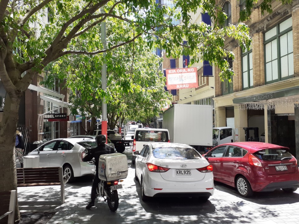
Since I was first elected in 2010 I have taken a keen interest in the topic of parking. I advocated for the removal of parking minimums in the Auckland Unitary Plan and initiated a Getting Parking Right for Auckland seminar targeted at business associations in 2013. I’m convinced by the substantial body of evidence that reveals the rich rewards available to cities that get parking management* right. Parking is one of the biggest levers available to local government and has system-wide implications. It is also a topic which provokes emotive headlines that politicians find hard to ignore, heated public meetings, and many complaints from constituents.
At the Planning Committee on 4 November we considered the objectives and principles, as recommended as a package by the Auckland Transport Board, that will form the strategic direction underpinning the development of the 2022 Parking Strategy.
Here is a fleshed out version of the points I made at the meeting in support of the recommendation. Greater Auckland has also reported on the meeting here.
The opportunity
O’Connell St, City Centre, Auckland showing before and after once parking removed to create space for people
I started by thanking the Auckland Transport Board for doing the ground work ahead of the council committee meeting. We were only being asked to endorse the AT Board’s recommended strategic direction so that a parking discussion document can be prepared. We were not signing off on the removal of parking or a final version of the strategy. We are only at the starting point of consultation to inform a refresh of the existing 2015 Parking Strategy.
If we get the strategy right, parking management can be a key lever to reduce our carbon emissions, increase mode shift and encourage active transport, improve safety, reduce transport inequity and reduce congestion across the network. We will have the right size tools to respond to growth and increasing intensification. It will be good for business and good for Auckland.
“War on cars”
Elliott Street shared space blocked to people and deliveries by parked cars
Our shared spaces, footpaths and public squares are increasingly filling up with parked cars. Illegal parking is going unchecked on our grass verges and on busy arterials. Driving is heavily subsidised and drivers have become used to the idea that parking in the public realm is largely “free”. There are NO signs that Auckland Transport is anywhere close to waging a “war on cars”. The cars in Auckland are doing just fine and driving is fully supported as a major part of the transport system.
Examples of illegal parking
In fact, rather than an attack on cars, an effective parking strategy, as proposed by the AT Board, is pro-driving. It will reduce congestion and improve connectivity and access to the places drivers want to go. It is pro-communities, pro-equity, pro-children , pro-city building and good urban design. It is also positive for the 30% of Aucklanders who don’t drive at all and those needing space for access (whatever the mode and personal ability).
It’s a “radical plan”
The parking strategy report that came to the Planning Committee grabbed headlines as a “radical plan to remove parking on many of the city’s roads to make way for more bus lanes and cycleways” (NZ Herald, 2 November 2021 )
The current Parking Strategy 2015 was arguably “radical” for Auckland or at least progressive for its time. The strategy provides for parking to be de-prioritised and for road space to be allocated in favour of active transport, PT, and the movement of people and freight. What is being proposed now is not new or “radical” but a refresh of the existing strategy to give AT a clear mandate to implement the very parking management tools AT already has available.
If anything it is “radical” to NOT effectively manage parking to achieve Auckland’s strategic objectives. It is “radical” to give away a valuable resource for free.
It is also not “radical” to take a decade to implement the strategy, as proposed by AT, when many of the parking management tools have already been in place for over 6 years.
Bringing the community along
One of the reasons given by AT for the need to refresh the 2015 Parking Strategy is to provide a “new community mandate”, to “reset expectations” and “set out the need for change”. The report notes that “Our community’s receptiveness to change is diverse. The approach to public engagement will aim to take our communities with us through the changes arising from the parking strategy”.
There are many examples of how the community has already been brought along as a result of the current strategy and in response to a growing city.
Drivers are enjoying the benefits where parking has been removed on key arterials to speed up their trips. It is not necessary to undertake expensive road widening if space is re-allocated from parked cars such as proposed for Great North Road. AT’s Future Connect enables Aucklanders to understand the long-term network plans and where parking is likely to be removed in the future.
Many residents were outraged when the first residential parking scheme was trialed in St Marys Bay almost a decade ago to cope with the influx of all day commuter parking. That scheme proved extremely successful and has served as the template for a city-wide roll out.
It has been well signaled since 2015 that residents of new apartments will not be eligible for residential parking permits. In the city centre and central suburbs there is no longer an expectation that vehicle storage will automatically be available on public roads for free.
Business Associations were once very skeptical about the benefits of paid parking have been won over by the results. It is good for business to use demand responsive pricing to encourage turn over and to allow customers to purchase the parking they need. There’s is a heap of evidence from NZ and across the world to share with businesses about the economic opportunities of re-allocating road space to PT, active modes and extended footpaths. (for example the success of the Karangahape Road street upgrade).
Commuters who once used the residential streets of Ponsonby, Grey Lynn and Freemans Bay to “park and hide” have discovered the expansion of PT services such as the new bus service to Ponsonby Rd from Kingsland station and the competitive price of PT once parking is no longer “free”. Commuters on Waiheke are used to paying for parking at Matiatia implemented to manage the demand. The same approach at all of Auckland’s crowded park and rides located next to frequent PT and served by feeder services will benefit all commuters (*once commuting returns to pre-covid levels of course).
Its all coming too fast
In the debate committee members raised concerns that with the NPS- UD allowing increasing intensification (with no parking minimums) this is not the time to push ahead with the parking strategy. That we are “making life hard” and “creating a situation”
The NPS-UD is the reason more than ever to push ahead with implementing the parking strategy. Intensification is coming whether we like it or not and we have to proactively plan now how we use the public realm to the benefit of all Aucklanders. There needs to be a really clear signal to the market that car storage has to be factored into any decision making when purchasing or renting a home. On-road parking can no longer be advertised as guaranteed “free parking”. As the report states “Roads are critical assets and valuable public space. They serve a range of purposes, principally movement and places, and they need to cater for all modes, rather than just prioritising cars. The way in which road space is allocated is critical as it should be used, and useable, for all Aucklanders, regardless of their travel choices.”
It is difficult for those caught in the transition. It is a transition that has been happening for over 3 decades. It was a transition for residents who moved into the city centre during Auckland’s first apartment explosion in the 90’s expecting to park for free on-street. It has happened for commuters who accepted a job presuming all central residential streets would remain “free” . It has been a transition for residents living on key arterial roads like St Lukes or Manukau Road who can no longer park on street.
During the debate I also mentioned that part of the transition will be encouraging residents to use their off-street garage space for parking rather than the storage of stuff (85 % of houses are estimated to have off-street parking available). Councillors for Manurewa-Papakura Newman and Dalton were right to point that many garages are actually homes.
We don’t solve Auckland’s housing, congestion and inequity issues by pushing out the implementation of the strategy. We don’t help drivers or improve PT by clogging up arterials with parking. We don’t serve our communities by hiding how much parking is subsidised or by accepting a poor return on valuable assets (AT was unable to provide information on parking subsidies or the net parking revenue but from the report it appears to be very low rate of return compared to other cities)
We have to provide the right incentives, services, facilities, information and support to Aucklanders as we transition to a low carbon transport system and an intensified city. Importantly it will all happen with public consultation.
One of my constituients wrote to me with “Any councillor who supports AT’s latest madness is equally mad”. To the contrary, I think it is the AT Board members and Committee members who supported the strategic direction who are completely sane to make evidence based decisions and to embrace a parking strategy that is Good for Auckland.
*Note
“Parking management” is used to refer to the range of tools available to manage parking such as paid parking, park and ride services, residential parking schemes, enforcement, removal of parking on arterials etc
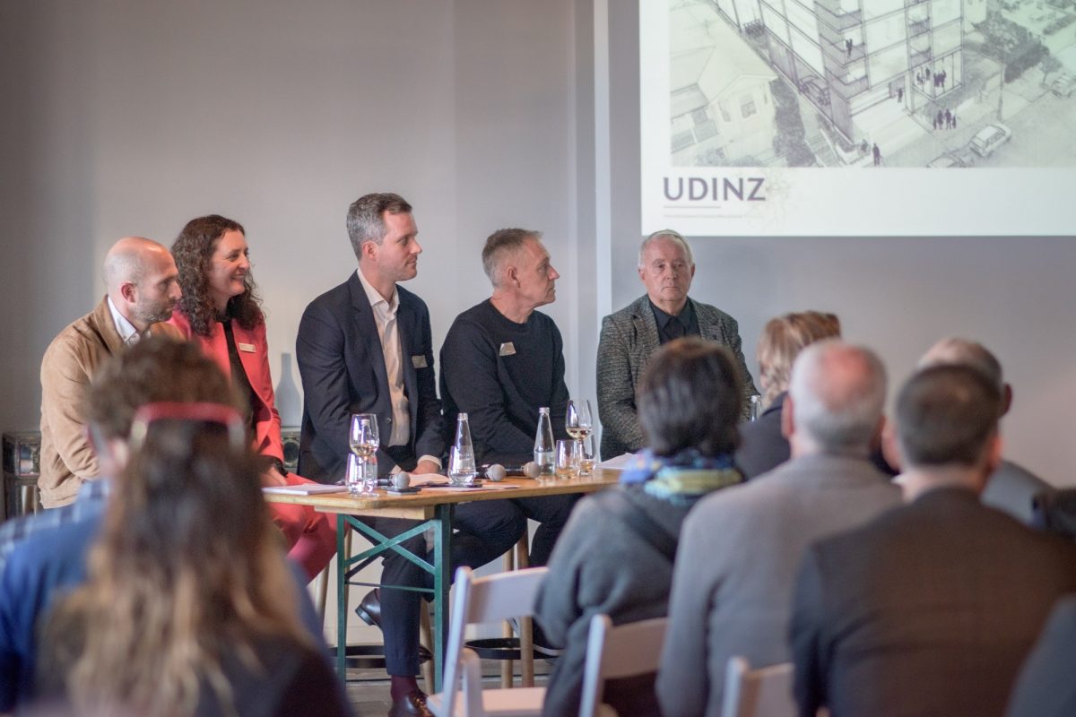
I was recently invited by the Urban Development Institute of New Zealand (UDINZ) to be part of a panel discussion to take a closer look at the government’s new National Policy Statement on Urban Development (NPS-UD) and how it could impact central suburbs like Ponsonby. The event was provocatively headlined “flexible zoning in Ponsonby?” Unsurprisingly this resulted in a number of concerned and curious residents attending. Since the NPS-UD was first consulted on by government in 2019 it has largely so far flown under the radar even though it will have a significant impact on Auckland and other metro centres.
I was on the panel as the local Councillor but as Auckland Council is currently working on an official response to the NPS-UD I provided an update on the process and only a personal view about the likely implications. I was joined on the panel by Chris Crow, Urban Economist PwC (who also gave a scene setting presentation), Geoff Cooper, GM Strategy, NZ Infrastructure Commission, Don Mathieson, Co-Chair, Herne Bay Residents Association and Colin Leuschke, Director, Leuschke Architects.
The Government prepared the NPS-UD as part of its Urban Growth Agenda to address New Zealand’s housing challenges. The NPS-UD 2020 requires councils to plan for growth and ensure a well-functioning urban environment for all people, communities and future generations. It requires Auckland Council to implement a series of prescriptive “intensification” policies relating to height and density through a plan change to the Auckland Unitary Plan by August 2022.
Many will remember the bitter battle and difficult process over the Unitary plan especially with regards to the extent of protection for heritage and special character. The government’s directive to councils to make room for growth and to remove rules that constrain supply means that the Unitary Plan has to be revisited. There is some alignment with the current plan (e.g. allowing more people to live closer to jobs, goods and services, providing greater housing choices), but the NPS-UD is likely to require significant changes to the Unitary Plan in some parts of Auckland.
The intensification policies the council has to implement focus on enabling greater heights and densities within “walkable catchments” of frequent transport networks and in “other locations” that are accessible to employment, goods, services, education or in high demand. In these locations there has to be a minimum zoning of six stories unless “qualifying matters” apply such as maintaining open space for public use or heritage orders.
Approximately 30,000 properties sit within the current Special Characters overlay that will fall within the NPS-UD areas that have to be considered for further intensification through up-zoning. Council will need to carefully consider what locations fall within the directive and whether Special Character is a “qualifying matter”, and if so, should this apply across the board, or in some but not all areas. Council has the massive task of undertaking site-by-site surveys and analysis for every property in order to be subject to a qualifying matter. Personally I think we have to find a way of retaining the special character of neighbourhoods that tell the story of where we have come from and are valued by all Aucklanders. I don’t think it is a zero sum game between providing much needed housing and heritage. As Don on the panel mentioned there are plenty of compact cities around the world that have found a way to grow at the same time as protect heritage. It is also a wider debate that what is considered heritage and the value of our landscapes is not just a European construct.
At this stage however, it is important to note that council is only at the start of a lengthy period of detailed policy, planning and public engagement work on the NPS-UD and how it needs to be applied. Another challenge that has to be worked through is what infrastructure will be required to support the increased density and who pays for that infrastructure. No decisions have been made yet. Aucklanders will have opportunities to have their say.
This is just a brief summary of the NPS-UD. The UDINZ event provided the first occasion to share some initial thoughts at a very early stage. Please refer to the Ministry for the Environment website for more details.
Report to the 1 July Planning Committee meeting seeking endorsement of approaches in response to several the intensification provisions in the National Policy Statement on Urban Development 2020 (item 13).
Quietly, over the past six years, Willis Bond & Co has been building a new neighbourhood of award-winning apartments at Wynyard Quarter. Private investment has followed the public spend to create people-orientated spaces designed for modern urban living. This “placemaking” includes wide footpaths, new plazas and parks, rain gardens, activated event spaces and lush ngahere.
I was fortunate to attend a recent celebration hosted by managing director Mark McGuiness to welcome the new residents and thank those involved in the development. Inevitably, the conversation turned to Auckland’s prolific orange road cones.
Orange cones have become a convenient focus of rage for some commentators in Auckland.
In McGuiness’ view the cones are a positive symbol that the city is getting stuff done. They show progress is underway, and the city is improving after decades of under-investment, poor planning and short-sighted decision-making.
I think of it as Auckland moving from a town with a cowboy mentality focused on short-term gains, to Tāmaki Makaurau, a truly international city with a uniquely indigenous point of difference.
Auckland Council is making progress on the things that matter for our city. We’re working to stop poo from entering our harbour and we’re getting on with essential work such as improving our ferry infrastructure and ensuring the Quay St sea wall doesn’t collapse.
We’re delivering new public spaces and creating the right conditions for new residential, retail and office investment. I don’t think it makes sense for any of this construction to be slowed down or stopped.
New Ferry Basin public space “Te Wananga” due for completion in December 2020
When the cones are removed from Quay St a stunning street will be revealed; one that will never go back to a four-lane road. Just as other international cities have embraced their waterfront, Quay St, together with a new downtown square, will be our welcome mat for international events happening in 2021. Slow speed, pedestrian-focused environments will become the new normal in our city centre.
It is time for Aucklanders to move on from the myths that “public transport is rubbish” and “no one uses cycle lanes”. All the evidence (that could fill a separate column) points to the opposite.
We are no different to people in other international cities. We embrace the most convenient, reliable and affordable transport option. We jump on bikes when we feel safe. We shop, relax, linger and spend in inviting places where people – not cars – are king.
Wynyard Quarter was the “guinea pig” for perfecting placemaking in Auckland, but this best-practice approach is now spreading benefits across the city.
It is also time to drop “CBD” and instead refer to it as the city centre as it has a growing residential population, with more than 33,000 people already calling it home.
The work symbolised by the humble orange cone work will benefit not just the residents I represent, but all Aucklanders, because a functioning, thriving city centre is good news for our region and our country.
Our city centre generates a fifth of Auckland’s GDP and more than 130,000 people work there.
Our biggest infrastructure project, City Rail Link, will double the number of people who live within 30 minutes of the city centre when it opens in 2024.
Along with our construction partners, we have to do more as a council to share the vision of what is happening in the city centre so Aucklanders can see the wider benefits. We need to ensure traffic management is exemplary, projects are coordinated and efficiently managed, and that businesses and residents are looked after through the construction. We must help all those who need to travel into the city regardless of transport mode.
Collectively as Aucklanders, we’ve got to put the orange cone “chaos” into perspective. When I recently missed an early morning flight it wasn’t cycleway construction that delayed me getting to the airport. It was the traffic I created, other traffic on the road, and a minor crash. These types of delays are so commonplace Aucklanders consider this a “normal” inconvenience.
I agree with McGuiness that we shouldn’t turn orange road cones into the enemy. When the first stage of Wynyard Quarter opened in August 2011, Aucklanders were amazed at the welcoming transformation and flocked to the waterfront. As parts of downtown are completed and pedestrians are welcomed back, I have no doubt that we’ll get the same reaction.
Delivering people-friendly, safe and vibrant environments continues not just in downtown but across the city. We can all feel proud at the stuff that is getting done. The future is in progress.
• Pippa Coom is an Auckland Councillor for Waitematā and Gulf Ward.
In March Auckland Transport consulted on the introduction of a new bylaw to set new speed limits, including lower speed limits for approximately 10% of Auckland’s local roads. Hearings are currently underway to present to a hearings panel made up of AT Board Chair, Mark Gilbert, AT Board member Sir Michael Cullen, Exec GM Service Delivery Andrew Allen, and another AT exec member. Here is my presentation on behalf of the Waitemata Local Board.
Speed Limits Bylaw Hearing
Thank you for the opportunity to present today.I am here as Chair of the Waitemata Local Board representing the city centre and central suburbs of Tamaki Makaurau. I’ve been transport lead for the board for almost 9 years and I’m also an Executive committee member of Trafinz the NZ road safety institute representing Auckland Council. I was part of the team that launched the Auckland Vision Zero campaign in July 2016 along with Brake – the road safety charity, Cycling Advocates Network , Walk Auckland and NZ School Speeds calling for Government and local authorities to adopt a Vision Zero approach to road safety – aiming for zero road deaths and injuries.
Tragically since that time the number of road fatalities and serious injuries has continued to increase. We’ve just had an horrific 10 days on NZ’s roads with 28 people losing their lives. Just in the last 24 hours 2 people have been critically injured in Auckland . In Waitemata a pedestrian was seriously injured last week just near here on Quay Street.
We as politicians, governors, decision makers, enforcement officials need to take responsibility for the fact we have overseen a 78% increase in DSIs over a 5 year period on our watch.
This is clearly unacceptable. I’d like to thank CEO Shane Ellison and the AT board for their leadership in confronting this crisis head on and for taking the first serious steps in Auckland to make our streets safer.
As you are all well aware, one of the fastest and most cost-effective ways to reduce road danger is to implement speed reduction measures. A drop of just 10km/h can make a huge difference to the safety of our streets. Reducing a 50km/h local street to 40km/h reduces the risk of pedestrian death from 60% to 25%. Speeds of 30 km/h are the maximum any vulnerable or unprotected road user can withstand without sustaining death or serious injuries. In fact, lowering speeds is the most valuable move any local authority can make if we are serious about saving lives. The World Health Organization has concluded that a five percent reduction in average speed can result in a 30 percent decrease in traffic fatalities
There is of course a heap of evidence that backs up why implementing safe and appropriate speeds works. I will leave that to the experts but I was really pleased to hear AT Board chair Lester state at the launch of the consultation that the final decision would be based on the evidence. An evidence based approach is essential as we navigate through a highly emotive topic .
With regards to the Local Board position I would like to highlight our key initiatives from our local board plan, our on going advocacy and our feedback on the consultation that supports Auckland Transport taking forward the proposed speed limit changes and moving on to the next stage as soon as possible.
We were the first local board to adopt Vision Zero.
In the Local board Plan 2017 Outcome 5: “An accessible, connected and safe transport network with well-designed streets” we have an Objective to “Improve safety for all road users” including the following Key Initiatives:
Work with Auckland Transport (AT) to implement slow traffic speed zones in the city centre and residential areas, and through town centres.
Advocate to AT to adopt a target of zero serious injuries or deaths on our roads as part of a comprehensive approach to road safety.
Advocate to the NZ Transport Agency to change the give way rule at side street crossings to favour pedestrians.
We are now currently in the process of updating our annual advocacy positions to Auckland Transport. These will be agreed to as part of our Annual Local Board Agreement 19/20) but are proposed:
Safer Streets – Auckland Transport to adopt a target of zero serious injuries or deaths on our roads as part of a comprehensive safe systems approach to road safety including safe road design, enforcement, safer speeds and driver education.
Safe and appropriate speeds – Support slower speeds that are safe and appropriate in residential areas, through villages town centres and in the city centre
We are taking this approach with the support of our communities who have consistently told us they want safer streets – where kids can walk to school, streets that are healthier, and attractive, and streets are destinations. Slower speeds will bring a range of additional benefits – it is good for business, reduces pollution and makes for a kinder more caring community. Slower speeds will also help the city welcome small wheeled mobility like e-scooters without introducing more conflict on our crowded footpaths that need to be prioritised for pedestrians.
We are responding to fundamental changes to the way the city is growing. The City Centre population is almost at 60,000 – it is no longer a CBD.
We are host to the region with hundred of thousands of people coming into the city centre every day for work, study and play and as tourists and visitors. There are now 118,000 City Centre employees.
We are yet to see the AT feedback report for Waitemata so I am not in a position to give specific feedback on each proposal but we know there is general support for safe and appropriate speeds and in fact for more extensive changes. For example the Freemans Bay School parents who are asking for the inclusion of Wellington and Hepburn Streets in the Freemans Bay zone. Residents on John Street have questioned why they are not part of a Ponsonby slow speed zone.
We know there is push back on streets that are designed like motorways such as Hobson/Nelson Street that encourage speeding. However, this is now the most dense residential area in Aotearoa so we have to re-imagine how these streets function and who is prioritised.
The speed needs to come down but as part of a much broader package of safety improvements such as removing motorway style signage, pedestrian focused treatments and road diets. In the long term the local board supports Hobson and Nelson being restored to two way streets.
A hearts and minds campaign is also needed to bring Aucklanders along on a shared understanding that slower speeds are pro-community, pro- business, pro children. It will make our streets more accessible and safe for people of all ages and abilities.
In concluding I’d like to acknowledge the AT staff who have fronted the consultation and are doing the mahi. I know it has not always been easy but this is important work.
And finally but not least to acknowledge the victims of the road safety crisis and the loved ones they have left behind. If we are serious about reducing road trauma the speed limit must be reduced.
On 19 September we celebrated 125 years since New Zealand became the first self-governing country in the world in which all women had the right to vote in parliamentary elections. Although it wasn’t until 1919 that women were eligible to stand for Parliament and another 40 years before Elizabeth McCombs became Aotearoa’s first elected female member of parliament.
Ellen Melville, the first woman elected on to Auckland City Council in 1913, stood unsuccessfully for parliament in 1919 for the electorate of Grey Lynn. She went on to stand a further six times always polling highly but blocked from achieving her potential by the sexism of the time. The Ellen Melville Centre in Freyberg Place was erected in memory of her 33-year membership of the Auckland City Council. To coincide with the one year anniversary of the re-opening of the upgraded Ellen Melville Centre the local board and the Auckland Branch of the National Council of Women recently hosted a morning tea in honour of The Rt Hon Helen Clark who has a room named after her at the Centre. The former Prime Minister continues to be a strong advocate for women’s rights.
I’m grateful for all the women who fought vigorously for the right to vote and for the right to stand for public office. I ultimately owe my career to them. I was first elected on to the Local Board in 2010 on the City Vision ticket but in 2009 I experienced my first taste of political campaigning when I stood unsuccessfully as an independent in the Auckland Energy Consumer Trust election. Now renamed Entrust, the 5 Trustees are elected every three years by the 320,000 Auckland electricity account holders. Entrust owns a 75% share in Vector providing an annual dividend to consumers. The Entrust election usually goes under the radar resulting in a very low voter turnout. However, what has been described as the “least well-known political soap opera in Auckland” has been blown open. The C&R trustees, who have held all spots on the Trust for 9 years, are infighting and have dumped long standing Vector chair, Michael Stiassny. There are indications C&R are planning on selling down the Vector shares. There are serious issues at stake that hopefully will encourage far more electricity account holders to exercise their right to vote even if it does require a trip to a post box!
Pest Free Auckland 2050
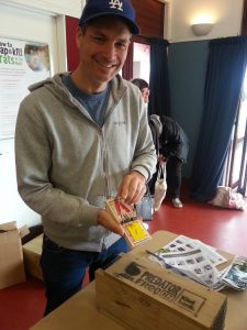
Jesse Mulligan at the launch of Predator Free Grey Lynn held at GLFM in August 2017
As part of Conservation week, Auckland Council recently hosted Pestival 2018 an annual event to showcase community-led conservation and an opportunity to discuss best practice to create predator free environments that encourage the return of native birds.
Broadcaster and Grey Lynn local Jesse Mulligan was MC for the event. He paid tribute to the many volunteers who are working on Pest Free Auckland 2050 initiatives. Jesse is also coordinator of Predator Free Grey Lynn, a local group that aims to get rid of native bird killers like rats and stoats. There are other local Predator Free New Zealand groups that can be found on Facebook or via Auckland Council’s website page Pest Free Auckland 2050.
On 10 March I attended a joint Planning Committee and Waitematā Local Board workshop hosted by Panuku to discuss the extensive Waterfront and City Centre Work Programme. Over the next year we are going to see the refresh of the Auckland Plan, the City Centre Masterplan and the Central Wharves Strategy and further work on the Wynyard Quarter Framework Plan. The invite described the workshop as follows
Significant progress has been made towards achieving Auckland’s vision of our CBD waterfront as a world-class destination and economic driver for the region. The Council family is currently working together to build on this progress and refresh our thinking with respect to the changing context of the waterfront, so as to ensure that we continue to deliver on the potential for this crucial part of the city – from Harbour Bridge to Teal Park.
You are invited to a workshop to inform the next stage of waterfront planning. The workshop will help you to fully understand the current state, interrogate the impending decisions, and provide guidance for the strategic refresh.
This complex and ambitious development programme is being planned and delivered by an integrated taskforce from across Council, Panuku Development Auckland, ATEED and Auckland Transport.
After the workshop I wrote the following in a facebook post in reaction to one of the slides from the presentation:
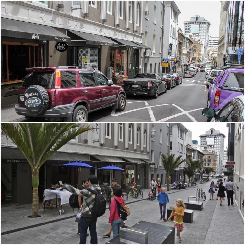
Interesting to attend the Planning Committee workshop this morning on the waterfront and city centre work programme. What it really highlighted to me is how much of our planning is still being dictated by Auckland Transport engineers and their “expectations” and modelling of traffic volumes. The design of the city is a political decision. As we know from smart people like Ethan Kent (one of many international speakers we’ve been fortunate to host in Auckland) if we design for “cars and traffic we will get more traffic. If we design for people and places, we will get people” This is so clearly demonstrated on O’Connell Street. If we’d listened to the engineers the upgrade would have included car parking. Instead the politicians led by Shale Chambers set the vision for a shared space. It is working so well, especially while it is now temporarily closed for the developments nearby, the retailers would like it permanently closed to cars. As we move ahead into the next version of the Waterfront plan and City Centre master plan, Auckland Transport needs to ask what the vision is (e.g. a carfree city centre, a pedestrian first city centre, a child friendly city, low carbon city etc), the politicians should then confirm, after public consultation, the outcomes we want and we must then demand the city is built to achieve that vision.
O’Connell Street before and after (Photo Credit: Transport Blog)
The Weona-Westmere walkway opened just before Christmas 2016 on a beautiful summer’s day. Over the holiday break many people have told me how much they’ve enjoyed the new walk and the opportunity to explore along previously inaccessible coastline.
I now have a new favourite loop walk that includes the Weona-Westmere walkway and connects up with local paths through regenerating native bush.
On a google map of the route I’ve included details about how to access the walk, places of interest, photos along the way and pits stops (including toilets and drinking fountains).
It would have been hard to imagine even a few years ago politicians flocking to the opening of a cycleway. In fact there were hardly any cycleway openings in Auckland until the PM opened Grafton Gully cycleway in September 2014. However that all changed when serious investment in cycling got underway thanks in part to the Urban Cycling programme. The additional government funding matched with Auckland Council interim transport levy funding is starting to have an impact. As the network of cycleways grows on busy routes cycling numbers are increasing with a doubling of numbers coming into the city centre in the last year.
Protected cycleways like the new one on Quay Street feel safe and pleasant to ride. They attract commuters, recreational riders, tourists and families with children. They unleash the huge latent demand for opportunities to ride safely. They are good for businesses , good for health & wellbeing and good for improving the liveability of Auckland*. It is not surprising politicians of all colours want to celebrate when new cycleways open!
Dawn blessing for the cycleway
High Five for Kathryn King, AT’s walking & cycling manager from Ropata Selwyn from Mangere Bikefit
PM John Key and Mayor Len Brown at the opening of Quay St cycleway 2016
Members of the Waitemata Local Board, Cr Chris Darby and the Mayor Len Brown
The new cycleway counter on Quay Street
PM John Key and Hon Simon Bridges the first to ride the Quay St cycleway (Photo credit: Transport Blog)
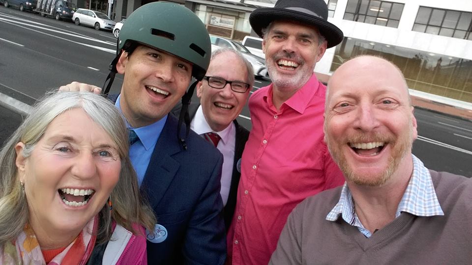
Cycleway selfie with Auckland Transport cycleway project managers
Cycleway selfie with the Mayor
Cycleway selfie – Barb Cuthbert, Hon Simon Bridges, Mayor Len Brown, Patrick Reynolds and Paul Shortland
Auckland’s waterfront will be an improved urban space and an even busier cycle route following the opening of the Quay St Cycleway today.
The Prime Minister, Transport Minister Simon Bridges, Mayor Len Brown and a large group of people on bikes, were the first to use the city centre’s newest cycleway. The opening was preceded by a dawn blessing with Iwi representatives.
A new cycle counter on the promenade, a first for Auckland, will highlight the number of people cycling along one of Auckland busiest routes.
On the waterfront side of Quay St, the 1km, two way cycleway goes from Princes Wharf at Lower Hobson St to Plumer St. The $2.18m cycleway is being delivered by Auckland Transport and has local funding and an investment from the Government through NZ Transport Agency and the Urban Cycleways Programme.
It will benefit everyone who spends time at the waterfront and will encourage more people to start cycling into the city centre says Kathryn King, Auckland Transport’s Cycling and Walking manager.
“Having a dedicated cycleway like this means there is more space on the promenade for people to walk and enjoy the harbour views. The planter boxes, which provide protection from traffic, improve this wonderful space by adding some greenery.
“The cycle route into the city centre along Tamaki Dr is the busiest route in Auckland, and this will make cycling from the east even more attractive. Providing a protected cycleway on Quay St gives people working in the downtown area greater travel choice and an excellent cross-town route that avoids a lot of city traffic.”
Mayor Len Brown says it’s another important chapter in his vision for Auckland as the world’s most liveable city as it transforms the city centre into a pedestrian and cycle friendly destination.
“This project is another example of Auckland Council, Auckland Transport and the Transport Agency working well together to achieve a great outcome.”
Bike Auckland, chair, Barbara Cuthbert says the cycleway is a great addition to downtown Auckland. “It’s hugely exciting to have a safe separated space for people cycling and those walking close to rail and ferry services.”
The three-metre-wide cycleway connects with the Beach Rd Cycleway at Britomart Pl and by the end of 2018 will link with the Nelson St Cycleway and Westhaven to City Cycleway at Princes Wharf and the Tamaki Dr Cycleway.
When phase two of Nelson St Cycleway is constructed next year, the city centre cycle loop will be complete. This loop includes Lightpath, Nelson St, Grafton Gully, Beach Rd and Quay St cycleways.
Auckland Transport is working with project partners Auckland Council and the Government through the NZ Transport Agency and the Urban Cycleways Programme on a $200m programme of cycle improvements from 2015 to 2018.
Quay St Cycleway
The Quay Street Cycleway is delivered by Auckland Transport and is one of the projects funded in the 2015-18 Urban Cycleways Programme (UCP).
Auckland Transport is working with project partners Auckland Council and the Government through the NZ Transport Agency and the Urban Cycleways Programme on a $200m programme of cycle improvements from 2015 to 2018.
The UCP involves central government partnering with local government to accelerate the delivery of $333 million of key cycle projects around New Zealand over the next three years
The $2.18 million cycleway is funded from $0.70M Central Government, $0.75M National Land Transport Fund, $0.73 million Auckland Transport. This project is part of the wider Auckland city centre package project announced through the Urban Cycleways Programme.
The one kilometre long, three metres wide, two-way cycleway goes from Princes Wharf, Lower Hobson to Plumer St. The majority of the route is on-road, physically protected from traffic with concrete separators (similar to Nelson St Cycleway) and planter boxes.
This cycleway connects with the existing shared path on Quay St in the east. By 2018 AT will have delivered another cycleway that will connect Quay St Cycleway at Plumer St with the start of the Glen Innes to Tamaki Dr Shared Path at Hobson Bay. People will be able to cycle and walk from Glen Innes to the city centre.
Beach Rd Cycleway connects with Quay St at Britomart Pl allowing people to cycle all the way to the Northwestern Cycleway via Beach Rd Cycleway and Grafton Gully Cycleway.In the west, people can now cycle over Te Wero Bridge to Wynyard Quarter and around the Viaduct. Ultimately it will connect with Westhaven Dr to City Cycleway and Nelson St Cycleway when they are completed in 2017.
When Nelson St Cycleway phase two is complete next year, a city centre cycle loop will be complete including the pink Lightpath, Grafton Gully Cycleway, Beach Rd Cycleway and Quay St Cycleway. The project team is currently working on how best to connect Nelson St Cycleway (which currently ends at Victoria St) with Quay St Cycleway.
Cycling in Auckland by numbers
750 cycle trips per day on pink Lightpath since it opened December
A doubling of the number of people cycling into the city over three years.
50% increase in people cycling in Symonds St/Grafton Gully corridor following opening of Grafton Gully Cycleway in 2014
20% increase in people cycling on Northwestern Cycleway in May 2016 compared with May 2015.
Upcoming cycle projects in Auckland
Mangere Future Streets opening late September
Mt Roskill Safe Routes opening late October
Ian McKinnon Dr Cycleway public consultation starts July
Karangahape Rd Streetscape Enhancement and Cycleway public consultation by August.
Great North Rd Cycleway public consultation by the end of 2016.
Notice of Motion: Auckland Transport Street Tree Planting Policy
A notice of motion is a useful tool available to elected representatives to get action on an issue when the organisation fails to respond by other means. As lead of the transport porfolio for the Waitemata Local Board I have a particular interest in what goes on in the road corridor managed by Auckland Transport. I want our streets to be safe, vibrant, well connected and beautifully designed for everyone to enjoy. I’ve come to appreciate how much trees benefit our urban environment and can enhance every transport-led project (not to mention act to reduce GHG emissions).
However what I have come up against time and time again is the lack of a standard practice or policy to ensure Auckland Transport plants street trees. Many oppportunities are being missed to add trees to the city streetscape. Individual project managers are doing their best but the budget arrangements between AT and Auckland Council parks are a block to trees being incorporated into street designs and renewal projects. I’ve set out these issues and examples below by way of background to my Notice of Motion.
At the Waitemata Local Board meeting last night (14 June 2016) my recommendations were unanimously passed (seconded by Member Dempsey). We all recognise the huge value of street trees and would like to help Auckland Transport progress a tree planting policy for Auckland.
Recommendation
a) That the Notice of Motion be received.
b) That the Waitematā Local Board:
i) notes the benefits of urban street trees and the Auckland Plan, City Centre Master Plan and Waitematā Local Board Plan 2014 commitment to plant street trees;
ii) requests Auckland Transport in association with Auckland Council Parks develop:
A street tree planting policy; and
A strategy to meet the City Centre Masterplan street tree target of a 25% increase by 2021;
iii) requests Auckland Transport allocate budget (capex and opex) for funding new street trees as part of streetscape projects and footpath renewals;
iii) requests that this Notice of Motion is circulated to all Local Boards, the Parks, Recreation and Sports Committee, Auckland Development Committee, Auckland Transport Board and Chief Executive and Auckland Council Policy and Bylaws team
Background
Auckland Council, with the support of the Waitematā Local Board, has made a clear commitment to plant street trees in the urban environment.
Directive 8.2 of the Auckland Plan is to protect, enhance and increase Auckland’s green infrastructure networks. Auckland Council is committed to increasing the number of trees on reserves and streets. Council has committed to valuing natural heritage and ‘greening’ Auckland’s expanding network of open public spaces which provides for a more attractive city, while reducing GHG emissions and improving community resilience to the effects of climate change and resource scarcity and by supporting local food production.
As outlined in the Waitematā Local Board Plan, the board supports “increasing the number of native plants and trees in our parks and streets to help restore biodiversity” (Local Board Plan 2014, page 32).
In the Becoming a Local Carbon Community Action Plan (August 2015) we have committed to an Action Area of Enhancing the Urban Forest and Biodiversity.
As part of the Urban Forest Mapping Project Report for Waitematā we committed $2500 to draw up a tree inventory and to collect data in order to analyse the urban forest layer in the local board area. This work will assist us in assessing the need and timing for the replacement of trees.
In February 2016 the City Centre Masterplan targets were reviewed and revised targets approved by the Auckland Development Committee. The Local Board supports Outcome 8: An exceptional natural environment and leading environmental performer and the revised target of increasing streets trees in the city centre by 25% by 2021.
Street trees provide a range of benefits in the urban environment including:[1]
Improve pedestrian safety by slowing traffic
Good for business by increasing foot traffic in town centres
Reduce crime
Improve the health and wellbeing of neighbourhoods by increasing the attractiveness and security of walking
Reduce the need for drainage infrastructure
Provide shade
Provide oxygen and sequester carbon
In the photo left Pohutukawa trees on Great North Road saved from road widening with the support of the Waitematā Local Board for future generations to enjoy.
Auckland Transport is responsible for planting trees in the road corridor on behalf of Auckland Council. The responsibility for the ongoing care and maintenance of streets sits with Auckland Council Parks.
Despite the clear benefits of street trees and the Auckland Council commitment to increase street trees, Auckland Transport doesn’t have a policy to ensure street trees are planted in the urban environment. Auckland Transport also doesn’t have a strategy to meet the City Centre Masterplan street tree target. The responsibility to consider the addition of street trees is left with individual project managers on a case-by-case basis.
Auckland Transport has confirmed that street trees will only be included in a project if a specific budget is identified for the planting and for the ongoing water/maintenance cost. If there is no budget for ongoing maintenance (for at least 1 year) Auckland Council Parks will not agree to take on the responsibility for new trees.
Auckland Council Parks have provided the following response:[2]
Parks advocate for the inclusion of new tree assets in the road corridor where private development impacts on public open space and where AT is delivering renewals and streetscape upgrades. However, Parks only plays an advisory role (ie we are asked to comment on designs) in the majority of instances. If council is to deliver positive outcomes at all opportunity Auckland Transport and the consenting arm of council need to incorporate conditions around additional tree planting and which for the following reasons may be difficult to do or will require additional funding:
New tree planting in the road corridor or within public open space is not a requirement of private development and there are no rules requiring resource consent applicants to plant anything unless they are seeking approval to remove existing vegetation or regulatory consider there are adverse visual effects from the development that need mitigating
Footpath renewal budgets do not come with additional budget to plant new trees.
Tree planter boxes, or in ground planters, can only be funded by new projects through CAPEX and Community Facilities only accept them from a maintenance perspective when there are funds put aside for their ongoing maintenance. The same would apply to private development projects in the road corridor / public open space.
Parks will of course continue to advocate, with the relevant stakeholders and partners, for the urban forest and support tree planting wherever it is practical (ie accounting for in ground services, footpath widths, AT design requirements etc), but local board involvement may help provide a more focused approach across the relevant departments / organisations either by escalation or a board workshop to which key officers / managers from Parks (Community Services and Facilities), AT and regulatory are invited.
Currently, the only two funding sources that have been identified to cover the additional consequential opex costs associated with a new street trees (or planters) are either that it is Auckland Transport provided or, if the project was initiated by the Local Board, Locally Driven Initiative (LDI) funded.
The Local Board should not have to fund maintenance costs for new street trees that are associated with non-Board projects. As an Auckland-wide commitment, new street trees should be funded as an asset from a governing body controlled budget.
The following examples illustrate the various situations in which Auckland Transport is failing to take up opportunities to plant street trees.
Graham Street footpath renewal
Footpath maintenance and footpath renewals
The footpaths on Graham Street were recently renewed on a like-for-like basis following completion of a new development. The Local Board was not informed in advance and no consideration was given to the inclusion of street trees.
Streetscape upgrades or footpath works associated with private developments
Works associated with the new Countdown development on Williamson Ave included street trees and the closing of Rose Road to create a pedestrian plaza. Unfortunately, only the street trees on the southern side of Williamson Ave alongside the supermarket were included in the resource consent conditions. With the agreement of Auckland Transport, Countdown contractor re-configured Rose Road with an expanded footpath but no steps were taken to include trees (photo right).
Since this issue was raised by the Local Board, Auckland Transport agreed in March 2016 to include three new tree pits. These tree pits will now have to be retrospectively installed into the footpath at Auckland Transport’s expense.
New streetscape upgrades
When Auckland Transport undertook the upgrade of the Scotland Street/College Hill intersection as a safety project, the Local Board requested that the project include a street tree or appropriate greening.
Auckland Transport supported a planter and had funds to pay for it but Auckland Council Parks did not support it because of the lack of funding for the ongoing maintenance.
Auckland Council Parks supported a street tree but Auckland Transport was not willing to include a tree pit in the design because of underground utilities.
Since the photo left was taken two car parks have been reinstated but the Board is still waiting for a resolution with regards to the inclusion of some kind of greening.
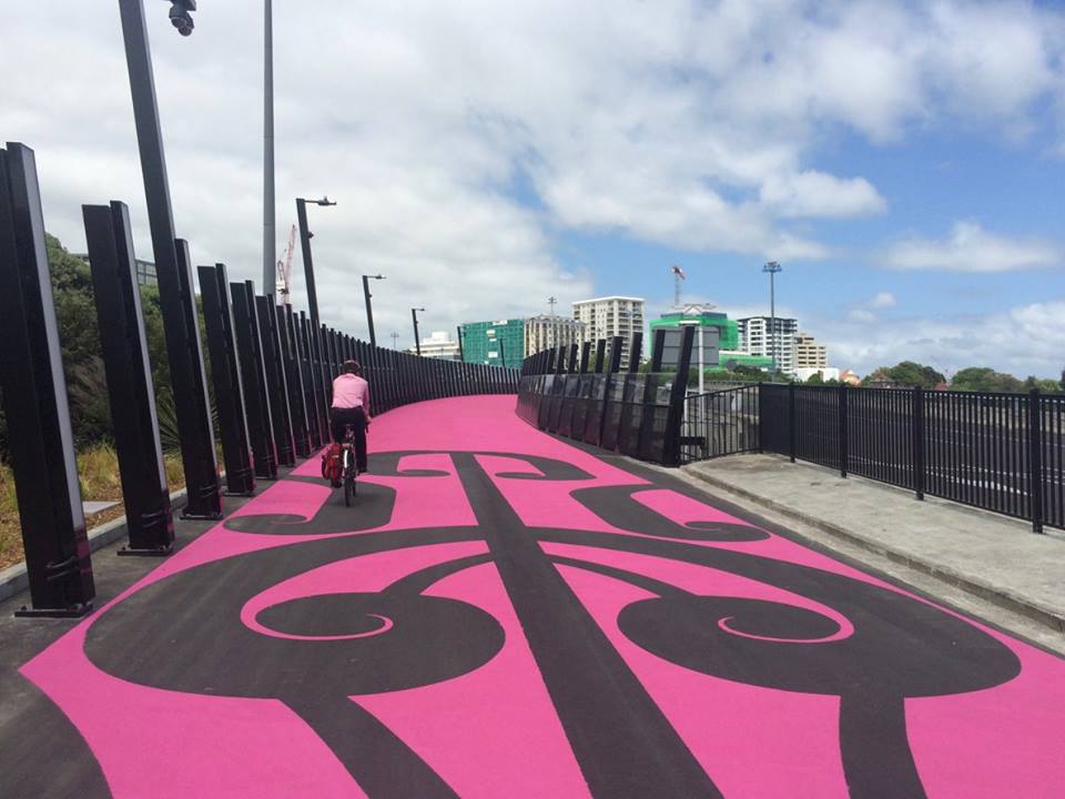
Te ara i whiti – Lightpath opened yesterday to rave reviews and a huge turn out of people excited to experience the world’s first ever pink (officially magenta) coloured cycleway created from a transformed disused motorway off-ramp.
The day started with a dawn blessing that allowed for a contemplative walk with iwi reprepresentatives along the route to admire the new art works and take in the newly created vistas of the city as the sun came up.
Photo: 95bfm
Hon Simon Bridges with the help of super hero riders from Freemans Bay primary school offically opened Phase One that includes a new swirling Canada Street Bridge connecting to the magenta-coloured Nelson Street off-ramp that joins the cycleway that runs down the length of Nelson St to the intersection of Victoria St. Phase 2, to start early next year, will take the entire Nelson St cycleway to Quay St.
In the evening thousands gathered on foot, on skateboards and on bikes to enjoy the “first hoon” and interactive light show that runs along one side.
It was a really happy day for Auckland and wonderful to take part in the celebrations for the magic that has been created in an incredibly short time.
Nelson St off ramp before/after – City Centre Masterplan image
Since the Nelson St off ramp closed in 2005 people have looked down on spaghetti junction and imagined what could be possible to break up the endless grey motorway that dissects the city. The idea to re-purpose the off -ramp took shape in the City Centre Masterplan 2012 (CCMP). It was visualised as a NYC style Highline with an urban garden. In 2013 Matter Architects installed hundreds of bikes as part of an award winning Designday installation which raised further questions about how the off-ramp could be used.
Janette Sadik-Khan inspirational Auckland Conversation presentation in May 2014 provided the platform for a challenge to city’s leaders to get behind a “quick win” transformational pilot project. Barb Cuthbert and Max Robitzsch from Bike Auckland (then Cycle Action Auckland) were ready with just the right project – a concept for the off-ramp as a cycleway connected to K’rd (also supported and promoted by Transport Blog). Fortunately the timing was perfect with a new Regional Director at NZTA willing to make the idea a reality and Auckland Transport agreeing to get on board to tackle Nelson St to provide a business case for the off-ramp as a key connection in the city’s cycling network. The crucial funding arrived with the Government’s announcement of a $100m Urban Cycling Investment Fund in August 2014 followed by confirmation that
Photo: Phil Walter
Nelson St would be included in the programme in January 2015 (I was a member of the Urban Cycling Investment panel that recommended the programme to the Minister). Political support came from the Mayor Len Brown, Councillor Chris Darby (the Council’s political urban design champion) and of course the Waitematā Local Board! (our small financial contribution was to fund a drinking station on route)
The final part fell into place with the decision of the City Centre Advisory Board to use the targeted rate paid by central businesses to fund the WOW factor for the project. This gave Auckland Council’s urban design champion Ludo Campbell-Reid and the Auckland Design Office the opportunity to get creative and follow through on the potential identified in the CCMP to make sure Auckland ended up with something really unique.
photo: Bike Auckland
Following public feedback the concept was created by Monk Mackenzie architects and LandLAB, in association with artist Katz Maihi. Māori patterns and narrative form a core part of the designs, following discussions with iwi. The path includes etched carvings at intervals along the length, with a 6-metre pou at the entrance. The colour (by Resin Surfaces Ltd) represents the heartwood of a freshly cut totara, with the red and pink shades strengthened to contrast with the surrounding motorway lanes. It includes LED lights by Iion lighting lining the safety barriers, that can interact and pulse as people pass them, as well as a strong magenta surface colour that fades out at the northern end in a Māori design (details from the Auckland Council media release).
Waitemata Local Board funded drinking station on Nelson St
I’d like to acknowledge and thank all who played a part in the Lightpath & Nelson St cycleway project from Auckland Council, Auckland Transport, NZTA and the many contractors (including Hawkins Construction, GHD, Construction Landscapes, PFS) who worked hard up right to the opening day. Te ara i whiti is a fantastic example of what can be achieved when the stars align on a great idea and creative people are given the brief and funding to make it happen.
I have previously reported on the recommendations the transport portfolio has made for locations to be included in Auckland Transport’s footpath work programme 15/16 including footpaths requiring maintenance.
In August Christopher Dempsey and I went on a site visit with Auckland Transport’s head of maintenance to ascertain what works can be leveraged from the renewal budget to deliver local board priorities. We followed up by outlining what we would like AT to focus on:
Cheshire Street, Parnell
Accessible access to Parnell Station
As we noted there are a number of missing and narrow footpaths in the area between Parnell Rd and the entrance to the new station on Cheshire St. Restoring all of these footpaths is clearly a big job.
In the meantime we would like to know what AT is doing to ensure that there is at least one accessible route available when the station opens. I.e. a route that is well signposted and suitable for wheel chair users, mobility scooters, prams, people wheeling luggage etc from Parnell Road to the station. This needs to be a priority as it is impossible to walk to the entrance currently without walking on the road.
Update: to be investigated and potentially funded from the Local board capex fund
Cook St pedestrian crossing
Cook Street
We are concerned about the lack of a pedestrian facility to cater for the growing number of residents on Union St who will have a strong desire line to cross over Cook St to access Victoria Park, New World, Sale St etc.
Pedestrians currently have to cross three lanes of high speed traffic or walk 400m up to the Nelson St intersection for a safe crossing
Princes St
We heard that Princes St is on the renewal list and a project team is being set up to address the many complex issues of upgrading one of Auckland’s historic roads. We asked to be kept close to this work and the project include the entire length of Princes St to the Emily Place intersection and for cycling facilities to be scoped as part of the design (this also needs to be tied into the cycling contra-flow on Alfred St that we have had logged with AT for some time now but has not been actioned)
AT update: The upgrade does not include the Emily place intersection (the transport portfolio has logged this separately)
Winchester St access to K’rd
Walkway signage
We noted a number of locations without walkway signage but where NO EXIT signs incorrectly give the impression there is no pedestrian access:
Liverpool St towards K’rd
Liverpool St steps to Airedale St
Hargreaves St to Beaumont St
Gudgeon St to Beaumont Quarter (
Winchester St to K’rd – this connection has been newly discovered and has recently been demarcated by the adjoining land owner. There is a good opportunity to provide a pleasant walking route from Newton Rd to K’rd via Edinburgh St (photo right)
City Road between Liverpool St and Symonds St and Liverpool St between City Road and K’rd
City Road
After learning that City Road is on the 15/16 renewal programme we have confirmed that we would like to ensure that the 1m footpaths are not replaced on a like for like basis as this is no longer best practice in a high foot traffic location (even on a rainy afternoon we observed more people walking through the area than driving). See photo right.
This is a good opportunity for AT to assess the traffic movements and look at how the footpaths can best be widened (eg narrowing the lanes; restricting rat running traffic; contra flow for cyclists etc)
AT update: AT has confirmed investigating footpath widening options with AT’s walking and cycling team
Howe St/Hopetoun St/Hereford St
Thank you for agreeing to look at the Hopetoun St/Howe St intersection where the footpath on the bridge abruptly ends without a crossing point.
We also noted that 1000 new residents are moving into the Hopetoun St area and improvements are needed to cater for the increased foot traffic. (For example Can the Hereford St/Hopetoun St intersection please be logged as needing a pedestrian facility)
AT update:AT now plan to implement this when the Hopetoun St Kerb &Channel/footpath renewal between Howe St and Ponsonby Rd is completed during the 16/17 financial year.
Marmion St, City Centre
Real Groovy development – Marmion St, White St, Waverley St
We agreed that any renewals planned for 15/16 should be put on hold in this area until the Real Groovy apartment development has been completed and an assessment can be made of pedestrian movements (we noted the lack of pedestrian facilities currently particularly on Marmion St )
Christopher is going to check the resource consent conditions and what street scape changes are planned as part of the design.
AT update:All programmed kerb & channel/footpath and resurfacing renewal work deferred from the following sites to allow coordination with the private development: Liverpool St, Turner St, White St, Marmion St and Waverly St
Mayoral Drive/Albert St entrances to the Aotea Centre and Bledisloe Carparks/ access to the bus stop
We noted the lack of pedestrian facilities in this area particularly to the bus stop from the Bledisloe Car park and across the car park entrances.
We have yet to receive an update from AT on what is planned as part of the CRL works to cater for bus passengers at this location.
Hargreaves St, Freemans Bay
Hargreaves St
We noted the large number of drivers who are parking on the substandard footpath.
Agreed Christopher to check development plans in this area before any action taken.