Trees at threat from Great North Road widening

St Lukes interchange – update on the proposed widening of Great North Road

In early February NZTA awarded the contract to construct the next stage of Auckland’s Western Ring Route – upgrading the Northwestern Motorway (State Highway 16) between the St Lukes Road and Great North Road interchanges.  The $70m project is jointly funded by the NZ Transport Agency and Auckland Transport. (Transport blog reported on the widening of the St Lukes interchange here)

St lukes intersection Great North RoadAs part of the project AT and NZTA want to widen Great North Road to provide an extra lane turning onto a newly widened St Lukes overbridge and to feed a two lane motorway onramp . Last year AT sought the Waitemata Local Board’s consent to remove 6 mature pohutukaka trees on Council land opposite MOTAT on Great North Road to create an additional lane (I reported on this in September here).  

The Board declined consent but approved for the trees to be trimmed as part of stage one of the project (allowing for the Great North Road lane to be raised to meet the height of the new St Lukes Bridge). The conditions of this approval were confirmed by the Manager – Local and Sports Parks Central (acting under delegated authority) including a request to prioritise cycling and pedestrian improvements as part of the Great North Road corridor management plan that is underway. See the details below

A a meeting on 19 February AT confirmed it is going ahead with seeking a notified resource consent to remove the trees. The public will now have a say in whether AT and NZTA have made a case for widening Great North Road. I certainly don’t think they have and the proposed design is a very poor outcome for PT users, walkers and cyclists.

25 November 2013

To: Aurecon New Zealand Limited

RE: Landowner Approval for works within 820 Great North Road, Grey Lynn (Waitemata Ward) by Auckland Transport and New Zealand Transport Agency.

I refer to your application for landowner approval for works within 820 Great North Road, Grey Lynn. The following approvals were sought from both Auckland Transport and New Zealand Transport Agency:

 Auckland Transport

 –       Temporary use of open space land designated as D06-08 at 820 Great North Road to carry out earthworks and landscape planting associated with the raising of the carriageway of Great North Road and St Lukes Road.

–       Pruning of three pohutukawa trees along the road frontage of 820 Great North Road.

 The extent of the works is shown in the drawings titled:

 –       “Single Left Turn Lane Option, Great North Road, General Arrangement” (drawing number: 215023-SK-C-100-103 Rev A); dated 04/10/2013; prepared by Aurecon New Zealand Limited.

–       “Single Left Turn Lane Option, Great North Road, Planting Details” (drawing number: 215023-SK-A-919-103 Rev A); not dated; prepared by LA4 Landscape Architects.

New Zealand Transport Agency

–       Temporary use of open space land designated as D06-08 at 820 Great North Road for the purpose of carrying out battering (re-contouring) work parallel to the boundary with SH16.

–       Works within 820 Great North Road will include the removal of vegetation, earthworks (including battering) and landscape planting.

The extent of the works is shown in the drawings titled:

 –       “Single Left Turn Lane Option, Great North Road, General Arrangement” (drawing number: 215023-SK-C-100-103 Rev A); dated 04/10/2013; prepared by Aurecon New Zealand Limited.

–       “Single Left Turn Lane Option, Great North Road, Planting Details” (drawing number: 215023-SK-A-919-103 Rev A); not dated; prepared by LA4 Landscape Architects.

–       “RW-112 St Lukes Road Interchange Northern Abutment Basalt Cut Slope Elevation and Plan Sheets 2 to 4” (drawing numbers: 215023-D-J-240-511, 512 & 513 Rev C); dated 15/07/2013; prepared by Aurecon New Zealand Limited.

 This letter provides formal landowner approval on behalf of Auckland Council, subject to the applicant’s formal acceptance of the following conditions:

  1.     The applicant must contact the Auckland Central Park Ranger – Waitemata Ward (Ph: 301 0101) to arrange a pre-commencement site visit and access to 820 Great North Road.

 2.     This letter provides landowner approval only and does not replace the requirement for resource consent. All works must be completed in accordance with the rules of the Auckland Council District Plan – Operative Auckland City – Isthmus Section 1999, or the conditions of any resource consent issued by Auckland Council.

 Vegetation and Landscape

 3.     Pruning of trees within 820 Great North Road shall occur in accordance with the Auckland Transport Code of Practice dated 16 June 2013 and detailed on Aurecon’s spreadsheet for “Over Dimension Envelope Pruning Requirements at existing kerb at 5.0m height from design level”.

 4.     Prior to works commencing beneath the dripline of the pohutukawa trees at 820 Great North Road Auckland Transport and/ or their contractor shall submit to Auckland Council Local and Sports Parks Central for approval, a construction methodology for all works within the dripline of the trees. Specifically detail shall be provided regarding the build up of the carriageway and footpath.

 5.     The approved construction methodology required by condition 4 shall be implemented on site.

 6.     All tree work shall be undertaken following agreement on methodology and be carried out to the satisfaction of the Arboriculture and Landscape Advisor – Central.

 7.     All tree work shall be carried out by Auckland Council approved contractors.

 8.     All tree pruning and works within the dripline of vegetation within 820 Great North Road shall occur as described in the “Arboricultural Implication Report: Proposed Great North Road (East) carriageway narrowing at the St Lukes Road interchange”, dated October 2013, prepared by The Specimen Tree Company.

 9.     Auckland Council’s Parks Arborist Simon Cook shall approve the use of and brand of any ‘High Fungal Mulch’ or other treatment to be placed beneath the trees within 820 Great North Road.

 10.  Prior to landscape planting commencing a detailed planting plan shall be submitted to Auckland Council Local and Sports Parks Central for approval. The planting plan shall be based on the drawing numbered: 215023-SK-A-919-103 Rev A and include details of species, plant numbers and spacing.

11.  Removal of the asphalt on the footpath adjacent to 820 Great North Road is to be carried out using a small digger with a straight blade bucket – under arboricultural supervision. Root heave is visible within the existing footpath (not in the carriageway) indicating the presence of Pohutukawa roots within this area. Therefore the construction methodology must include a layer that will continue (even if only in the short term – e.g. 5yrs) to allow air and water passage. The detail is to be approved by the Arboricultural and Landscape Advisor but might, for example, involve a layer of rocks overlaid with geotextile and then a compacted layer overlaid with seal or root cells which are used in a number of roads and footpaths in central Auckland.

 12.  Where the ‘W’ Barrier is to be installed between the carpark and SH16, the existing carparks and kerbing shall be cut back to allow a 1m planted overhang between the edge of seal and the barrier, ensuring that the resultant carparks meet the requirements of the Unitary Plan.  Extend Coprosma repens ‘Poor Knights’ to this area.   W Barriers to be on steel supports to minimise their structure.  New kerbing to match existing.  A 1m overhang between the edge of seal and the barrier can be provided. Based on geotechnical investigation taken it is likely that this 1m strip can be planted, however this will be confirmed on site during the works.  Kerb relocation will be carried out in accordance with the District or Unitary Plan rule relevant at the time of construction.

 13.  The style and location of the guard rail along the southern edge of 820 Great North Road adjacent to the battered edge with the motorway shall be designed in association with Local and Sports Parks Central.

 14.  Replace all swathes of Muehlenbeckia complexa on Council land with Anamenthale lessionaina.

15.  Interplant sunnier mass planted areas of Phormium ‘Dwarf Green’ with Leptospermum scoparium ‘Tui’, planted in massed clumps, towards centres of beds.

 16.  Replace all proposed flax/anamenthale lining footpath/shared paths replaced by a more upright species, such as Apodasmia or Libertia to prevent trip hazards caused by drooping foliage.

 17.  Planting maintenance/defects period to be 1 year.

 18.  Any landscape hardworks (walls, paving etc) is to match existing.

 Share with care cycle path

Cycle and pedestrian connections through this precinct are a priority for the Waitemata Local Boards.  Achieving a well-planned and connected cycleway is considered part of the mitigation for the loss of open space caused as a result of the project.  The Waitemata Local Board and Albert-Eden Local Board request Auckland Transport confirm consultation for the Great North Road Corridor Management Plan Project will be undertaken with the Boards as part of the CMP project and that the following matters will be considered through this process:

  • a safe pedestrian and cycle connection on the south side of Great North Road through the motorway intersection
  • a safe pedestrian and cycle crossing at the GNR/ Bullock track intersection, which is one of the most dangerous in Auckland
  • separated, continuous cycle lanes along GNR
  •  in collaboration with other stakeholders and Parks, provide connections off GNR via Motions Road and/or Bullock Track/Old Mill Road to Meola Road
  • acknowledgement that Great North Road is on the Auckland Cycle Network
  • provision of cycle delineators on the north bound cycle lanes on the St Lukes Bridge
  • the installation of grab rails where possible
  • the number and location of pedestrian crossings at the intersection of St Lukes and Great North Road
  • the installation of barriers on pedestrian refuges

 20. The work areas shall be adequately fenced to prevent public access within 5m of the work areas.

 21.  All adjacent Residents which share a common boundary with the Reserve shall be notified five working days prior to commencement of works on site.

22.  Any physical work must be carried out in accordance with the requirements of the Health and Safety in Employment Act 1992, Health and Safety in Employment Amendment Act 2002, and any regulations made pursuant to Section 21 of the Act.

23.  Works shall not commence before 7:00am nor continue past dusk or 6pm, whichever is earlier. Works within the reserve shall not be undertaken during weekends or public holidays.

24.  The works area and machinery located within the Reserve shall be left secure overnight.

25.  The park shall be reinstated to the satisfaction of the Parks Advisor. Once work has been reinstated satisfactorily, the Parks Advisor and the Parks and Recreation Advisor will arrange for the bond to be released.

26.  This written approval expires one year from the date of the issue of this letter.

Please note, the Council is granting approval for temporary access in its non-regulatory capacity. This approval does not bind the Council in its capacity as a regulatory authority in any way, and any consent or approval given under this agreement is not an approval or consent in its regulatory capacity, and vice versa.  The Council will not be liable to any other party if, in its regulatory capacity, the Council declines or imposes conditions on any consent or permission any party seeks for any purpose associated with this approval.

If there are, any amendments to this proposal a new assessment will need to be undertaken by Parks, Sport and Recreation prior to any works commencing.

YS etc

Manager – Local and Sports Parks Central, Parks, Sport and Recreation

Draft Ponsonby Road masterplan update

Ponsonby Road masterplan Pollen StreetThis update was published in the February Ponsonby News

Last year the draft Ponsonby Road Master plan generated a huge amount of interest, lots of creative suggestions for the future development of Auckland’s iconic street and a number of queries about how the plan was coming together. Here is an update on the draft, the process so far and next steps.

The idea for a master plan came out of work started by the Western Bays Community Group building on previous studies, plans and initiatives such as the 40km speed limit.  A working group made up of Waitematā Local Board members, the Ponsonby Business Association, community organisations, stakeholders, and Mana Whenua representatives informed the draft Master plan through a series of workshops. Auckland Council also commissioned a report on Māori heritage values and opportunities to better engage with relevant Iwi for the project area. The working group was assisted by Auckland Council planners, urban designers, heritage advisers, landscape and retail specialists, as well as transportation experts from Auckland Transport.

The working group approach was unique in bringing stakeholders around the table early on in the process and developing a draft from the grassroots up. It was big contribution from a group who volunteered their time.   It meant we learnt a lot along the way, challenged “normal” Council processes but ended up with final draft for consultation reflecting a wide range of views.

The vision put forward in the draft is to develop Ponsonby Road as a vibrant, well connected place for people whilst protecting, enhancing and celebrating its unique heritage, reinforcing its role as a key entertainment and boutique shopping destination and improving the natural environment. The draft identifies specific outcomes to achieve this vision over the next 30 year and is framed around four themes – transport and movement, arts , culture and heritage, the natural environment and open space and land use.

The draft plan includes concepts for shared spaces, pedestrian improvements, cycle lanes, bus stops,  native planting, street furniture designs, art works and the opportunities at 254 Ponsonby Road (the Nosh site currently owned by Auckland Council) to provide for a new open space.

Consultation on the draft took place over an extended period involving pop in sessions, a public meeting and draft concepts on display at the Ponsonby Community Centre.  Almost 300 submissions were received on the draft which is an impressive number for this type of consultation. What was also impressive was the quality of the submissions and the comprehensive, thoughtful responses.

Overall strong themes emerged from the feedback that will inform how the master plan is finalised and what projects should be a prioritised for implementation. A full report of the feedback will be on the Board’s March agenda.   It is likely that  a final of the plan will be ready to be signed off by the Board mid-year.  Updated concepts for the development of 254 Ponsonby Road will be consulted on separately.

The draft plan is available on the Auckland Council website.

Waitematā Local Board transport advocacy areas

Auckland Council Annual plan 14 15Submissions on the Auckland Council Annual Plan 14/15 close on Monday at 4pm. This is a good opportunity to let your Local Board and the Governing Body (the Mayor and Councillors) know what key transport projects you think should be prioritised. 

The plan is essentially the Council budget for year 3 of the Long Term Plan. Publicity has been very low key this year  because there are so few new spending proposals or changes from the Long Term Plan and the main focus at the moment is on the proposed Unitary Plan consultation (submissions close on 28 February). But it is still worthwhile making a submission.

As part of the Annual Plan, Local Boards consult on their one year agreements with the governing body – our funding and service levels – and outline our proposed projects and activities (the proposed budget changes of each Local Board are available here)

In their annual agreement Local Boards also put forward all the projects they are advocating for to the Governing Body and the CCO’s in particular Auckland Transport. The Waitematā  Local  Board has the longest list of advocacy areas of any Board in relation to transport projects that we want Auckland Transport to fund and take forward. Our complete list is below. 

So in providing feedback on the Annual Plan 204/15 you can comment on the Governing body’s key transport priorities ( I find the Transport theme very disappointing as it  doesn’t include any walking and cycling projects as priorities  – full document here ) and your Local Board’s transport advocacy areas. The online feedback form is available here

cycle lane Lower Domain DriveWaitematā Local Board Advocacy areas to Auckland Transport 

Cycle infrastructure

Consult with local boards on the development of the Cycling Business Plan and routes and priorities of the Auckland Cycle Network.

Improve cycle infrastructure through the completion and extension of the Auckland Cycle Network with safe, connected, dedicated cycleways including:

  • Carlton Gore Road (bike lanes currently planned).
  • Beach Road, linking with the Grafton Gully Cycleway and with Tamaki Drive and Parnell Station.
  • Parnell to the City Centre walk/cycleway, through the new underpass south of the Parnell Train Station.
  • Nelson & Hobson Street (with separated two-way cycleways, as described in the City Centre Masterplan).
  • Wellesley St connection to Auckland Domain under Symonds St overbridge and on-road connection to the NZTA funded / constructed Grafton Gully Cycleway.

Prioritise the upgrade of all routes in 2014/2015 currently identified as “complete” on the Auckland Cycle Network within the Waitematā Local Board area, but are not of a safe standard.

Traffic calming

Work with the local board on identifying traffic calming measures for the shopping areas in Parnell, Ponsonby, Karangahape Road and Richmond Road to support 40km per hour zones. This would include for example, raised crossings, raised intersections and kerb build-outs to narrow the road.

Undertake a trial of a slow speed zone in a residential area.

Implement the city centre 30km per hour speed zone (as described in the City Centre Masterplan).

Cycle safety

Prioritise the installation of advance cycle stop boxes with feeder lanes including in the following locations:

  • Williamson Avenue northeast coming onto Ponsonby Road
  • College Hill Road westbound coming onto Ponsonby Road
  • Tamaki Drive, westbound at The Strand
  •  St Stephen’s Avenue westbound coming onto Parnell Road
  • Karangahape Road eastbound at Symonds Street, onto the Grafton Bridge
  • Great North Road eastbound coming on to Karangahape Road.

Ensure safe, connected and continuous cycling is provided for in the St Lukes bridge widening including undertaking cycling safety works at the Bullock Track and Great North Road intersection.

Pedestrian safety and amenity

Improve intersections for pedestrians with substantial foot traffic and develop solutions to improve safety and amenity for pedestrians. This includes:

  • All intersections with left–turn slip lanes and no pedestrian facility
  • Intersections with long pedestrian crossing delays
  • Undertaking route optimisation for pedestrians in the city centre including automatic pedestrian phases on one way streets.

Advocate for a change of the give way rule requiring motorists to give way to pedestrians crossing parallel to the priority (main) road at intersections.

Richmond Road Safety Plan

Complete the implementation of the safety improvement action plan during the 2014-2015 financial year in conjunction with Auckland Council for the shopping areas and school zones of Richmond Road, concentrating on the following elements

  • Pedestrian and cycle safety
  • Traffic calming and slower speeds
  • Urban design.

Franklin Road upgrade

Undertake the planned upgrade of Franklin Road to provide for safe and continuous walking and cycling pathways from Ponsonby Road to Victoria Park including continuous pedestrian facilities (i.e. an unbroken footpath on both sides of the road) across all side streets, driveways and intersections (for example by installing raised tables).

Newmarket traffic management plan

Develop a traffic management plan for Newmarket to make traffic flow in a way that is logical and supports public transport, walking and cycling and economic development. This would include consideration of parking, arterial infrastructure, motorway access and signage.

Residential parking zone

Auckland Transport to implement the residential parking zone scheme to manage commuter parking in central Auckland suburbs.

Auckland Domain traffic management

Auckland Transport to improve walking and cycling access to and around the Domain, while discouraging commuter parking use of the Domain through:

  •  Implementation of a parking scheme for the Domain that works to discourage commuter parking (e.g. through pricing)
  •  Improving walking and cycling options
  • Contribute to the development of a Masterplan for the Domain (to be led by Auckland Council).

SkyPath

Auckland Transport and Auckland Waterfront to progress the Auckland Harbour pathway project (the SkyPath) for delivery in 2014/2015.

Footpaths

  • Prioritise the 2014/2015 footpath renewal programme in conjunction with the Waitematā Local Board.
  • Create an agreed public consultation framework for the footpath renewal programme.

Greenways

Fund and deliver the on-road components of the Waitematā Local Board greenways project prioritised for 2014/2015.

Set the three year programme of works in collaboration with the Waitematā Local Board with regards to footpaths, road safety initiatives, cycleways, parking, greenways.

Support other Waitematā Local Board agreement priorities including:

  • the introduction of low impact storm water solutions in the Local Board area;
  • delivery of green walls, roofs and community gardens on Auckland Transport assets e.g. car park buildings;
  • drinking water fountains in the street environment;
  • development and implementation of the Ponsonby Road master plan;
  • Wayfinding signage for pedestrians; and
  • Upgrade of Teed Street (western part), York Street and Kent Street, Newmarket.

What my mum knows about cycling

Barbara Grace with her electric bikeMy mum, Barbara Grace, has had a lot of time to think about what would make Auckland a great place to cycle. When we immigrated to NZ in 1982 she brought her bike and since then hasn’t stopped cycling for transport around town. Today she has three bikes – her folding Brompton, her bike for performing with the Velociteers (New Zealand’s only synchronised cycling performance group ) and her electric bike which is her new pride and joy. She rarely uses her car as she also has a convenient bus stop right outside her house and a goldcard!

It wasn’t that long ago people used to say to her “I know you, you are the lady that cycles around Ponsonby” – she was recognised because so few people were on bikes. She has been waiting a long time for Aucklanders to appreciate the benefits of cycling and for the roads to feel safe for everyone.  She’s  had a few scary moments herself – most recently knocked off by a guy who “just didn’t see her” as he turned out of a side street into her path (despite being  “high viz” as she  was lit up like a Christmas tree).

Barbara Grace performing with the VelociteersSo my mum has been following with particular interest the recent debate about cycle safety following the tragic fatality in Parnell early in January. I think she nailed it with her most recent letter to the NZ Herald that was published last week.

Dear Editor

Thank you NZ Herald for having a week of bike related stuff.  So many opinions from the daft to the very useful.

This is what I know:

  • A small but significant proportion of all road users don’t  obey the rules and are ill-disciplined and arrogant. Trying to work out whether motorists or cyclists are worse is impossible and  pointless. An important difference is that its the motorists who  kill and injure on a regular basis.
  • Cyclists contribute as much as anyone to road maintenance etc. and provide a positive cost/benefit.
  • Because the number of cyclists is increasing all the time (hooray!) we need to get our act together and have bells and lights and show more respect to pedestrians.
  • Every year cycle tourists from overseas, leave NZ shaken and horrified at the way they were treated on the road, this is no help at all to our tourism industry.
  • In spite of the problems, cycling in Auckland is the most efficient and enjoyable way to get around the city.

Thank you

Barbara Grace

Barbara Grace taking part in the 2013 Pride Parade on her Brompton


Walking and cycling on Auckland Harbour Bridge a step closer with approval of Skypath

SkypathYesterday’s Governing Body meeting was dominated by the censure of the Mayor. But also on the agenda was a very significant and exciting project that has strong public support. In a confidential session the council voted to move the project to the next phase allowing council officers to work towards a formal agreement with the Skypath trust and their backers.

The Skypath presentation is available here including details of the proposed construction and a range of  impressive design images . Ben from Cycle Action Auckland also spoke in support of the project and highlighted that it is a critical link for walking and cycling.  More details on how the path will connect at each end on Transport Blog. 

Photo credit: Cathy Casey

I had a last minute call up to speak on behalf of the Waitemata Local Board (standing in for our Chair Shale Chambers who waited 3 hours to speak) to confirm the backing of the Board.

I noted the Board’s long term support for the project which is included in our Local Board Plan and emphasised that we are now keen to move on to the details which will address the concerns raised by the resident associations. There is no doubt that it is a transformational project that has the Board’s full support to be taken forward to the next stage.

Congratulations to everyone who has worked so hard to get to the project to this point in particular Bevan Woodward from the Skypath Trust.


Who will be Auckland’s Janette Sadik Khan?

Paul Steely WhiteCycle Action Auckland recently brought the executive director of Transportation Alternatives in New York, Paul Steely White to Auckland.

At a breakfast presentation hosted by AECOM and Heart of the City, Paul discussed what it had taken to start transforming New York into a cycling city.

He highlighted some keys to New York’s success:

  • Moving beyond “vehicular levels of service”  to wider benefits and modal targets which became possible after  Janette Sadik-Khan was made the Commission of Transport
  • Using other  metrics for measures of performance such as the number of seniors on a street because they want to be there
  • Taking a  “green paint” approach – for example the  quick and dirty work over of Times Square (which started as a trial but has now been made permanent because it was so successful)
  • Doing it quickly with public input a key part of the success (Janette Sadik-Khan’s mantra: Her mantra: Do bold experiments that are cheap to try out.)

Paul observed that Auckland felt like where New York was at 10 years ago.   So what is it going to take to transform Auckland? After being inspired by stories from New York I think we need our own Janette Sadik-Khan who can turn around the culture at Auckland Transport and provide visionary leadership.

From my experience on the Transport portfolio over the last three years I think that Auckland Transport is incapable at the moment of learning any of the lessons from New Year because the organization is fixated on providing a roading network only for efficient vehicle movements.  Cycling infrastructure is considered to be an optional extra and nice to have rather than integral to every transport project.  Auckland Transport is not even on track to meet the Auckland Plan targets for completing the Auckland Cycle Network.

The good news is that Paul Steely White saw signs that the “liveable streets revolution” is underway in Auckland and acknowledged the work of cycling advocates.  What we need now to actually make Auckland the world’s most liveable city with the most liveable streets is our own Janette Sadik-Khan.

Paul Steely White’s visit to Auckland

Auckland Conversation presentation on video

‘Heroic risks’ – US visitor marvels at perils of city cycling NZ Herald 11 October 2013

Kim Hill radio interview

Janette Sadik-Khan: New York’s Streets?  Not so mean anymore. Ted Talk September 2013

Residential parking policy for inner city Auckland

St mary bay parkingI gave an update on the work Auckland Transport has underway on a residential parking policy in my September board report

Parking – Residential parking in St Marys Bay

The St Marys Association has recently raised, in a letter drop, concerns about possible changes to the residents parking scheme that has been successfully trialled for the last year (and recently extended for another year). They do not want to see any moves to encourage commuter parking on residential streets and have not been reassured by the responses received from Auckland Transport..

At our monthly catch up in August Auckland Transport confirmed that a parking strategy is going to the Auckland Transport Board in September which will include residential parking principles. They then intend to consult on a residential parking policy.

My understanding is that the policy is still very much under development and that there are a number of issues the policy needs to cover such as:

  • The appropriate level of on-street parking capacity for each specific zone or suburb: The St Marys Bay trial has been such a success the average capacity is now at 50%.  The consultation needs to give residents an opportunity to respond as to what they think is appropriate in their community.  The Association has made it clear that 50% is about right for St Marys Bay. In areas closer to the city centre or with more mixed use (such as Parnell) there is likely to be greater tolerance for higher  levels of on street parking  (in the city centre the aim is to have capacity at about 75-80% which always guarantee car parking).  In areas with narrow streets and heritage homes a lower level of capacity may be more appropriate.
  • How the scheme prioritises users: The residential policy should seek to prioritise residents but there needs to be consultation on who else the on-street parking can be made available for. For example Freemans Bay and Ponsonby residents may be more receptive to local workers and business owners using the available on street capacity because there are a higher proportion of home based businesses.
  • The appropriate tools to manage the additional capacity through pricing: My understanding is that the parking team are investigating a range of options. A coupon scheme has been given as one example by AT which was strongly rejected by the Association. Through any scheme it is possible to prioritise residents and discourage commuters – it is just a matter of getting the pricing tools right.

I have also been reassured that AT is not working on a policy that seeks to apply a one size fits all scheme to distinct suburbs. There needs to be flexibility about how a residential scheme is applied. For example in Parnell there is a greater need for late night restrictions because of the visitors coming to the bars and restaurants.  Pricing may also need to vary depending on the desirable level of on street parking.

My understanding is that all these issues are going to be covered in the AT policy and it will be consulted on.  It is through the policy development that we need to ensure that St Marys Bay ends up with an appropriate scheme based on the successful trial. I also want to ensure the policy is not delayed as there is a need for effective residential parking schemes in the other central suburbs particularly Freemans Bay.

Parking issues should be reported to Auckland Transport by calling 3553553

The role of bicycles in the suffrage movement

Pippa Coom and Len Brown on Suffrage Day 2013

[updated on the 200th anniversary of the bicycle to include the pic of the Darrow siblings]

2013 marks 120 years since NZ women were granted the vote. I was really fortunate to be invited by NCWNZ – Auckland branch to speak on the role of the bicycle in the suffrage movement at the annual celebration of suffrage day at Khartoum Place. Here is my short speech:

I love using a bike for transport because it is freedom

Freedom from traffic jams, petrol prices and parking problems

So I can imagine the incredible feeling of freedom experienced by women when the safety bicycle was invented in the 1880’s. Cycling was an activity that women could do equally with men, especially wearing bicycle bloomers.

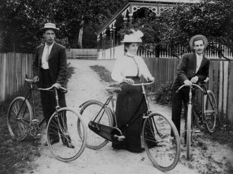
Miss Darrow with her brothers in Thames around 1885 (not known to be a suffragist but this is a lovely photo of a woman in the 19th Century NZ enjoying the freedom of riding
Miss Darrow with her brothers in Thames around 1885 (not known to be a suffragist but this is a lovely photo of a woman in the 19th Century NZ enjoying the freedom of riding)

NZ women were huge enthusiasts for riding. Kate Sheppard was one of the pioneering cyclists and a member of the Atalanta cycling club in Christchurch. I can just imagine Kate and the suffragists on their bicycles collecting many of the 32,000 signatures that secured women the vote. I thank them for their activism and determination and acknowledge the role of the bicycle in the emancipation of women.

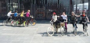
I also give thanks to the frockers who have come along today on their bikes- including Kate Sheppard’s great, great niece, Barb Cuthbert who is also an activist working to get more Aucklanders cycling every day.

Just by riding a bicycle as a woman you are demanding freedom of the road and investment in cycling infrastructure.  Fortunately the Mayor is committed to making cycling a priority in his second term so we can reclaim the roads for women and children and ride with the same confidence as the suffragists in the 19th Century.

Thanks  to Julie Fairey and Margaret Wilson from the NCWNZ for the opportunity to speak about bicycles on this significant day.

Removal of trees on Great North Road for SH16 widening

St lukes intersection Great North RoadI provided this update in my September Board report to our the Waitemata Local Board meeting on 10 September

Auckand Transport and NZTA are seeking the Board’s land owner consent to remove 6 large pohutakawa trees at the intersection of Great North Road and St Lukes Road (opposite MOTAT) to provide for an additional lane for traffic approaching the west bound SH16 onramp.

At an all of Board workshop in August 2013 attended by officials from NZTA, Auckland Transport, Council parks officers and consultants to the project we discussed the reasons for widening the road and the proposed mitigation (the photo shows the trees currently and the same area in 5 years time).

My personal view is that the case for the widening has not been made. The modelling by NZTA and AT suggests the intersection will reach capacity by 2026 with delays of 7 minutes at the peak. However I am not satisfied that they are using the new EEM (economic modelling manual) from NZTA that states default traffic growth assumptions are no longer to be used and real evidence for their predictions must be produced.

“Discontinuation of a default traffic growth rate (travel demand predictions) – The current ‘default’ travel growth rates (1-3%) generally do not accurately reflect the current situation in New Zealand and we are discontinuing these. Funding applications will therefore be required to provide evidence that any assumption of the future growth is realistic.”

It is most likely that the 2026 numbers used to justify destroying the trees are based on an assumption that the traffic is going to grow. There are options available to NZTA and AT to provide the lanes required within the current road width which need to be pursued. The other option is to wait to see if the predictions are correct.

I am also not satisfied with the cycling facilities that have been proposed for the intersection. There are some improvements with an off road shared path across St Lukes bridge however the cycle lanes are not continuous nor safely connected to the existing network.

Build it and they will come: Grafton Gully cycleway stage one opens

Stage one of the Grafton Gully cycleway was opened this morning by NZTA.

The 300-metre long section between Grafton Road (by the business school ) and Alten Road provides a small experience of the joys of riding on a safe, dedicated, high quality cycleway . Stage two on Churchill street is currently under construction. Stage three should start in October providing a continuous connection from Beach Road to Upper Queen Street and the NW Cycleway.


Waitemata Local Board Transport Projects

Every year Local Boards negotiate an annual agreement with the Governing Body (the Councillors and Mayor) that forms part of the Annual Plan and sets out the Board’s budget and service levels. A section of the annual agreement also includes the advocacy projects the Local Board is seeking Council Controlled Organisations like Auckland Transport, Watercare and Waterfront Auckland to deliver.

The Waitemata Local Board has a detailed list of advocacy areas to Auckland Transport for delivery as part of the Board’s 13/14 Annual Agreement. Auckland Transport reports quarterly at our monthly business meeting on our advocacy projects (next report due 13 August 2013).

Waitemata Local Board Transport advocacy areas to Auckland Transport

 cycle lane Lower Domain Drive1.     Cycle infrastructure

Auckland Transport to consult with Local Boards  on the development of the Cycling Business Plan and the routes and priorities of the Auckland Cycle Network

a) Auckland Transport to improve cycle infrastructure through the completion and extension of the Auckland Cycle Network with safe, connected, dedicated cycleways.

  • Carlton Gore Road  (painted bike lanes currently planned)
  • Beach Road, linking with the Grafton Gully Cycleway and  with Tamaki Drive and Parnell Station
  • Wellesley St connection to Auckland Domain under Symonds St overbridge and on-road connection to the NZTA funded / constructed Grafton Gully Cycleway.
  • Parnell to the City Centre walk/cycleway, through the new underpass south of the Parnell Train Station
  • Nelson & Hobson Street (with separated two-way cycleways, as described in the City Centre Masterplan)

b) Auckland Transport to prioritise for upgrade, in the 2013/2014 financial year, all routes currently identified as “complete” on the Auckland Cycle Network within the Waitemata Local Board area but are not of a safe standard.

2. Traffic calming

a) Auckland Transport and the Board to work together on identifying traffic calming measures for the shopping areas in Parnell, Ponsonby, Karangahape Road and Richmond Road to support 40 km/h zones. This would include for example, raised crossings, raised intersections and kerb build-outs to narrow the road.

b)  Auckland Transport to extend the  trial of a slow speed zone in a residential area.

c)  Auckland Transport to implement the city centre 30km/h speed zone (as described in the City Centre Masterplan).

3.     Cycle safety

Auckland Transport to prioritise the installation of advance cycle stop boxes with feeder lanes including in the following locations:

i)             Williamson Avenue northeast coming onto Ponsonby Road

ii)            College Hill Road westbound coming onto Ponsonby Road

iii)           Tamaki Drive, westbound at The Strand

iv)           St Stephen’s Avenue westbound coming onto Parnell Road

v)            Karangahape Road eastbound at Symonds Street, onto the Grafton Bridge

vi)           Great North Road eastbound coming on to Karangahape Road.

4. Pedestrian safety

Auckland Transport to improve intersections for pedestrians with substantial foot traffic and develop solutions to improve safety and mobility for pedestrians. This includes:

  • All intersections with left–turn slip lanes and no pedestrian facility
  • Intersections with long pedestrian crossing delays.

Auckland Transport to advocate for a change of the give way rule requiring motorists to give way to pedestrians at intersections.

5. Richmond Road Safety Plan 

Auckland Transport to complete the implementation of  the  safety improvement action plan during the 2013-2014 financial year, in conjunction with Auckland Council for the shopping areas and school zones of Richmond Road, concentrating on the following elements:

  • Pedestrian and cycle safety
  • Traffic calming and slower speeds
  • Urban design.

6.      Franklin Road upgrade

Auckland Transport to undertake the planned upgrade of Franklin Road to provide for safe and continuous walking and cycling pathways from Ponsonby Road to Victoria Park including continuous pedestrian facilities (i.e. an unbroken footpath on both sides of the road) across all side streets, driveways and intersections (for example by installing raised tables).

7.     Newmarket traffic management plan

Develop a traffic management plan for Newmarket to make traffic flow in a way that is logical and supports public transport, walking and cycling and economic development. This would include consideration of parking, arterial infrastructure, motorway access and signage.

8.     Residential parking zone

Auckland Transport to implement the residential parking zone scheme to manage commuter parking in central Auckland suburbs.

9.     Auckland Domain traffic management

Auckland Transport to improve walking and cycling access to and around the Domain, while discouraging commuter parking use of the Domain through:

i)             Implementation of a parking scheme for the Domain that works to discourage commuter parking (e.g. through pricing)

ii)            Improving walking and cycling options

Contribute to the development of a Masterplan for the Domain (to be led by Auckland Council).

10.  Newmarket street  upgrade

Auckland Transport to work with Auckland Council to investigate an upgrade for the western part of Teed St), York Street and Kent Street  (the Eastern part of Teed St and Osborne Street having been completed in 2010.

11.  Sky path

Auckland Transport to progress the Auckland Harbour pathway project (the SkyPath) for delivery in 13/14.

12.  Footpaths

a)     Auckland Transport to prioritise the 2013/2014 footpath renewal programme in conjunction with the Waitemata Local Board

b)     Auckland Transport to create an agreed public consultation framework for the footpath renewal programme.

1Waitemata Greenways3. Greenways

Auckland Transport to fund and deliver the on-road components of the Waitemata Local Board greenways project prioritised for 2013/2014.

14.  Auckland Transport to set the three year programme of works in collaboration with the Waitemata Local Board with regards to footpaths, road safety initiatives, cycleways, parking, greenways.

15.  Auckland Transport to support other Waitemata Local Board agreement priorities including:

  • Support the introduction of low impact storm water solutions in the Local Board area
  • Support delivery of green walls, roofs and community gardens on Auckland Transport assets e.g. car park buildings
  • Support drinking water fountains in the street environment
  •  Support development of the Ponsonby Road master plan
  • Wayfinding signage for pedestrians


The long and winding Richmond Road

This appeared in the May edition of Ponsonby News

Book-ended by café Jafa and a new shopping strip at one end and Ponsonby Central at the other, Richmond Road offers a diverse range of unique neighbourhood experiences as it meanders its way through Grey Lynn.

Along the way there are two schools, three churches, the Buddhist Centre, Community centre, local shops, cool bars, fabulous cafes, boutique retail and of course the variety of the West Lynn shops dominated by the long serving Harvest Wholefoods. Richmond Road hosts the Grey Lynn Farmers Market on Sundays, the Car Boot market and Kraftbomb at the end of every month as well as the Grey Lynn RSC and West Lynn Street party nights.

berm guerilla garden Richmond roadThere are also surprises on route. See if you can spot the “guerilla” flower and herb garden, a shop window art installation, the teddies playing in a large tree and the swing-by community library nestled in a front fence (a clue is the swing out front). Majestic Carlile House sits eerily vacant waiting for a deal to be struck between the church owners and Council so this historic relic can be gracefully restored. I’ve heard many people who work or live along its length say they love Richmond Road for the vibrant atmosphere, the eclectic mix of heritage houses and the easy connections to everything the wider Grey Lynn/Ponsonby area has to offer.

All the activity on Richmond Road , including the recent opening of Farro Fresh, however has also resulted in increased traffic and a diminishing pedestrian experience. After more than four years of raising concerns about the safety of students, Richmond Road School has been successful in Auckland Transport taking action to install a range of traffic calming measures including new signage, markings and raised strips to encourage slower speeds.

These improvements are being undertaken as part of the overall Richmond Road Safety Action Plan which is a Waitemata Local Board initiative. We are working with Auckland Transport to target the shopping areas and schools zones concentrating on pedestrian and cycle safety and traffic calming together with good urban design to provide enhanced overall attractiveness and amenity.

The next priority for action is the West Lynn shopping area to tackle the on- going issues regarding the speed of traffic, illegal parking, and concerns for pedestrian safety. Other priorities include the zone where Countdown, Mitre 10 and Farro Fresh converge and the intersection of Richmond Road and Peel Street (by the Little Grocer ). The Board’s proposed Greenways Route will add a new dimension to Richmond Road by providing a link between Grey Lynn Park and Coxs Bay.

By taking a “complete street” urban design approach and working to make people the priority, Richmond Road has the potential to offer an even greater destination experience and not just a circular route through Grey Lynn