New Government urged to take more action on road safety as support for Vision Zero increases

NZ’s road toll is tragically rising.  A new road safety approach is needed that will work.

The Waitemata Local Board is with Brake, Cycle Action Network and NZ School Speeds in backing Vision Zero.

Media Release: Brake Road Safety Charity

New Government urged to take more action on road safety as support for Vision Zero increases

Date: 6 October 2017

Advocates are calling on the new Government to take a fresh approach to road safety, as road deaths increase for the fourth year in a row.

Already this year 283 people have been killed.

A group of organisations has come together to call on Government and local authorities to adopt a Vision Zero approach to road safety – aiming for zero road deaths and serious injuries.

The calls come from Brake, the road safety charity, Cycling Action Network, NZ School Speeds, and Waitematā Local Board Chairperson Pippa Coom, and follow recent moves by some local authorities to embrace Vision Zero.

The organisations are welcoming the moves by Hamilton City Council and Waitematā Local Board to include a target of zero road deaths in their plans, and are urging the new Government and other local authorities to also adopt Vision Zero.

There has also been an increase in public support for Vision Zero measures. A petition set up by NZ School Speeds, ‘Go Dutch and Stop Child Murder’, which calls for 30km/h speed limits around schools and minimum passing gaps between vehicles and cyclists to help children get to and from school safely has gained over 4,000 signatures in a week. According to global best practice, places where high numbers of people on foot and bike mix with other traffic should have 30km/h speed limits.

Caroline Perry, Brake’s NZ director, said: “New Zealand needs to go beyond the current Safe System approach by aiming for Vision Zero. We must create a safe, sustainable, healthy and fair transport system for everyone.”

She says Vision Zero is a proven strategy to bring down the road toll and ultimately bring an end to road deaths and serious injuries.

“At its core is the principle that life and health can never be exchanged for other benefits within society.

“Vision Zero aims to change how governments, organisations, and people approach road safety. A core message is that there are no ‘accidents’. Crashes have causes that are preventable. Working with bereaved families, we see the devastating consequences of crashes. We need action now to reduce our road toll. This approach is reducing road deaths abroad and it’s vital we have it in New Zealand and show that the only acceptable number of deaths on the road is zero.”

Patrick Morgan, Cycling Action Network said: “Safety is no accident. It’s time we moved beyond the Safe System approach, which has failed. With road deaths increasing again this year, we need to adopt Vision Zero, to protect people.”

Lucinda Rees, NZ School Speeds, said: “Make roads safer with consistent and safe lower speed limits so that all can travel safely, and children have the opportunity to journey to school on foot or bike. Action is needed now.”

Pippa Coom, Chairperson of the Waitematā Local Board said: “For too long politicians and transport planners have accepted road fatalities are inevitable. We urgently need a new approach that is proven to work.”

Organisations and individuals with an interest in Vision Zero are urged to find out more and get involved by contacting the organisations above, or going to https://www.facebook.com/groups/VisionZeroforNZ/.

Notes
Total road deaths in NZ by year:
2016 – 328
2015 – 319
2014 – 293
2013 – 253
Source http://www.transport.govt.nz/research/roadtoll/

Brake: www.brake.org.nz
Cycling Action Network: Patrick Morgan tel 027 563 4733, www.can.org.nz
NZ School Speeds: www.facebook.com/NZSchoolSpeeds
Go Dutch and Stop Child Murder Petition: https://www.change.org/p/nz-minister-of-transport-go-dutch-and-stop-child-murder

Related reading

Hamilton City Council has introduced a vision zero target.


Conference report back: 2 Walk and Cycle conference

 Conference report back:  2 Walk and Cycle conference – moving towards healthy communities, Auckland 6 – 8 July

“Cities have the capability of providing for everybody only when and only because they are created by everybody” Jane Jacobs (quoted by Tyler Golly, conference presenter)

PM John Key and Mayor Len Brown
PM John Key and Mayor Len Brownat the Quay St cycleway opening

I attended the 2 Walk and Cycling Conference 2016, the premier national conference addressing walking and cycling issues held every two years. The conference’s focus was on active, human-powered transport to achieve healthier, smarter and more liveable cities.

A great deal has changed since I attended my first 2 Walk and Cycle Conference in 2008.  The debate has shifted from trying to convince politicians “why” cycling should be funded and on the agenda to “how” to best deliver cycling infrastructure as part of an integrated transport network. The funding situation has improved massively. Eight years ago a very small percentage of Council and Government transport budget was directed to walking and cycling. Previously the conference has been dominated by advocates arguing the case for increased investment and discussing case studies from overseas. 

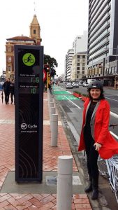
The new cycleway counter on Quay Street

This year the conference, with significant sponsorship from NZTA, was attended by a range of professionals many of whom are working on projects in NZ boosted by the Urban Cycling Investment fund.

Auckland played host to the conference putting on a number of associated events.  Delegates were treated to a Pecha Kucha special transport edition sponsored by Auckland Transport, Auckland Conversations with the conference keynote speaker Gil Penalosa and were invited to attend the opening of the Quay Street cycleway that includes Auckland’s first visible cycle counter (10,000 trips recorded within the first 19 days!). 

Delegates were also able to experience Auckland’s growing cycling network and the award winning Te ara i whiti/Lightpath.

I participated in the conference as delegate, workshop presenter (Vision Zero workshop detailed in Attachment A), as networking breakfast host (with Margaret Lewis, to discuss the success of K’rd Open Streets event – photo right) and as one of the judges of the Bike to the Future awards announced at the conference dinner (Attachment B).

Conference informal networking breakfast with K'rd's Margaret Lewis
Conference informal networking breakfast with K’rd’s Margaret Lewis

I found the conference hugely encouraging and affirming of how far we have progressed in Auckland with making cycling a viable option for more people to enjoy. There is however still much to do if Auckland is going to unleash the huge benefits that can be realised from prioritising walking and cycling.  My only disappointment about the conference was the lack of diversity that failed to capture the many cycling “tribes” of Auckland.

There were a number of key themes that I took away from the conference

Healthy communities designed for everyone

 There is overwhelming evidence that policies encouraging walking and cycling provide major health benefits.  The Minister of Health should be the biggest champion of active transport when considering ways to combat soaring obesity related illnesses such as diabetes.

Karen Witten in her presentation Healthy places and spaces bringing a children’s voice to city planning noted that children involved in active transport have higher rates of physical activity. “Cities that work for children work for everyone”

The keynote speaker Gil Penalosa talked about all ages, all abilities networks that encourage activity that helps everyone (see more from Gil’s presentation below).  Another keynote speaker Ben Rossiter from Victoria Walks said that “walking is fundamental to healthy communities.”

 Shared paths

 Dr Ben Rossiter from Walk Victoria gave a hard hitting, evidence based assessment on the need to design for walkability.

His presentation, Walking promotion and advocacy: An Australian story explained very convincingly why safer road design is needed for older pedestrians and why shared paths are not best practice. 

  • 25- 40% of those who suffer from a hip injury die within one year
  • If want to deal with health and obesity walking is critical
  • Constraints to older people walking – dogs off leash, bike riders on shared paths
  • If you need sign to slow down the street is designed wrong!

 His view is that shared paths should only be supported where designed for low speed, recreational environments where it is clear that cyclists must give way.

This is a particular issue in Australia and New Zealand where shared paths are often preferred to avoid difficult decisions about re-allocating road space for separate cycle lanes.  This presentation is relevant to a number of designs that are currently being considered for Auckland’s cycleway network eg Ian McKinnion Drive that has recently gone out for consultation and Nelson Street phase 2 that included a section of shared path opposed by the Waitematā Local Board.

 Pop- ups and temporary trials

 I have heard many experts recommend trials and pop ups as a low cost, quick way to demonstrate the benefits of new street design and build community support. Tyler Golly in his presentation Communities Designing Communities, shared ideas from Canada such as bike corrals, painted kerb extensions and parklets.

The Waitematā Local Board has been a supporter of trials particularly for cycling infrastructure but it has proved very difficult to progress.  Part of the problem has been the lack of a nimble, empowered AT team who are able to focus on trials.

Lorne Street parkletHowever we hopefully might start seeing “parklets” in the city.  An Auckland Council parklet popped on Lorne Street during the conference (photo right).  Providing additional space for people by removing two car parks was an instant success for nearby food vendors who reported a tripling in trade. High Street retailers take note!

We’ve also heard that AT is working a temporary brightly painted contra-flow cycle lane on Federal Street.

Road safety

 A number of speakers highlighted how essential it is to make city roads safer for walking and cycling with a range of measures:

  • Lower speeds
  • Changes to the give way rules
  • Vision Zero policy
  • Creating more traffic free areas and restrictions (a pro liveability measure discussed by Glen Koorey, What can NZ learn from cycling in Europe)
  • Network of cycleways
  • Traffic calming measures

Disappointingly the CEO of Auckland Transport does not appear to prioritise safety over efficiency. In his opening address he responded to the challenge of more pedestrian walking zones by saying the real problem in the city centre is not the speed and volume of traffic but the number of people walking while looking at their phones!

Vision Zero is a policy that I have been championing with the support of the Board.  Together with Cycle Action Network, Brake NZ and Walk Auckland I took part in a workshop on Building a grassroots campaign for Vision Zero: Why we need a new approach to road safety and how we can make it happen.  (see Attachment A)

 Auckland Conversations and keynote speaker, Gil Penalosa. The 8 80 City: Creating Vibrant and Healthy Communities

How can we create vibrant and healthy cities for everyone, regardless of age or social status? What is the role of streets – the largest public space in any city? How can parks improve the quality of life that attracts and retains people to their communities? 

Gil answers these questions while also explaining a simple and effective principle for inclusive city building: ensuring the safety and joy of children and older adults (from 8 year olds to 80 year olds) are at the forefront of every decision we make in our cities. Drawing on his experience as Commissioner of Parks and Recreation in Bogota, Gil presents some of the now widely celebrated approaches to urban regeneration through investments in parks and public spaces. Gil also draws upon examples from cities around the world which demonstrate the power of parks and public space in making lives happier, communities better, and economies stronger.

Key points:

  • Sustainable mobility: moving people towards a brighter, healthy more equitable future
  • Gil was responsible for starting Ciclovia (Open Streets) in Bogota – his advice is to just do it as requires no capital investment, works to change minds and is an inclusive event that belongs to everyone (In Auckland we have now held three “ciclovia” type events and more are planned)
  • When saying “no” also saying “yes” to something else eg more cars, more pollution and obesity.
  • Designing a city for everyone is not a technical issue or funding issue but a political issue
  • Need to evaluate cities by how they treat the most vulnerable
  • Transport policies have a direct impact on equality and equity. 25% of income is tied up with mobility by car but for lower income is often nearer 50%
  • Supports a focus on putting pedestrians first to encourage walkability: Vision Zero, max speed limit of 30Km p/h, quality infrastructure that shows a respect for people
  • Benefits: environment, economic activity, health

Skypath presentation with Richard HillsSkypath

It is great news that in the same month as the conference councillors agreed unanimously to progress Skypath the walk/cycleway over the Auckland Harbour Bridge.

See Attachment C for the presentation I gave in support at the Finance and Performance Committee on 21 July.

Quay Street Cycleway opening

It would have been hard to imagine even a few years ago politicians flocking to the opening of a cycleway.  In fact there were hardly any cycleway openings in Auckland until the PM opened Grafton Gully cycleway in September 2014.   However that all changed when serious investment in cycling got underway thanks in part to the Urban Cycling  programme. The additional government funding matched with Auckland Council interim transport levy funding  is starting to have an impact.  As the network of cycleways grows on busy routes cycling numbers are increasing with a doubling of numbers coming into the city centre in the last year.

Protected cycleways like the new one on Quay Street feel safe and pleasant to ride. They attract commuters, recreational riders, tourists and families with children.  They unleash the huge latent demand for opportunities to ride safely.  They are good for businesses , good for health & wellbeing and good for improving the liveability of Auckland*.  It is not surprising politicians of all colours want to celebrate when new cycleways open!


Auckland Transport Media Release

8 July 2016

Auckland’s waterfront will be an improved urban space and an even busier cycle route following the opening of the Quay St Cycleway today.

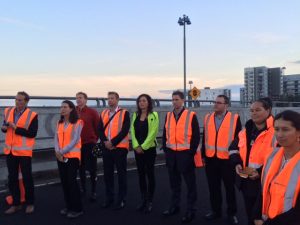
The Prime Minister, Transport Minister Simon Bridges, Mayor Len Brown and a large group of people on bikes, were the first to use the city centre’s newest cycleway. The opening was preceded by a dawn blessing with Iwi representatives.

A new cycle counter on the promenade, a first for Auckland, will highlight the number of people cycling along one of Auckland busiest routes.

On the waterfront side of Quay St, the 1km, two way cycleway goes from Princes Wharf at Lower Hobson St to Plumer St. The $2.18m cycleway is being delivered by Auckland Transport and has local funding and an investment from the Government through NZ Transport Agency and the Urban Cycleways Programme.

It will benefit everyone who spends time at the waterfront and will encourage more people to start cycling into the city centre says Kathryn King, Auckland Transport’s Cycling and Walking manager.

“Having a dedicated cycleway like this means there is more space on the promenade for people to walk and enjoy the harbour views. The planter boxes, which provide protection from traffic, improve this wonderful space by adding some greenery.

“The cycle route into the city centre along Tamaki Dr is the busiest route in Auckland, and this will make cycling from the east even more attractive. Providing a protected cycleway on Quay St gives people working in the downtown area greater travel choice and an excellent cross-town route that avoids a lot of city traffic.”

Mayor Len Brown says it’s another important chapter in his vision for Auckland as the world’s most liveable city as it transforms the city centre into a pedestrian and cycle friendly destination.

“This project is another example of Auckland Council, Auckland Transport and the Transport Agency working well together to achieve a great outcome.”

Bike Auckland, chair, Barbara Cuthbert says the cycleway is a great addition to downtown Auckland. “It’s hugely exciting to have a safe separated space for people cycling and those walking close to rail and ferry services.”

The three-metre-wide cycleway connects with the Beach Rd Cycleway at Britomart Pl and by the end of 2018 will link with the Nelson St Cycleway and Westhaven to City Cycleway at Princes Wharf and the Tamaki Dr Cycleway.

When phase two of Nelson St Cycleway is constructed next year, the city centre cycle loop will be complete. This loop includes Lightpath, Nelson St, Grafton Gully, Beach Rd and Quay St cycleways.

Auckland Transport is working with project partners Auckland Council and the Government through the NZ Transport Agency and the Urban Cycleways Programme on a $200m programme of cycle improvements from 2015 to 2018.

Quay St Cycleway

  • The Quay Street Cycleway is delivered by Auckland Transport and is one of the projects funded in the 2015-18 Urban Cycleways Programme (UCP).
  • Auckland Transport is working with project partners Auckland Council and the Government through the NZ Transport Agency and the Urban Cycleways Programme on a $200m programme of cycle improvements from 2015 to 2018.
  • The UCP involves central government partnering with local government to accelerate the delivery of $333 million of key cycle projects around New Zealand over the next three years
  • The $2.18 million cycleway is funded from $0.70M Central Government, $0.75M National Land Transport Fund, $0.73 million Auckland Transport. This project is part of the wider Auckland city centre package project announced through the Urban Cycleways Programme.
  • The one kilometre long, three metres wide, two-way cycleway goes from Princes Wharf, Lower Hobson to Plumer St. The majority of the route is on-road, physically protected from traffic with concrete separators (similar to Nelson St Cycleway) and planter boxes.
  • This cycleway connects with the existing shared path on Quay St in the east. By 2018 AT will have delivered another cycleway that will connect Quay St Cycleway at Plumer St with the start of the Glen Innes to Tamaki Dr Shared Path at Hobson Bay. People will be able to cycle and walk from Glen Innes to the city centre.
  • Beach Rd Cycleway connects with Quay St at Britomart Pl allowing people to cycle all the way to the Northwestern Cycleway via Beach Rd Cycleway and Grafton Gully Cycleway.In the west, people can now cycle over Te Wero Bridge to Wynyard Quarter and around the Viaduct. Ultimately it will connect with Westhaven Dr to City Cycleway and Nelson St Cycleway when they are completed in 2017.
  • When Nelson St Cycleway phase two is complete next year, a city centre cycle loop will be complete including the pink Lightpath, Grafton Gully Cycleway, Beach Rd Cycleway and Quay St Cycleway. The project team is currently working on how best to connect Nelson St Cycleway (which currently ends at Victoria St) with Quay St Cycleway.

Cycling in Auckland by numbers

  • 750 cycle trips per day on pink Lightpath since it opened December
  • A doubling of the number of people cycling into the city over three years.
  • 50% increase in people cycling in Symonds St/Grafton Gully corridor following opening of Grafton Gully Cycleway in 2014
  • 20% increase in people cycling on Northwestern Cycleway in May 2016 compared with May 2015.

Upcoming cycle projects in Auckland

  • Mangere Future Streets opening late September
  • Mt Roskill Safe Routes opening late October
  • Ian McKinnon Dr Cycleway public consultation starts July
  • Karangahape Rd Streetscape Enhancement and Cycleway public consultation by August.
  • Great North Rd Cycleway public consultation by the end of 2016.

Related reading

Key unlocks Quay Street – Transport Blog

A gray, sunny day for lots of joy on Quay Street – Bike Auckland

Prime Minister John Key geared up on Auckland’s Quay Street cycleway – Auckland Now

*Benefits of investing in cycling in New Zealand communities – NZTA

Creating safe connections to Lightpath

Photo: Phil Walter
Photo: Phil Walter

[Update 11 February 2016: Auckland Transport and NZTA have provided updates in response to our December Board resolution – AT’s walking and cycling team response to each point in italics below]

We can’t get enough of the new Te ara i whiti/Lightpath and Nelson St Cycleway. It is a pleasure to ride and the magenta magic is stunning (#LightpathAKL for all the images).

However we are concerned about the poor standard of connections to this fantastic cycling infrastructure. The approach roads to the Canada St entrance are not pleasant to ride on especially for less confident riders and a number of detours are expected of commuters wanting a smooth ride and direct route. There is also a lack of signage to Lightpath from K’rd .

First hoon opening on 3 December
Photo: Ronald Andreasson

We (transport portfolio of the Waitemata Local Board) have asked Auckland Transport and NZTA to follow up on a number of issues that we are already aware of since the opening on 3 December. Many of these will get fixed as part of the proposed K’rd cycleway and some are already being investigated by a NZTA safety auditor but we wanted to confirm the urgent action we think is needed on the connections to the Canada St entrance to Lightpath from K’rd, Grafton Gully cycleway and Ian McKinnon Drive. Fortunately there is a lot of road to work with and low parking demand on Canada St.  Please let us know if we have missed anything from the list below (either use the comments or email me pippa.coom@aucklandcouncil.govt.nz)

At the Waitemata Local Board meeting in December 2015 we passed the following resolution:

Moved by Deputy Chairperson PJ Coom, seconded by member CP Dempsey:

i) That the Auckland Transport Update – December 2015 report be received.

ii) That the Waitematā Local Board notes the public feedback analysis for the Nelson Street Cycleway Phase 2 and requests Auckland Transport provide a direct connection to Wynyard Quarter via Market Place and the Western side of Nelson St in addition to the proposed Quay St connection.

Upper Queen St missing connection to GGC
Missing crossing point between Grafton Gully Cycleway and Canada St shared path. Photo: Christopher Dempsey

iii) Congratulate NZTA and Auckland Transport on the successful opening of the Nelson St cycleway Phase 1

vi) Requests that NZTA and Auckland Transport urgently undertake measures (interim if necessary) to provide safe connections from K’rd, Grafton Gully Cycleway and Ian McKinnon Drive to the entrance of Te ara i whiti/Lightpath at Canada St including:

  1. Installation of an advance cycle box on K’rd at the intersection of Pitt St and Mercury Lane for the right hand turn on to Mercury Lane  In the short term we are proposing to trial a cycle barnes dance at this intersection which will enable people on bikes to cross the road and access Mercury Lane without conflict with other vehicular traffic.  In the longer term this movement will be improved further in the KRd Streetscape Upgrade project.
  2. Traffic calming on Mercury Lane We are including traffic calming on Mercury Lane in the reference design for the street once the CRL works are complete.  We will investigate ways of better enabling this movement in the short term.
  3. Canada St 11am 8 December 2015Treatment to provide for riders moving across the traffic lane to enter the right hand slip lane on Mercury lane to cross over Canada St to the entrance to the Canada St bridge In the longer term access to the Light Path from Mercury Lane will be addressed in the upgrade of Mercury Lane as part of the CRL works.
  4. Traffic calming on the approach to the Canada St give way sign at the intersection with Mercury Lane  An improvement to this section of Mercury Lane will be included in the reference design for the street as part of the CRL works.  We will investigate opportunities for temporary measures before the CRL works commence. .
  5. Installation of a cycle facility from Upper Queen St bridge to the K’rd intersection on the western side of Upper Queen St We plan to upgrade this section of Upper Queen Street as part of the KRd Streetscape Upgrade project
  6. Wayfinding signage on K’rd  We have included the requirement for wayfinding signage as part of the KRd Streetscape Upgrade project.  We will investigate opportunities for temporary signs in the meantime
  7. Appropriate kerb ramps for riders wishing to enter the Canada St shared path from Mercury Lane The New Zealand Transport Agency are investigating this request as part of the final safety audit.
  8. Signalised crossing from Grafton Gully to the southern side of Canada Street across Upper Queen St. This movement is currently catered for as a two part crossing over Upper Queen Street and Canada Street.  As part of the KRd Streetscape Upgrade project we will look for opportunities to improve the level of service for people walking and cycling.

vii) Requests NZTA and Auckland Transport to report back to the February 2016 meeting of the Waitemata Local Board on the actions taken

At our February board meeting where AT verbally presented the updates we emphasised the need for quick fixes rather than waiting for the the improvements that are promised to be delivered as part of the K’rd Streetscape Upgrade Project (to be delivered by 2017/18) and the CRL works (2022).

NZTA has also provided this update:

The work around Murray Lane and Canada Street is being reviewed as part of the final safety audit which is due to be concluded imminently with remediation work to follow. I will provide an update on this when it is available.

Nelson Street Cycleway gets underway

Aucklanders are going to be blown away by the cycling project that got started on 23 April.  The Nelson Street cycleway will provide an off road connection from where the Grafton Gully cycleway exists on Upper Queen Street all the way to the waterfront via a bridge connecting Canada St with the old Nelson Street motorway off- ramp and a new separated cycleway down Nelson Street.  We are not far off being able to circle the city by bike. Can’t wait!

Media Release NZTA Nelson St blessing

Nelson Street Cycle Route Gets Underway

A dawn blessing has marked the start of work on the Nelson Street Cycle Route.

Kaumatua from Ngati Whatua o Orakei, Te Aki Tai, Ngati Paoa and Te Kawerau a Maki led the blessing which took place on the disused Nelson Street off-ramp.

The Nelson Street Cycle Route will link Upper Queen Street to Quay Street via the disused off-ramp and connect to the north-western and Grafton Gully cycleways, providing easier and safer access to and from the city centre.

The project will be delivered in partnership with Auckland Transport and delivered in two phases.

Nelson St blessingPhase one will see the construction of a bridge from Canada Street, connecting with the old Nelson Street motorway off-ramp and continuing as a separated two-way cycle path along the western side of Nelson Street to Victoria Street.

Construction of the bridge is first to get underway.  It will be built off-site and when completed will be put in place overnight.

Phase two will extend the separated cycle path from Victoria Street down to Quay Street and will also provide a link along Pitt Street to join Karangahape Road and Union Street.

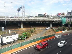
Canada Street preparation for Nelson St off ramp bridge
Canada Street preparation for the bridge to connect to the old Nelson St off ramp

Construction of the cycleway from Canada Street to Union Street will be undertaken by Hawkins Construction. The completion of Phase one to Victoria Street is expected late this year and phase two by the middle of next year.

Canada Street bridge to Nelson St off ramp
Looking across to the old Nelson St off ramp to be connected from Canada St

Remembering Malcolm (Mel) Coom: Speed limit enforcement will save lives

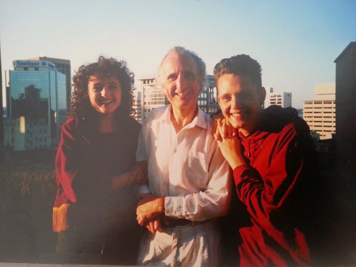
Pippa Coom, Malcolm Coom and Adam Coom Dec 1991
Me, my dad Malcolm Coom and brother Adam. December 1991

Just over twenty years ago my generous, fun loving, warm hearted dad was making plans for an overseas trip. He regularly visited the UK (where his parents lived) but this time he was especially excited about including lots of dancing into his travels leading up to the Rio Carnival. My dad loved to dance Latin American style and was a regular at the old El Inca club on K’rd.

Before he left for the UK he set out on a roadie to visit me in Wellington where I lived at the time. He never made it. At Sanson on SH1 he missed the turn off to Wellington and a few minutes later along SH3 he was killed instantly in a head on crash.

He was 49.

Many years later and now with a role on the Waitematā Local Board advocating for road safety, I’ve come to think of the crash not just as a personal family tragedy but also how it provides an understanding of the “safe systems” approach to creating a forgiving roading network.

Every part of the system failed my dad.

The Road: The signage on SH1 used to be terrible. It was easy to miss the turnoff at Sanson like my dad did. Shortly after the crash Transit upgraded the signage.

The crash occurred where an overtaking lane abruptly ends at the brow of a hill.

Road Use:  The driver of the on- coming car pleaded not guilty (I think the charge was careless driving). He couldn’t remember the crash and could not believe that he had caused it. He thought of himself as a safe driver who was very familiar with the stretch of road.

The Vehicle: My dad loved old cars (unlike his dad who after a working life in the Vauxhall factory in Luton was able to upgrade his car every year). The car he was driving (I think a Rover) didn’t have any driver safety features like air bags.

Speed: The other driver made a mistake misjudging a simple over taking move in a passing lane. Unfortunately his speed gave him no time to react when he found himself on the wrong side of the road.

Even the best drivers make mistakes. What we don’t have to accept is that fatalities and serious injuries are just an inevitable consequence of driver mistakes. A safe system approach means that we can demand a lower road toll and even zero road deaths (“Vision Zero“)  but we all have to play our part.  We need improved road design, safer vehicles, competent road users and safe speeds.

The NZ Police are currently under pressure to get their messaging right about their approach to enforcing the speed limit and need to explain why the road toll has increased during the holiday period (when the trend is downwards). However I absolutely back the Police taking a hard line on speed enforcement (with the posted limit recognised as the limit without fiddling with “tolerances” rounds the edges) . It is a lazy political response to claim  (as Ron Marks MP has done) that speed management is about revenue gathering. It is based on international evidence that reducing speeds reduces the number and severity of crashes.

If anything I would like to see the Police put even more resources into enforcing urban speed limits.  The Waitematā Local Board is advocating for slower speeds in residential areas (starting with a trial) and supports the City Centre Masterplan objective of a central slow speed zone.  Reducing speeds will contribute to liveability and encourage more people to walk and cycle.  And of course easing back on the gas will save lives. 

Safe systems approach explained

Stop the “blame game” – improving road culture in NZ 

Edinburgh to roll out 20mph speed limit across city

The Safe System approach aims to create a forgiving road system based on these four principles:

  1. People make mistakes

People make mistakes and some crashes are inevitable.

  1. People are vulnerable

Our bodies have a limited ability to withstand crash forces without being seriously injured or killed.

  1. We need to share responsibility

System designers and people who use the roads must all share responsibility for creating a road system where crash forces do not result in death or serious injury.

  1. We need to strengthen all parts of the system

We need to improve the safety of all parts of the system – roads and roadsides, speeds, vehicles, and road use so that if one part fails, other parts will still protect the people involved.

Grafton Gully Cycleway opening

Auckland’s biggest ever cycle infrastructure project was opened yesterday (Saturday 6 September 2014) by Barb Cuthbert, Chair of Cycle Action Auckland, the PM and the Mayor Len Brown.  The Grafton Gully cycleway links the NW cycleway via Upper Queen Street Bridge to Quay Street via new separated cycle lanes on Beach Road.  Transport blog recorded the opening speeches. There were many people to thank and acknowledge for the successful completion of the project after many years work (much of it behind the scenes to keep the project alive)

I’ve never been so excited about a cycleway opening before. Grafton Gully sets a new standard for design, safety and connectivity. It is beautiful to ride and gives a glimpse of what should be possible across Auckland to make cycling pleasant and easy. I especially love how the route has opened up all the  long forgotten bush in the gully and provides a stunning view down to the Harbour (the Waitematā Local Board has plans for walking connections into Symonds St Cemetery which will open up even more of the native bush).

What was a bit lost in the applause for NZTA’s work on Grafton Gully was that Upper Queen Street Bridge (the removal of general traffic lanes and slip lanes to provide a new shared path)  and Auckland Transport’s Beach Road cycleway was also opened at the same time. The project teams have worked extraordinarily hard to coordinate the opening of all three sections and deserved far greater acknowledgement.

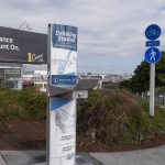
In March I reported that Auckland Transport was 6 months behind NZTA and that Upper Queen Street Bridge was not even at the design stage.  The Waitematā Local Board’s advocacy was instrumental in both projects being brought forward. We also funded the installation of a drinking station on the corner of Upper Queen Street and Ian McKinnon Drive ( a location suggested by Cycle Action Auckland).

I think we can now look forward to a fabulous summer of cycling in Auckland especially once Waterfront Auckland’s Westhaven Promenade opens later in the year.


Transport Blog – the completed Grafton Gully Cycleway (lots of photos and videos)

Cycle Action Auckland  – Go have ride – Grafton Gully and Beach Rd open

NZTA media release – Big boost for Auckland cyclists with opening of central city link

Vernon Tava – opening of the Grafton Gully cycleway

Monthly Board report March 2014

Covering activities from 1 February – 1 March 2014

Portfolio report:  Transport

Beach Road – Grafton Gully Connection

Beach Road looking West between Te Taou Crescent and Mahuhu CrescentAt our February Board meeting Auckland Transport reported on the very positive feedback in response to their consultation on the Beach Road separated cycleway that will connect to the Grafton Gully Cycleway currently under construction by NZTA.

The Board confirmed our support for the project however we raised concerns regarding the delay by AT in completing Beach Road to coincide with the opening of Grafton Gully cycleway planned for September 2014 (NZTA’s original completion date was April 2014). AT are approximately 6 months behind NZTA which means cyclists using Grafton Gully will exit Churchill Street on to the potentially very unsafe environment of Beach Road (similar to the location where a cyclist was killed in January).

Upper Queen Street

We therefore requested at our February meeting that Auckland Transport takes all steps necessary to ensure those parts of the Beach Road Cycleway that connects to the Grafton Gully Cycleway is completed by September 2014.

At the same time Auckland Council is meant to be delivering the connection from Grafton Gully to Ian McKinnon Dr on Upper Queen Street. The latest update from the City Centre Transformation team confirmed that the design is not even under way and the budget of $900k has been re-allocated

Having raised concerns about the delays I hope to be able to report next month that Auckland Transport and the City Centre team are taking all steps possible to prioritise safe connections to the Grafton Gully cycleway.

St Lukes interchange – Great North Road widening

In early February NZTA awarded the contract to construct the next stage of Auckland’s Western Ring Route – upgrading the Northwestern Motorway (State Highway 16) between the St Lukes Road and Great North Road interchanges.  The $70m project is jointly funded by the NZ Transport Agency and Auckland Transport.

St lukes intersection Great North RoadAs part of the project AT and NZTA want to widen Great North Road to provide an extra lane turning onto a newly widened St Lukes overbridged to feed a two lane motorway onramp. Last year AT sought the Waitemata Local Board’s consent to remove 6 mature pohutukaka trees on Council land opposite MOTAT on Great North Road to create an additional lane (I reported on the reasons for opposing the widening in September).

The Board declined consent but gave approval for the trees to be trimmed as part of stage one of the project (allowing for the Great North Road lane to be raised to meet the height of the new St Lukes Bridge). The conditions of this approval were confirmed by the Manager – Local and Sports Parks Central (acting under delegated authority) including a request to prioritise cycling and pedestrian improvements as part of the Great North Road corridor management plan that is currently underway. (Refer ATTACHMENT A)

At a meeting on 19 February AT confirmed it is going ahead with seeking a notified resource consent to remove the trees (and will hold off trimming the trees until a decision on the removal has been made). The public will now have a say in whether AT and NZTA have made a case for widening Great North Road at the expense of the trees. I certainly don’t think they have and the proposed design delivers very poor outcomes for PT users, walkers and cyclists.

Pedestrian safety

Anglesea StreetGordon Price, a visiting speaker from Vancouver (details below), emphasised the importance of making walking our first transportation priority.

Some examples of where the Board  is pushing for pedestrian priority is at intersections such as Angelsea Street and Ponsonby Road. Auckland Transport is proposing safety improvements with pram ramps and curb extensions however the first draft of the design still prioritises turning traffic. We have asked AT to go back to the drawing board to look at a pedestrian table that will create a continuous walking experience along Ponsonby Road (and is consistent with the feedback we heard on the Ponsonby Road masterplan).

An update on the Ponsonby Road masterplan is attached (ATTACHMENT C)

Monthly transport update

At the Monthly Transport catch up with the Transport portfolio the following issues were discussed:

  • Auckland Transport’s hosting of the Cowie Street  bridge design public meeting (various issues regarding the facilitation)
  • Proposed drinking station design and locations
  • Beach Road cycle way update
  • Auckland Transport’s Parking strategy (approved by the AT Board in February for consultation)
  • Bike parking at events
  • Route optimisation for walkers entering the city centre particularly at the Mayoral Drive/Greys Ave intersection

Current issues are reported back monthly by AT on our public agenda including the details of the consultation undertaken with the Transport portfolio on behalf of the Board.

Portfolio Report: Community

Community-led place making champions Group

A group has been set up by Roger Blakely, Chief Planning Office to promote community-led place making through the local boards. The Terms of reference for the group have now been confirmed (ATTACHMENT B). I am chairing one of the teams set up to look at identifying best practice and effective ways of promoting community-led placemaking.

Berms policy and guidelines

Wedding flowers from the berm

In mid-February Auckland Transport confirmed it was reviewing its policy on berms and would be drafting guidelines.

I have asked Auckland Transport to ensure that in drafting the guidelines AT takes into account the place making role of berms/grass verges and the many benefits to the community (not just the road corridor operations view of the issues). For example – litter reduction, storm water management, streetscape amenity values, community development and bio-diversity.

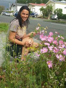
It would be great to see the positives stated up front  by AT out of which flow the guidelines on best practice rather than just a list of what not to do. (Photo of my neighbour Char picking flowers from her berm for her wedding)

Other issues relevant to the Community portfolio

A range of meetings were attended during February relevant to the Community portfolio – these are listed below.

Other board activities

Local Board Agreement

In February Council had three overlapping consultation processes underway which put considerable pressure on the community to understand the issues and to respond on time.

Council’s consultation on the draft Annual Plan closed on 24 February. Publicity was very low key this year because there were few new spending proposals or changes from the Long Term Plan.  As in previous years I found the Council website difficult to navigate for making a submission on the Annual Plan and sought a number of changes to make it easier to find relevant information.

Unitary Plan

Submissions on the Unitary Plan closed on 28 February. The role of the Board during the consultation process was to encourage submissions and respond to assist with queries. For example I had an extensive dialogue with the Freemans Bay Residents Association regarding minimum parking requirements and attended a meeting in Herne Bay at short notice regarding the zoning on Jervois Road.

Local Board Plan public meeting 1 MarchLocal Board Plan

In February the Board kicked off the development of our next local board plan with a series of public meetings (photo from the meeting in Grey Lynn on 1 March).  The plan sets the objectives for our local community for the next three years and beyond. This is an opportunity to let the Board know what projects and initiatives we should prioritise.  A feedback survey is available on the Council website (due by 31 March) .

A draft plan will go out for formal consultation in June 2014.

Long Term Plan 2015-2025 scene setting workshop

The workshop represented the formal launch of the development of the Long Term Plan 2015-25.  The Workshop was an important scene setting day proving  insights from experts about future trends and challenges facing Auckland.  These insights will inform the debate and discussion that will take place in the course of developing the Long Term Plan.  Rod Oram was MC the day with external speakers Gordon Price, Arthur Grimes and Professor Natalie Jackson.

An afternoon session covered a high level ‘stocktake’ across the Auckland Council’s Senior leaders who provided an update on current plans and the challenges and opportunities ahead for their part of the business.

I found the day gave purpose to our role as elected representatives, assisted with an understanding of the Long Term Plan process and provided a value opportunity to discuss and debate the transformation change required in Auckland.

Gordon Price session with Local Boards

Gordon Price, a former six-term Vancouver city councillor, spent a week in Auckland during February. Gordon spoke at a special session for local boards and at the all of council LTP 2015 – 2025 scene setting workshop. Here are some of the key points I took from this presentation which drew on his experience of planning and implementing a liveable city with a focus on “density done well.”

The test is whether you can you raise children – if yes then good enough for everyone else

As the  rate of change slows down perception of change increases therefore incremental change is appropriate for established neighbourhoods.

Recipe for urbanity – 5 practical choices:

  • Car (there is NO war on the car)
  • Car share/taxi
  • Transit of all kind
  • Bike
  • Walking

Aspire to:

  • Mixed use compact cities
  • Clean green and safe
  • Variety of housing options
  • Many transportation choices (where feet replace wheels)
  • Well designed public spaces

His key message is to apply it consistently – and the lesson is that this works!

Workshops and meetings

In the period 1 February – 1 March I attended:

  • Fortnightly communications update on 3 February
  • Waitemata Local Board workshop on 4 February
  • Transport portfolio: Informal presentation on the options for a Boulevard on Stanley Street/The Strand
  • Meeting organised by the GLBA for Grey Lynn groups to discuss the Unitary Plan
  • Arch Hill residents meeting on 10 February regarding progress on taking Bunnings to the Environment Court
  • Ponsonby Business Association Board meeting on 11 February
  • Meeting with Chris Davidson, CEO, Parnell Trust on 11 February
  • Waitemata Local Board monthly business meeting on 11 February at Parnell
  • Meeting to discuss issues with Sea Scout’s Leased Premise – 55 West End Road, Cox’s Bay and update on Basement Theatre car parking on 12 February
  • Waitemata Local Board workshop on 13 February
  • Intro meeting with the Community Portfolio and Mary Dawson, Chief Executive, Auckland Regional Migrant Services (ARMS Trust)
  • Meeting to discuss AT’s Code of Practice on 17 February
  • Community Liaison Meeting  for SH16 St Lukes to Great North Road hosted by NZTA on 17 February
  • Waitemata Local Board workshop on 18 February
  • Parks portfolio meeting to discuss way finding
  • Waitemata Local Board briefing on Emergency Management with Shane Webb (Civil Defence – Central Zone Manager) on 18 February
  • Project briefing on Auckland Transport’s proposal to install a bus turnaround at Coxs Bay
  • Meeting with John McDonald – Minister at large in the City Centre
  • Meeting of the Sky path project steering group on 19 February
  • Meeting on 19 February  with Auckland Transport to discuss phase 2 of the St Lukes Interchange Notice of requirement (resource consent to widen Great North Road)
  • Meeting with Edward Bennett of the K’rd Business Association to discuss transport projects proposed for the K’rd precinct plan
  • Site meeting at Campbell Free Kindergarten with Frances Kelliher, Circability Trust 20 February
  • Waitemata Local Board Finance Committee on 20 February
  • Public Meeting in Parnell on the Waitemata Local Board Plan 20 February
  • Community-led Placemaking Champions Group meeting
  • Unitary Plan meeting with Herne Bay residents on 24 February
  • Waitemata Local Board workshop on 25 February
  • Local Board Members seminar with Gordon Price on 25 February
  • Community Development monthly catch-up on 25 February
  • Meeting for the Community Liaison group for the Cowie st/Laxon Terrace bridge project hosted by Auckland Transport on 25 February
  • LTP 2015-2025 scene setting workshop for all elected representatives on 26 February
  • Transport catch up on 27 February
  • Meeting to discuss on-going safety issues raised by a resident in Myers Park (meeting brought together NZ police with council safety and community development teams)
  • LGNZ Zone 1 meeting on 28 February as the Board’s representative
  • Local Board Plan public engagement sessions on 20 February in Parnell and 1 March in Grey Lynn

Events and functions

Ciclovia on QuayIn the period 1 February – 28 February 2014 I attended:

  • Public meeting on Fluoridation public information evening with a presentation by Professor Paul Connett on 4 February 2014 organised by Fluoride Free Auckland
  • Cycle Action Associates breakfast on 5 February at the Auckland Art Gallery
  • Ciclovia on Quay Street on Saturday 8 February (see ATTACHMENT C – Ciclovia on Quay reclaims Auckland’s streets)
  • Dropped by Auckland Transport’s Go by Bike day pit stops at 1 Queen Street and Karanga Plaza on 12 February
  • Lantern festival 13 February
  • Splore Festival at Tapapakanga Regional Park 14-16 February (see ATTACHMENT C Splore setting the standard for zero waste events)
  • Public Session Ideas evening for the K Rd Precinct Plan on 19 February
  • Celebration of healthy eating at Gladstone Park Early Childhood Centre at the invitation of Parnell Trust on 21 February
  • Presented at the Department of Internal Affairs’ Community-led Development National Leadership Hui 2014 (as a trustee of Grey Lynn 2030)
  • Pride Parade on Ponsonby Road on 22 February
  • Music in Parks at Grey Lynn Park on 23 February
  • Official party at the Citizenship Ceremony at the Town Hall on 24 February
  • Three Queens –  mini music and theatre festival on Queens Wharf on 24 February.
  • Interview with Radio Ponsonby on 26 February
  • Social function with the Board and senior management of Regional Facilities Auckland on 26 February at the invitation of RFA
  • Frocks on Bikes meet up on 27 February to hand over the coordinating role to a new team (ATTACHMENT C – Thanks Frocks on Bikes – it’s been so much fun)
  • Unveiling of ‘Eyelight Lane’ public artwork at Fort Lane 27 February
  • Represented Auckland Council at the opening of the Grey Lynn School forest on 28 February (see photo below)
  • Opening for Ruben Paterson’s artwork “Andale, Andale” on Newmarket Train Station on 28 February at the invitation of the Newmarket Arts Trust


Opening of the Grey lynn School forest

Trees at threat from Great North Road widening

St Lukes interchange – update on the proposed widening of Great North Road

In early February NZTA awarded the contract to construct the next stage of Auckland’s Western Ring Route – upgrading the Northwestern Motorway (State Highway 16) between the St Lukes Road and Great North Road interchanges.  The $70m project is jointly funded by the NZ Transport Agency and Auckland Transport. (Transport blog reported on the widening of the St Lukes interchange here)

St lukes intersection Great North RoadAs part of the project AT and NZTA want to widen Great North Road to provide an extra lane turning onto a newly widened St Lukes overbridge and to feed a two lane motorway onramp . Last year AT sought the Waitemata Local Board’s consent to remove 6 mature pohutukaka trees on Council land opposite MOTAT on Great North Road to create an additional lane (I reported on this in September here).  

The Board declined consent but approved for the trees to be trimmed as part of stage one of the project (allowing for the Great North Road lane to be raised to meet the height of the new St Lukes Bridge). The conditions of this approval were confirmed by the Manager – Local and Sports Parks Central (acting under delegated authority) including a request to prioritise cycling and pedestrian improvements as part of the Great North Road corridor management plan that is underway. See the details below

A a meeting on 19 February AT confirmed it is going ahead with seeking a notified resource consent to remove the trees. The public will now have a say in whether AT and NZTA have made a case for widening Great North Road. I certainly don’t think they have and the proposed design is a very poor outcome for PT users, walkers and cyclists.

25 November 2013

To: Aurecon New Zealand Limited

RE: Landowner Approval for works within 820 Great North Road, Grey Lynn (Waitemata Ward) by Auckland Transport and New Zealand Transport Agency.

I refer to your application for landowner approval for works within 820 Great North Road, Grey Lynn. The following approvals were sought from both Auckland Transport and New Zealand Transport Agency:

 Auckland Transport

 –       Temporary use of open space land designated as D06-08 at 820 Great North Road to carry out earthworks and landscape planting associated with the raising of the carriageway of Great North Road and St Lukes Road.

–       Pruning of three pohutukawa trees along the road frontage of 820 Great North Road.

 The extent of the works is shown in the drawings titled:

 –       “Single Left Turn Lane Option, Great North Road, General Arrangement” (drawing number: 215023-SK-C-100-103 Rev A); dated 04/10/2013; prepared by Aurecon New Zealand Limited.

–       “Single Left Turn Lane Option, Great North Road, Planting Details” (drawing number: 215023-SK-A-919-103 Rev A); not dated; prepared by LA4 Landscape Architects.

New Zealand Transport Agency

–       Temporary use of open space land designated as D06-08 at 820 Great North Road for the purpose of carrying out battering (re-contouring) work parallel to the boundary with SH16.

–       Works within 820 Great North Road will include the removal of vegetation, earthworks (including battering) and landscape planting.

The extent of the works is shown in the drawings titled:

 –       “Single Left Turn Lane Option, Great North Road, General Arrangement” (drawing number: 215023-SK-C-100-103 Rev A); dated 04/10/2013; prepared by Aurecon New Zealand Limited.

–       “Single Left Turn Lane Option, Great North Road, Planting Details” (drawing number: 215023-SK-A-919-103 Rev A); not dated; prepared by LA4 Landscape Architects.

–       “RW-112 St Lukes Road Interchange Northern Abutment Basalt Cut Slope Elevation and Plan Sheets 2 to 4” (drawing numbers: 215023-D-J-240-511, 512 & 513 Rev C); dated 15/07/2013; prepared by Aurecon New Zealand Limited.

 This letter provides formal landowner approval on behalf of Auckland Council, subject to the applicant’s formal acceptance of the following conditions:

  1.     The applicant must contact the Auckland Central Park Ranger – Waitemata Ward (Ph: 301 0101) to arrange a pre-commencement site visit and access to 820 Great North Road.

 2.     This letter provides landowner approval only and does not replace the requirement for resource consent. All works must be completed in accordance with the rules of the Auckland Council District Plan – Operative Auckland City – Isthmus Section 1999, or the conditions of any resource consent issued by Auckland Council.

 Vegetation and Landscape

 3.     Pruning of trees within 820 Great North Road shall occur in accordance with the Auckland Transport Code of Practice dated 16 June 2013 and detailed on Aurecon’s spreadsheet for “Over Dimension Envelope Pruning Requirements at existing kerb at 5.0m height from design level”.

 4.     Prior to works commencing beneath the dripline of the pohutukawa trees at 820 Great North Road Auckland Transport and/ or their contractor shall submit to Auckland Council Local and Sports Parks Central for approval, a construction methodology for all works within the dripline of the trees. Specifically detail shall be provided regarding the build up of the carriageway and footpath.

 5.     The approved construction methodology required by condition 4 shall be implemented on site.

 6.     All tree work shall be undertaken following agreement on methodology and be carried out to the satisfaction of the Arboriculture and Landscape Advisor – Central.

 7.     All tree work shall be carried out by Auckland Council approved contractors.

 8.     All tree pruning and works within the dripline of vegetation within 820 Great North Road shall occur as described in the “Arboricultural Implication Report: Proposed Great North Road (East) carriageway narrowing at the St Lukes Road interchange”, dated October 2013, prepared by The Specimen Tree Company.

 9.     Auckland Council’s Parks Arborist Simon Cook shall approve the use of and brand of any ‘High Fungal Mulch’ or other treatment to be placed beneath the trees within 820 Great North Road.

 10.  Prior to landscape planting commencing a detailed planting plan shall be submitted to Auckland Council Local and Sports Parks Central for approval. The planting plan shall be based on the drawing numbered: 215023-SK-A-919-103 Rev A and include details of species, plant numbers and spacing.

11.  Removal of the asphalt on the footpath adjacent to 820 Great North Road is to be carried out using a small digger with a straight blade bucket – under arboricultural supervision. Root heave is visible within the existing footpath (not in the carriageway) indicating the presence of Pohutukawa roots within this area. Therefore the construction methodology must include a layer that will continue (even if only in the short term – e.g. 5yrs) to allow air and water passage. The detail is to be approved by the Arboricultural and Landscape Advisor but might, for example, involve a layer of rocks overlaid with geotextile and then a compacted layer overlaid with seal or root cells which are used in a number of roads and footpaths in central Auckland.

 12.  Where the ‘W’ Barrier is to be installed between the carpark and SH16, the existing carparks and kerbing shall be cut back to allow a 1m planted overhang between the edge of seal and the barrier, ensuring that the resultant carparks meet the requirements of the Unitary Plan.  Extend Coprosma repens ‘Poor Knights’ to this area.   W Barriers to be on steel supports to minimise their structure.  New kerbing to match existing.  A 1m overhang between the edge of seal and the barrier can be provided. Based on geotechnical investigation taken it is likely that this 1m strip can be planted, however this will be confirmed on site during the works.  Kerb relocation will be carried out in accordance with the District or Unitary Plan rule relevant at the time of construction.

 13.  The style and location of the guard rail along the southern edge of 820 Great North Road adjacent to the battered edge with the motorway shall be designed in association with Local and Sports Parks Central.

 14.  Replace all swathes of Muehlenbeckia complexa on Council land with Anamenthale lessionaina.

15.  Interplant sunnier mass planted areas of Phormium ‘Dwarf Green’ with Leptospermum scoparium ‘Tui’, planted in massed clumps, towards centres of beds.

 16.  Replace all proposed flax/anamenthale lining footpath/shared paths replaced by a more upright species, such as Apodasmia or Libertia to prevent trip hazards caused by drooping foliage.

 17.  Planting maintenance/defects period to be 1 year.

 18.  Any landscape hardworks (walls, paving etc) is to match existing.

 Share with care cycle path

Cycle and pedestrian connections through this precinct are a priority for the Waitemata Local Boards.  Achieving a well-planned and connected cycleway is considered part of the mitigation for the loss of open space caused as a result of the project.  The Waitemata Local Board and Albert-Eden Local Board request Auckland Transport confirm consultation for the Great North Road Corridor Management Plan Project will be undertaken with the Boards as part of the CMP project and that the following matters will be considered through this process:

  • a safe pedestrian and cycle connection on the south side of Great North Road through the motorway intersection
  • a safe pedestrian and cycle crossing at the GNR/ Bullock track intersection, which is one of the most dangerous in Auckland
  • separated, continuous cycle lanes along GNR
  •  in collaboration with other stakeholders and Parks, provide connections off GNR via Motions Road and/or Bullock Track/Old Mill Road to Meola Road
  • acknowledgement that Great North Road is on the Auckland Cycle Network
  • provision of cycle delineators on the north bound cycle lanes on the St Lukes Bridge
  • the installation of grab rails where possible
  • the number and location of pedestrian crossings at the intersection of St Lukes and Great North Road
  • the installation of barriers on pedestrian refuges

 20. The work areas shall be adequately fenced to prevent public access within 5m of the work areas.

 21.  All adjacent Residents which share a common boundary with the Reserve shall be notified five working days prior to commencement of works on site.

22.  Any physical work must be carried out in accordance with the requirements of the Health and Safety in Employment Act 1992, Health and Safety in Employment Amendment Act 2002, and any regulations made pursuant to Section 21 of the Act.

23.  Works shall not commence before 7:00am nor continue past dusk or 6pm, whichever is earlier. Works within the reserve shall not be undertaken during weekends or public holidays.

24.  The works area and machinery located within the Reserve shall be left secure overnight.

25.  The park shall be reinstated to the satisfaction of the Parks Advisor. Once work has been reinstated satisfactorily, the Parks Advisor and the Parks and Recreation Advisor will arrange for the bond to be released.

26.  This written approval expires one year from the date of the issue of this letter.

Please note, the Council is granting approval for temporary access in its non-regulatory capacity. This approval does not bind the Council in its capacity as a regulatory authority in any way, and any consent or approval given under this agreement is not an approval or consent in its regulatory capacity, and vice versa.  The Council will not be liable to any other party if, in its regulatory capacity, the Council declines or imposes conditions on any consent or permission any party seeks for any purpose associated with this approval.

If there are, any amendments to this proposal a new assessment will need to be undertaken by Parks, Sport and Recreation prior to any works commencing.

YS etc

Manager – Local and Sports Parks Central, Parks, Sport and Recreation

Removal of trees on Great North Road for SH16 widening

St lukes intersection Great North RoadI provided this update in my September Board report to our the Waitemata Local Board meeting on 10 September

Auckand Transport and NZTA are seeking the Board’s land owner consent to remove 6 large pohutakawa trees at the intersection of Great North Road and St Lukes Road (opposite MOTAT) to provide for an additional lane for traffic approaching the west bound SH16 onramp.

At an all of Board workshop in August 2013 attended by officials from NZTA, Auckland Transport, Council parks officers and consultants to the project we discussed the reasons for widening the road and the proposed mitigation (the photo shows the trees currently and the same area in 5 years time).
My personal view is that the case for the widening has not been made. The modelling by NZTA and AT suggests the intersection will reach capacity by 2026 with delays of 7 minutes at the peak. However I am not satisfied that they are using the new EEM (economic modelling manual) from NZTA that states default traffic growth assumptions are no longer to be used and real evidence for their predictions must be produced.
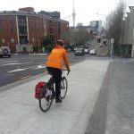
“Discontinuation of a default traffic growth rate (travel demand predictions) – The current ‘default’ travel growth rates (1-3%) generally do not accurately reflect the current situation in New Zealand and we are discontinuing these. Funding applications will therefore be required to provide evidence that any assumption of the future growth is realistic.”
It is most likely that the 2026 numbers used to justify destroying the trees are based on an assumption that the traffic is going to grow. There are options available to NZTA and AT to provide the lanes required within the current road width which need to be pursued. The other option is to wait to see if the predictions are correct.

I am also not satisfied with the cycling facilities that have been proposed for the intersection. There are some improvements with an off road shared path across St Lukes bridge however the cycle lanes are not continuous nor safely connected to the existing network.